Top 50 Apps Similar to Widespread Augmented Reality


AirMate 1.7.1
Airmate is a free and easy to use application for pilots,providinghelp for flight planning and navigation, and includingmany socialsharing features. Thanks to Airmate flight planningtools, you willget instant access to airport data and aviation mapsworldwide andup to date weather and NOTAMs. IFR and VFR airportplates arefreely available in US (FAA charts), all Europe, and morethan 200other countries. Many of them are georeferenced and couldbeoverlaid on the aviation chart. A powerful Plate Manager allowstodownload in advance all airport plates in a country, they couldbeeasily printed and viewed. During the flight, the moving mapwilldisplay the aircraft location along the route, show airportsandaeronautical data details. A profile view is available todisplayterrain elevation across the route. Airmate includes aworldwideaeronautical database updated free of charge withairports,navigation beacons, waypoints, airways, regulated andrestrictedareas. Topographic maps and elevation data for mostcountries maybe downloaded free of charge, as well as additionalaviation mapoverlays such US Sectionals. Airmate will also recordyour flightsand allow to replay them later or export the flightpath in gpxformat. A Satellite map display mode in flight planningor replaymode allows to familiarize with significant landmarks.Airmate willsave planned and flown flights, user waypoints and useraircraftsin the cloud and sync them between your devices. Airmatebringsnumerous social features to the community. Pilots mayleaveratings, tips and comments to share their experience withfellowpilots, and report fuel prices and landing fees. They couldfindfriends, instructors, flight schools, aviation events andaircraftto rent near their home airport or any visited airport.


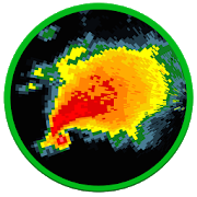


Weather Radar Pro - Get the forecast right 1.0
Weather forecast is one of the best weather apps providingyouhourlyweather forecasts and monthly weather forecasts.WeatherRadar givesyou accurate info on hourly weather forecast anddailyweatherforecast(weather today, weather tomorrow...) proWeatherapp detectsyour current location automatically. There aremanyinformation inweather forecasts in addition to ten daysfutureforecast. Accurateweather forecasts, real-time weatherradaralerts and severe weatherwarnings, with this weather app youwillbe up to date at all times !Weadar will help you getwarnings,storm, rain, hurricane at yourlocation with the stormtracker& hurricane tracker feature. Getthe latest specificsontemperature, rain, probability ofprecipitation, snow,wind,sunshine hours, sunrise and sunset times.Detailed displays ofairpressure, humidity levels and UV-Index.features: •Real-timeweather data and radar animations with blizzard&hurricanetracker: rain, snow, clouds, wind, currenttemperature,humidity,wave, pressure, current • Full report ofdetailed WeatherForecast:location time, temperature, atmosphericpressure, hourlyweathercondition, visibility distance, relativehumidity,precipitation indifferent units, dew point, wind speed,anddirection • Detectlocation by GPS & network to giveyouaccurate and reliableweather forecast. • Search &managemultiple locations manuallyto get your local forecasts andtrackweather conditions in yourcity. • Accurate & reliableforecastapp supportingnotifications • Real-time update widget •Chartgraphs of hourlyweather forecast and daily too, including aproweather radar •Today, tomorrow’s weather, 10 days futureforecast.• Weather appdescription: sunrise & sunset time,humidity,precipitationprobability, visibility, weather conditionsetc. •Change unitsetting of your live weather app: temperature(C/F),time format(12h/24h), precipitation (mm, inch), wind speed(km/h,mi/h, m/s),pressure (mmHg, hPa, mbar) • Weather forecast forallcountries& cities: Australia, Canada Weather, NewZealand,UnitedKingdom (UK), United States, USA Weather forecast(US),Auckland,London, New York, Sydney, Toronto, etc. ϟ LocalRadar,lightning: -Real-time Lightning Strikes as they occurredinselected time range- You can display it as an animation to onehourback in the past.彡 Wind: - Average wind speed 10 meters abovethesurface over thenext 10 days - Especially helpful fortrackinghurricanes and otherstrong wind events. ☂ Rain, thunder:-Rain/snow accumulation inthe last 3 hours, combined withlightningdensity forecast. - Nostorm will hit you unprepared!C°Temperature: - provides thecurrent temperature in CelsiusandFahrenheit, ☁ Clouds: - Theamount of cloud cover forecast inthelast 3 hours ☠ COconcentration: - Carbon monoxide is a toxicgasfor humans andother oxygen-breathing organisms - The level ofCOconcentration inthe troposphere is measured by a systemcalledParts Per Billion byVolume (PPBV). ⚠ Weather warnings: - TheCommonAlerting Protocol(CAP) shows you public warnings andemergencies,it generateswarnings on all possible dangers: Hightemperatures /Lowtemperatures, fires, Air quality,earthquakes,volcanoes,landslides, Flood, Avalanches, Waves &sea, etc - Youcan seewarnings using two filters: colorize byintensity and typeof thewarning We are trying our best to make ourweather forecastappbetter and better. Enjoy your life with ourweatherchannels.Download this pro weather app and share with yourfriends.


OruxMaps Donate
ATTENTION, THIS IS THE VERSION 'DONATE'. IFYOUWANT, YOU CAN TRY THE FREE VERSION, WHICH IS IDENTICALTOTHIS.IMPORTANT!: NOT ALL ONLINE MAP SOURCES ARE NOW DOWNLOADABLE.SELECTANOTHER SOURCE IF YOU CAN NOT FIND THE OPTION TO DOWNLOADAMAP.Map viewer, track logger.You can use OruxMaps for your outdoor activities (running,treking,mountain bike, paragliding, flying, nauticsports,....)100% no adversisementsOnline and offline maps. Support to multiple formats:-OruxMaps format. You can use maps from Ozi Explorer transformedwita PC tool.-.ozf2-.img garmin (vectorial) -no full support is provided-.-.mbtiles-.rmap-.map (vectorial from mapsforge). Support to custom themessimilatthan Locus themes.Support to Wms, you can use the application as a WMS viewer.Support to APRS sources.3D view.Support to multiple external devices:-GPS bluetooth.-Heart rate monitors, bluetooth Zephyr, Polar (includingbluettohsmart devices, like polar H7).-ANT+ (speed, cadence, heart rate, distance,...).-AIS information systems (experimental), for nautical sports,usingWifi o BT.More features:Support to KML KMZ and GPX formats.Share your position with your friends, display the position ofyourfriends in your device.Download online maps for offline use.Text to speech support.Profiles; save your preferences in your SD card.Statistics with graphics.Follow routes, with different alarms to alert you if you are nearawaypoint, or you are far from the route.Create/save wayponits, attaching photo/audio/videoextensions.Custom waypoints types, with your icons.Basic support to Geocaching.Correct the altitude of your tracks/routes using DEM files(offline)or online services.Search/download tracks from:-everytrail.com-gpsies.comSearch or create tracks using online services from Cloudmadeoroffline using Broute app.Upload tracks to:-mapmytracks.com-trainingstagebuch.org-ikimap-wikirutas-openxploraLive tracking using:-mapmytracks.com-okmap application-gpsgate protocolMore info here: www.oruxmaps.com


