Top 50 Apps Similar to Smart Compass

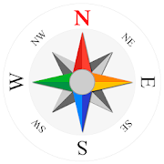
Compass Steel 3D
FEATURES:• Choose from multiple color themes• Choose between 2 heading modes - True heading (based onTruenorth) and Magnetic heading (based on Magnetic north).• Sun direction indicator• Moon direction indicator• Sunrise and sunset times• Moonrise and moonset times• Self-calibrates as you use• Marine-style compassPERMISSIONS:• Requires access to location coordinates to calculateTrueheading.


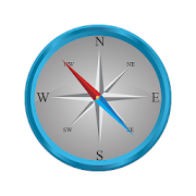
Compass Steel
FEATURES:• Ad-free compass app.• Choose from multiple color themes.• Choose between 2 heading modes - True heading (based onTruenorth) and Magnetic heading (based on Magnetic north).• Sun direction indicator.• Moon direction indicator.• Set and save a target direction.• Tilt-compensated and self-calibrates as you use.• High contrast design improves readability.PERMISSIONS:• Requires access to location coordinates to calculateTrueheading.Any suggestions or feedback are warmly welcomed.


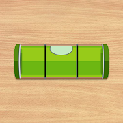
Compass Level & GPS
Take advantage of accurate andintegratedcompass, level and gps tools in one screen.For lovers of D.I.Y. and fans of self-assembling: this makes youanexpert in placing furniture, hanging up a shelf or frame.For tracking, hiking and camping fanatics: now you will never beoffcourse, always having the right position and direction.This tool is handy and very accurate - try it yourself!Advice: for a better accuracy, first calibrate once.✓ Compass Usage• Find and keep track of the right heading• Get information of your current position or atargetposition• Find your parked car through the target position feature.✓ Level Usage• Proper positioning of furniture• Straight installation of a shelf or a frame• Quickly level out your motor home or caravan✓ Features• Automatic horizontal and vertical level display• Choose Sound and/or Vibration when level• Manual compass and level calibration available• 'Hold / Release' button, for easy readout• Screen Capture: no notes, just copy• Sensor sensitivity and update-cycle adaptable• Powerful GPS feature: set target position, and find thedirectionand distance.✓ Remarks (Compass)• Sensor accuracy may differ depending on the device used• For better accuracy, keep away from magnetic fields andelectronicdevices.** Usermanual:http://lemonclip.blogspot.kr/2014/02/compass-level-user-manual.html• If you encounter any problem with this App or incorrectwording,please contact us via:- https://www.facebook.com/CompassLevel- [email protected]

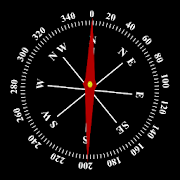


Compass Maps Pro - Digital Compass 360 Free 3.5
✦ "Compass Maps Pro - Digital Compass 360 Free"supportclassiccompass, fengshui compass and compass on the map. ✦Classiccompasssupport: - Show basic results with metrics anddirectionnames. -Lock / unlock compass - Screenshot result. -Change thecompass,direction arrow. - Zoom in / out compass. ✦Compass in map:-Locate or calculate direction at anywhere appearson map. -Searcha place via address name. Locate your location viaGPS,alsonavigate with magnetic compass. - Move the compass bytouchingthelocation you want on the map. - Assist the compass viewanywhereonthe map you want. ✦ The Feng shui compass type: -CompassFengshuidefault - Compass Fengshui 24 Mountains - CompassFengshui60 Jiazi - Compass Fengshui 72 Dragons - Compass FengshuiHeavenEarthHuman ✦ Compass Fengshui Measure the direction of thehouse,thedirection of the door ... ✦ "Compass Maps Pro - DigitalCompass360Free" support the following languages: English,VietnameseWarning:❋ To use compass for Android, your device musthavemagnetic sensorequipmented to read Earth magnetic field.Somephones do notsupport compass sensor so it can not use thecompass.❋ Some times,your magnetic sensor maybe not work well, youhave tocalibrate thedevice with 8-directions manually.

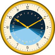
Sunday - Astronomical Clock 1.12
When does the sun go down? Is it longenoughbright to finish the work outside? Do i reach the viewpointpointin time to see a magnificent sunset?Such questions are answered by Sunday. It has theastronomicallaws of the Sun Run programmed to predict the course ofthesun.In Islam, the prayer times depend on the position of the sun.Thefive ritual prayers of Salad, Fajr (dawn), Dhuhr (noon),Asr(Afternoon), Maghrib (Sunset) and Ischa (evening) can bedisplayedaccording to different standards. A compass shows thedirection toMecca.The Sabbath (Shabbat) is in Judaism, the seventh day of theweek,a rest day on which no work is to be done. The start onFridayevening 18 minutes before sunset may also be displayedwithSunday.Set your own place via an integrated urban table or use GoogleMaps.Animate date and time by wiping across the screen orautomaticanimation. Explore cosmic rhythms and proportions of thesun at anytime and place on Earth.Use Sunday as app, wallpaper or widget.


Accurate Altimeter 2.2.32
The most downloaded Altimeter on the PlayStoreis now updated with a new interface and new features!- Altitude estimation with three different methods to be alwayssureto get a reliable measure, even without internetconnection.- Historical charts to see your excursions elevation gain.- Map with your elevation and contour lines.- Pictures with impressed place name and altitude.Altitude can be estimated:- With satellites triangulation. Slow and less accurate but itworkseven with no internet connection.- Taking the ground elevation at your current position fromaninternet web service.- Using the pressure sensor of your device (if available).Itcalibrates itself on pressure from the nearest weather stationtoimprove accuracy.As additional PRO features you can also:- compensate systematic error of pressure sensor- record altitude without opening the App- remove advertising


Magnifier, Magnifying Glass 4.6.4
Are you tired of trying to read somelabelswith small fonts? Now you can use your android device astheperfect digital magnifier.There is not need to take a magnifying glass when readingsmalllabels, with this app you will see the text big andclear.Magnifier has onscreen zoom and lighting controls so you canchangeit easy, you can also use your flash as torch in order to getabetter image, or activate the negative color mode.There is also a freeze image functionality that will let youfreezethe image so you can read it comfortably. Once you freezetheimage, you can save it or share it if you want.Try this app now and stop worrying about text you can't read!Key features:✓ High magnification factor✓ Zoom and Exposure controls✓ Flashlight for low light situations✓ Negative mode✓ Freeze, save or share images✓ Awesome image visibility✓ Really simple to useDisclaimer:The quality of the image is directly related with the quality ofthecamera of your device. Also the functionality offered issubjectedwith the hardware capabilities of the camera. As forexample somedevices doesn't have zoom, flash or auto focus.


Altimeter & Altitude Widget 4.57
DS Altimeter is an elevation meter,elevationlogger, and altitude mapper. In addition to showing andoptionallytracking your altitude, the app allows you to search thealtitudefor other locations as well.You can select from the best sources of elevationdata,including:1. Location based altitude from NASA's Shuttle RadarTopographyMission2. Satellite based altitude (GPS altitude) corrected toheightabove mean sea level (AMSL)3. Get actual land survey altitude values for your locationfromthe United States Geologic SurveyDevices equipped with a barometer sensor can also obtainpressurealtitude which is converted to true altitude. For the mostprecisereadings, calibrate the pressure altitude by entering areferencevalue or by selecting one from the app's dynamic list ofnearestairfields.USGS (United States Geologic Survey) altitude results arealsoavailable for customers in the contiguous United States, CanadaandMexico.DS Altimeter also works offline: barometric altitude andGPSaltitude corrected to elevation above sea level do not requireaninternet connection.NEW IN DS ALTIMETER: Record altitude profiles and elevationtracksfor your favorite journeys to the highlands, the lowlandsandeverything in-between!Upgrade the application to pro and gain access to even morefeaturesincluding the Altimeter Widget and variousbarometricaltimeter calibration methods.Going skiing? Record your ski run with DS Altimeter, then viewyourski trail with its elevation points on the included maps.Mininumand maximum altitude points for your run will beclearlyshown.Altitude mapping, altitude search and bathymetry (lake andseadepths) are also included with DS Altimeter. Tap anywhere on amapto get the altitude or water depth at that location.* The perfect altimeter for skiing, hiking, mountain climbingandother outdoor sports, boating, marine navigation and anytimeyouare curious about your elevation!
