Top 50 Apps Similar to Journey360


Measure Ground Control - Fly Drones & Manage Data 1.10.4
Measure Ground Control is an “all in one” drone deployment anddatamanagement software solution for UAV pilots, small businessesandlarge enterprises. Create a mission, plan a flight, checkairspace,and process your image data in a variety of formats, suchashigh-quality orthomosaics, 3D maps and 3D mesh, thermalimagery,digital surface models (DSM), and many more. Manage yourpilots anddrone fleet, create and reuse flight plans, store andmaintain flysites, build flight schedules, run safety checklistsand log flightdata, as well as create customized data reports. Withthe abilityto navigate seamlessly between the web and mobileapplications,Measure Ground Control features LAANC airspaceauthorization withbuilt-in Airmap technology, so you can fly anyairspace safely andFAA compliant. Process and create data productswith our advancedphotogrammetry and image processing featuring anintegrated Pix4Dtoolkit, or inspect and annotate image data usingour customScopito integration, all within the convenience of asinglesoftware application. Measure Ground Control offers multipleflightmodes including Panorama, Spotlight, POI, Profile, Trace,andTripod. Additional features can be activated for Enterpriseusers.Built for universal DJI compatibility. Device CompatibilityNot allAndroid compatible devices listed. Samsung (S20, S10, S9+,S9, S8+,S8, S7, S7 Edge, S6, S6 Edge, Note 20, Note 10, Note 9,Note 8)Huawei (P20 Pro, P20, P10 Plus, P10, Mate 10 Pro, Mate 10,Mate 9Pro, Mate 9, Mate 8, Honor 10, Honor 9) Vivo (X20, X9) Oppo(FindX, R15, R11) Xiaomi (Mi Mix 2S, Mi Mix 2, Mi 8, Mi 6, RedmiNote 5)Google Pixel 2XL, OnePlus (6, OnePlus 5T) Highlights Manualflightmode with live streaming Grid flight mode with terrainfollowCustom waypoint flight plans Mission creation and managementDronefleet & pilot management Image data processing &customreports Custom flight safety checklists LAANC digitalauthorizationrequest Flight logs & realtime flight info DJICompatibilityMavic (all) • Mavic 2 (all) including Smart Controller• Mavic Air1 • Phantom 3 (all) • Phantom 4 (all) • Exception beingthe P4PRTK- limited functionality • Inspire 1, 1 Pro and Inspire 2•Matrice 100/200/210 (all versions) • Matrice 600 & 600 Pro•Mavic Mini • Spark Plan a Mission Schedule and managemissioncalendar Assign pilots and equipment and send notificationsCreatea flight plan with a KML file, grid or waypoint plan Syncflightplans to the mobile flight app Check airspace and weather Fly&Collect Data Request LAANC authorization Retrieve and applyDJI GeoUnlock Fly with GPS-aided manual control, automated gridandwaypoint patterns Use active track modes including spotlight,POI,trace, orbit and profile Automatically upload flight logsandscreen captures Process & Analyze* Process imageryintohigh-quality data products powered by Pix4D Increaseimageprocessing accuracy with RTK drone data, or use GCPs infoCreateorthomosaics, digital surface models, and contour mapsMeasurelinear distance and area or add a 2D image layer to yourmapAnalyze data with our integrated Scopito annotation tool ReportandStore Data* Store unlimited flight logs, imagery, video,anduploaded files Track activity and compliance with built-inreportsExport and share data products (orthos, DSM, contours) asGeoTIFFor GeoJSON files Add inspection results and review missionandportfolio-level summaries Upload completed data products toeachmission Manage Operations* Access automatically uploadedflightlogs, including flight playback and screen capturesCheckautomatically flagged incidents for activity outside of safetybestpractices Add users, setup user profiles, control userpermissionswith pre-defined roles Manage equipment with automaticusagetracking Track program activity with dashboards and exportablePDFand CSV reports *Features only accessible via the MeasureGroundControl web application.


App in the Air: Flight Tracker
App in the Air - your personalflyingassistant that keeps you up-to-date with your flight:realtime status, airport tips and in-airport navigationmaps, flightprofile with all your flights logged. Even more: appworksoffline (gate changes and flight status updates aredeliveredvia SMS which requires no data roaming). And we are alsohaveAndroid Wear app, don't forget to try it!Automatic check-in. Sit back and relax, the rest is onus.Automatic check-in for 2 passengers: you can addsecondpassenger for automatic check-in and we will check youintogether if its possible.Featured in Business Insider's 100 Greatest Apps and"YourVerse” commercial.Flight tracking bot: you can try our Facebook Messenger bot totrackflights without installing theapp(http://messenger.com/t/appintheair)The biggest coverage worldwide that includes:- North American Airlines: American, Delta, United, Southwest,AirCanada, JetBlue, Alaska, WestJet, Aeromexico, Spirit &muchmore- Over 1000 airlines worlwide: KLM, Ryanair, ChinaEastern,Lufthansa, LATAM, China Southern, easyJet, Singapore,BritishAirways and others- All major US airports: Hartsfield-Jackson, Los Angeles(LAX),O'Hare, Dallas/Fort Worth (DFW), Denver International, JFK,SFO,Charlotte and much more- Busiest world airports - over 5000: Heathrow, Beijing,Haneda,Dubai, Paris-Charles de Gaulle, Hong Kong, Frankfurt,Istanbul,Soekarno-Hatta and others- All alliances: Skyteam, Star Alliance, OneworldKnow everything about your flight:- Don’t miss your flight - we will remind you about any changesofupcoming flight even without Internet!- Manage your time at airport - each flight has been broken into4stages: checkin/boarding/takeoff/landing time- Care about relatives? You can track their flight too.Be prepared in advance:- Take a chance to get best seat in plane - reminders aboutopeningonline checkin straight from the app.- Find places to eat, internet password, TSA security tipsandguidelines - advices from other travels, handy tips and whattoexpect at the 9 000 different airports.- Book airport lounges and purchase access to them withAndroidPay- Don’t know how to get to the city? We have quick links to bookacab (more than 200 cities worldwide) or express train(MoscowAeroexpress & Heathrow Express for now)Remember your travels:- TripIt integration allow you to import your itinerary andviceversa: smoothly synchronise your itineraries across TripIt andAppin the Air- Forward us booking confirmation [email protected] Count miles, hours you’ve flown and airports, airline&aircrafts you’ve visited and earn badgesMoreover:- Have an issue with the app? - we have support via email oronlinechat (in the app)- Miss some airports / airlines / features? - we listen to ourusersand release new updates every 2-3 weeks.Have questions? Feel free to write [email protected]


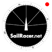
Sail Racer 6.6.4
This is a sail racing app for sailing enthusiastsandprofessionals.Application is used as an additional tool nexttostandard yachtequipment to take tactical sail decisionsfaster.Sail Racer appsuggest the favored end of the start line,monitorsyour position,time and guides the maneuvers that the startlinewas hit at thelast moment with the best possible speed duringyoursail. With thesail app it is easy to navigate in racing area.SailRacer interfaceis designed in a way that course efficiency,thelay lines andshifts could be captured in a splash of asecond.Skipper does notneed to analyze the numbers and canconcentrate onhandling theboat, maximizing performance and playingtacticalgames withcompetitors. Every wind gust and lull affect theboatheading and isvisualized in a “easy to read” shift bar on thetopof compass roseand on the map. Sail Racer is designedanddeveloped by sailors. Ithas everything to sail on the edge. -Timeto burn, Coundown andStarting box distances - Windaveragecalculation for 6minutes andan hour - Course averagecalculation(in case you do not have NMEAdata) - Boat efficiencyaccording topolar data - Mark, Laylinedistance and ETA - Tracker -Nauticalcharts - NMEA 0183 dataconnection, BlueTooth dataconnection,SailTimer wind information -Current indication and manymore -Works on watch (Android wear OS)More informationwww.sailracer.netSailrace.net app is free forlearning (Optimistkids, Lasers andother centerboards) and forevaluation purposes. Wekindly ask allkeel boat racers to purchasePremium license for 35euros / year.Have a good start and evenbetter finish.

Worldshade widget 6.3.4
Home screen widget that display an image of the earth indicatingthesun shade on the globe. The app shows data for sunrise andsunsetfor the current location or any selected location. Whenadding awidget, a default view is selected. By checking the option"Followposition", the projection will be selected to follow yourcurrentposition. The current position is marked with a red dot. Alocationmay be selected by tapping the globe, which then is markedby aviolet dot. Tapping outside the globe again selects thecurrentlocation. By default, the widget occupies two by two cellson thehome screen. Press and hold the widget to enable resizing.Afterinstallation it is possible to add a widget to the homescreen (tapand hold).
