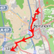
Top 19 Apps Similar to Map of Netherlands

TomTom GO Navigation 3.2.12
Get Offline Navigation, Online Experience with TomTomGONavigation:Downloadable GPS Sat Nav offline maps, preciselivetraffic, andspeed camera alerts*, both updated inreal-time.Download now usingthe 30-DAY FREE TRIAL offer to get thebestdriving experience. 😎KEEP YOUR MAPS UPDATED WHILE SAVINGYOURMOBILE DATA • Maps À LaCarte: Save your mobile data withofflinemaps available in 150countries, always ad-free. You decidewhichmap to download, basedon what you need. • Weekly Map Updates:Helpyou steer clear ofblocked roads and drive within speedlimits,even when you areoffline. • Moving Lane Guidance: Endtheguesswork - know what laneis yours and what exit totake.Proprietary maps coming from 20+years of experience, provideyouhigh-quality turn-by-turn guidanceon your ways. STAYCONNECTEDWITH REAL-TIME UPDATES: • TomTomTraffic: Avoid traffic anddangerzones in real-time withintelligent route • Speed CameraWarnings*:Helping you drive saferand hassle-free with speed alertsandwarnings for fixed and mobilespeed cameras. • Online Search:Yourgo-to destinations, as well aspopular attractions andessentialPOIs, are stored on the app. Onceconnected, you cansearchdestinations from the catalogue of TomTom.• Share ETA: Shareyourestimated time of arrival with coworkers,friends, and familyviathe messaging platform of your choice. DRIVESAFELY AND BE AWAREOFSPEED CAMERAS: • Points of Interest: Searchand finddestinations,scenic areas, and attractions on the way andwhen youarrive atyour destination. • Alternative Routes: See waysaroundtrafficcongestion backed by precise distance and timecalculations •Driveto Photo: Remember the name of that place?! Ifyou geotaggedthephotos you took there, the app will take youthere! • DrivetoContacts: Get easier route planning to the peopleyou know,withthe contacts stored on your phone. • Ad-Free: Avoidannoyingadsfor the most efficient journey without interruption. •NEW! :Nowworks with Android Auto After the free trial, you canselect oneofthe following auto-renewing subscription plans: $1.99- 1month$8.99 - 6 months $12.99 - 12 months Cancel or changeyourplananytime. Drive with TomTom Go Navigation, thestate-of-the-artGPSSat Nav around! 💯 If you have questions,feedback, or inputonsomething we may have missed, please follow us& share on:+Facebook @ TomTom + Twitter @ TomTom + Instagram@TomTomDriversDisclaimers: · The use of this app is governed bytheTerms andConditions at tomtom.com/en_us/legal/. ·Additionallaws,regulations, and local restrictions may apply. Youuse thisapp atyour own risk. * The Speed Camera Services must onlybe usedinaccordance with laws and regulations of the country whereyouaredriving. This functionality is specifically prohibitedinsomejurisdictions. It is your responsibility to comply withsuchlawsbefore activating the services. You can enable anddisableSpeedCamera warnings on TomTom GO Navigation. Learnmoreat:tomtom.com/en_us/navigation/mobile-apps/go-navigation-app/disclaimer/**Offerlimited to one free trial period per user. At the end ofthetrial,your subscription will be charged unless you cancel itatleast 24hours in advance.


Navmii GPS World (Navfree) 3.7.22
Navmii is a free navigation and traffic appfordrivers.Navmii combines FREE voice-guided navigation, livetrafficinformation, local search, points of interest and driverscores.Offline maps stored locally, for use without aninternetconnection. Over 24 million drivers use Navmii and our mapsareavailable for more than 150 countries.• Real voice-guided navigation• Real-time traffic and road information• Works with GPS only – internet not needed• Offline and Online Address search• Driver Scoring• Local Place search (powered by TripAdvisor, FoursquareandWhat3Words)• Fast routing• Automatic rerouting• Search using Postcode/ City/ Street/ Points of interest• Heads-Up Display (HUD) – upgrade• Community map reporting• HD accurate maps• + Much, much moreWe have thousands of 5-STAR REVIEWS:- why buy a satnav when navmii does it all- unbeatable value and functionality- love, love this app!Navmii features on-board OpenStreetMap (OSM) maps, which arestoredon your device and therefore you don’t need no dataconnection(unless of course you use the connected services). UseNavmiiabroad to avoid high roaming costs!We're always eager to hear about your experience of usingNavmii.You can contact us anytime by email, on Twitter or Facebookusingthe details below:- Twitter: @NavmiiSupport- Email: [email protected] Facebook: www.facebook.com/navmiigpsNote: continued use of GPS running in the backgroundcandramatically decrease battery life.


Flitsmeister
Flitsmeister is on a mission to makedrivingyour car cheaper, safer and more enjoyable than ever before.Over 1million Dutch and Belgian users activate Flitsmeisterafterfastening their seatbelt when they get in their cars.By activating Flitsmeister in your car you will receive alertsthathelp you save money and time, but also improve the safety ofyouand others around you.Flitsmeister will alert you for:- Speed traps- Speedcams- Traffic jams / Delays on your route- Road reconstruction- Closed lanes- Incidents- Nearing emergency vehicles- And more to come…When you’re not driving your car you can use Flitsmeister to getthelatest traffic information for your route. How long does ittake toget to work? Are there any speed traps on the way home?Thosequestions are no longer your concern. Flitsmeister has alltheanswers.COMMUNITY & FLITSMEISTER EDITORSThe traffic information within the Flitsmeister app isgeneratedmostly by our users’ input. You can submit reports andcorrectreports of others. We improve this user generated content byusinggovernment provided data, images from camera’s on the side oftheroad placed throughout the country and our ownFlitsmeistereditors.RADIO BROADCASTING:Flitsmeister traffic information is broadcasted daily onQ-Music,BNR Newsradio, Traffic Radio and more to come.COVERAGE:Still not convinced?Check our website with all the traffic information we provideonwww.flitsmeister.nl Or check the coverage websiteonwww.flitsmeister.nl/dekking for a live view of our users.CONTACT:Of course we’re on Twitter (@flitsmeister) andFacebook(flitsmeister). For any questions about the app you canreach us athttp://support.flitsmeister.nlREVIEWS:***** NU.nl *****“People yet to discover the app will find a complete solutionwithFlitsmeister, an app that paves the way for manysimilarapps.”***** TopGear *****“Great app for people who like to hurry up without emptyingtheirwallets on the side of the road.”***** Autoweek *****
“Radardetector falls behind: Thisworksbetter!”***** Autoblog *****“Number 1 Autoblog automative app: “The only speed trap appthatmatters.”
***** iPhoned.nl *****“Flitsmeister is king among the speed trap and traffic-apps!”

BackCountry Navigator TOPO GPS
Download topo maps for an offlineoutdoornavigator! Use your phone or tablet as an offroad topomappinghandheld GPS with the bestselling outdoor navigation appforAndroid! Explore beyond cell coverage for hiking andotherrecreation.Download topo maps for the US and many other countries inadvance,so you won't need cell coverage for navigation. Use storagememoryfor maps.New: Android Wear support to see navigation at a glanceonwristUse GPS waypoints from GPX or KML files, or enter yourowncoordinates using longitude/latitude, UTM, MGRS, or gridreference.Using GOTO makes a waypoint a locus for navigation.This uses many publicly available map sources as freedownloads.Some additional content available as an in apppurchase:-Accuterra Topo Map Source for $19.99/year. This can bepurchasedand used with or in instead of the free sources.- Boundary maps for 12 western states from the Bureau ofLandManagement(BLM) Overlay for topo maps valued by hunters.-GMU boundaries in some states-Lake Contours in several states.-Content from US TrailMaps including:-ATV, Whitewater, and Equestrian Trail MapsSee the menu under More-> "Purchasing AddOns". They can beshownon top of topo maps.You may try the DEMO version to make sure you like the maps inyourcountry.About topo (topographic) maps: Topo maps show terrain throughcolorand contours, and are useful for navigation offroad. Topo mapsandGPS can be used for hiking, hunting, kayaking, snowshoeing,&backpacker trails.You can create your own maps with Mobile Atlas Creator, or specifyacustom tile server. Built in sources include:OpenStreetMaps from MapQuestOpenCycleMaps showing terrain worldwideUS Topo Maps from Caltopo and the USGSUSTopo: Aerial Photography with markup.Canada Topo Maps from ToporamaMarine maps: NOAA RNC Nautical Charts (coastal)USGS Color Aerial photographyTopographic Maps of Spain and ItalyTopo maps of New ZealandJapan GSI maps.Many of the above sources are generally free to use.Use offline topo maps and GPS on hiking trails without cellservice.The GPS in your Android phone can get its position fromGPSsatellites, and you don’t have to rely on your data plan togetmaps. Have more fun and safe GPS navigation inthebackcountry.Use as a geocaching navigator by getting a pocket queryasGPX.Besides geocaching, use GPS for recording tracks and GPSwaypointson your trip, all the while tracking your GPS quest ontopographicmaps. It may replace your Garmin handheld GPS.Here are some of the outdoor GPS activities BackCountryNavigatorhas been used for:As a hiking GPS both on hiking trails and off trail.Camping trips to find that perfect camping site or the way backtocamp with GPS.Hunting trips for hunting wild game in rugged areas.Doing recon for a hunt or as your hunting GPSFishing: make it your fishing GPS.Search and Rescue (SAR).Trekking the Pacific Crest trail or other long term hiking.Kayak and canoe treks on inland lakes and streams or marine,coastalwaters.Backpacker trips: using topo maps of wilderness areas andnationalforests for navigation on trails with the GPS in yourrucksack orbackpack.Find your own ways to have fun in the outdoors. Be a maverickbyventuring beyond cell service boundaries with your GPS. Becomeapro at navigation with GPS for the outdoors.BackCountry Navigator has been on WM devices and preloaded ontheTrimble Nomad outdoor rugged device. This Android version ismoreflexible, featured, and fun. Create a memory with maps.For a one time fee, this a great addition to the outdoor gearyoubought at Cabelas, REI, or another outdoor store. Many havefoundthe Android GPS in a phone or tablet to substitute for aGarmin GPSor Magellan GPS, such as the Garmin GPS units Montana,Etrex, orOregon. Android can be your handheld GPS.


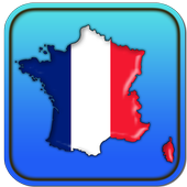
Map of France 1.24
GPS navigator with offline mapsforFrance.This is a free app that doesn't need an internet connection forthemaps.You can search addresses or points of interest.It's easy to get routing to your destination.You can get a list of points of interest fortourists,accommodation, parking, restaurants, bars, clubs,cinemas,theatres, auto services, shops, parks, schools, hospitals,sportareas.The application has detailed maps of major cities in France:Paris,Marseille, Lyon, Toulouse, Nice, Nantes, Strasbourg,Montpellier,Bordeaux, Lille, Rennes, Le Havre, Reims,Saint-Etienne, Toulon,Grenoble, Angers, Dijon, Brest, Le Mans andothers.This application is based on Osmand project under the GNUGPLv3license and uses high quality data from OSM.

OSM Downloader 2.1
ATTENTION! The given application downloads OpenStreetMap mapsforCity Guide 7 or 8, Navitel, 7 Ways navigator apps only. If youhaveany ideas regarding the support of other apps please contactme:[email protected] Downloader lets download OpenStreetMap maps for City Guide 7or8, Navitel, 7 Ways navigators.Features:* Choose maps by country* Download several maps simultaneously* Display downloaded maps and their updates* Search the needed map by cityAll error reports and suggestions are welcome: [email protected]

BackCountry Nav Topo Maps GPS
Use your Android as an offroad topo mappingGPSwith the bestselling outdoor navigation app for Android! TrythisDEMO to see if it is right for you, then upgrade to thepaidversion.Use offline topo maps and GPS on hike trails without cellservice!The GPS in your Android phone can get its position fromsatellites,and you don’t have to rely on your data plan to getmaps. Have morefun and safe GPS adventures in thebackcountry.Preload FREE offline topo maps, aerial photos, and road maps onyourstorage memory, so they are ready when you need them.Add custom GPS waypoints in longitude and latitude, UTM or MGRSgridreference. Import GPS waypoints from GPX files. Choose iconsforwaypoints much like in MapSource. (This app uses the WGS84datum,NAD27 is available in settings).Use GPS for hunting a waypoint or geocache, for recording tracksandGPS waypoints on your trip, all the while tracking your questontopographic maps.About topo (topographic) maps: Topo maps show terrain throughcolorand contours, and are useful for navigation offroad. Topo mapsandGPS can be used for hiking, hunting, kayaking, snowshoeing,&backpacker trails.The app has many built in map sources and allows you to createyourown maps with Mobile Atlas Creator. Built in sourcesinclude:OpenStreetMaps and NASA landsat data worldwide.OpenCyle Maps are topo maps that show terrain worldwide.USGS Color Aerial photography.Topographic Maps of Spain and Italy.Outdoor maps of Germany and AustriaTopo maps of New ZealandHere are some of the outdoor GPS activities BackCountryNavigatorhas been used for:Hiking both on hiking trails and off trail.Camping, to find the perfect camping site or the way backtocamp.Hunting trips for hunting wild game in rugged areas, includingreconfor the hunt.Bait fishing or fly fishing with a buddy.Search and Rescue (SAR) with GPS.Kayak and canoe trips on inland lakes and streams or marine,coastalwaters.Backpacker trips: using topo maps of wilderness areas andnationalforests to navigate on trails with the GPS.Snow adventures including snowmobiling, skiing (alpine orcrosscountry) and snowshoeing. Create a memory. Map it out.This a great addition to the outdoor gear you bought atCabelas,REI, or another outdoor store. Your android phone couldsubstitutefor a Garmin or Magellan outdoor handheld GPS! Youstorage hasmemory for maps.Find your own ways to have fun in the outdoors. Be a maverickbyventuring into new territory beyond cell service boundaries.Becomea pro at navigation with GPS.BackCountry Navigator has been previously available on WMdevicesand preloaded on the Trimble Nomad outdoor rugged device.ThisAndroid version is more flexible, featured, and fun.
Map of USA 1.24
This application turns your Android deviceintoa GPS navigator with offline maps.You can search easily locations in United States of America andyoucan add them to your route.Discover interesting places near you: accommodation,parking,restaurants, bars, clubs, cinemas, theaters, auto services,shops,parks, schools, hospitals, sport areas.It includes detailed maps of the biggest cities in USA: NewYork,Los Angeles, Chicago, Houston, Philadelphia, Phoenix, SanAntonio,San Diego, Dallas, San Jose, Austin, Jacksonville,Indianapolis,San Francisco, Columbus, Fort Worth, Charlotte,Detroit, El Paso,Memphis, Boston, Seattle, Denver, Washington,Nashville and others.How do I use maps on my SD Card?Go to General settings->Data storage folder and choose afolderon extSdCard.Starting Android version 4.4.x Android has changed the rules sothatno application can write to the external SD card anywhereoutsideits new standard folder Android/data/[PACKAGE-NAME].So you can only place the data in the standard SDfolder:(extSdCard)/Android/data/eu.mapof.usaThis application is based on Osmand project under the GNUGPLv3license and uses high quality data from OSM.