Top 39 Apps Similar to Sailware (Sailboat Racing)

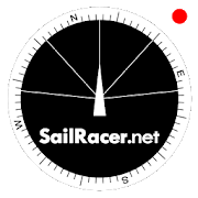
Sail Racer 6.6.4
This is a sail racing app for sailing enthusiastsandprofessionals.Application is used as an additional tool nexttostandard yachtequipment to take tactical sail decisionsfaster.Sail Racer appsuggest the favored end of the start line,monitorsyour position,time and guides the maneuvers that the startlinewas hit at thelast moment with the best possible speed duringyoursail. With thesail app it is easy to navigate in racing area.SailRacer interfaceis designed in a way that course efficiency,thelay lines andshifts could be captured in a splash of asecond.Skipper does notneed to analyze the numbers and canconcentrate onhandling theboat, maximizing performance and playingtacticalgames withcompetitors. Every wind gust and lull affect theboatheading and isvisualized in a “easy to read” shift bar on thetopof compass roseand on the map. Sail Racer is designedanddeveloped by sailors. Ithas everything to sail on the edge. -Timeto burn, Coundown andStarting box distances - Windaveragecalculation for 6minutes andan hour - Course averagecalculation(in case you do not have NMEAdata) - Boat efficiencyaccording topolar data - Mark, Laylinedistance and ETA - Tracker -Nauticalcharts - NMEA 0183 dataconnection, BlueTooth dataconnection,SailTimer wind information -Current indication and manymore -Works on watch (Android wear OS)More informationwww.sailracer.netSailrace.net app is free forlearning (Optimistkids, Lasers andother centerboards) and forevaluation purposes. Wekindly ask allkeel boat racers to purchasePremium license for 35euros / year.Have a good start and evenbetter finish.


DONIA 5.07
DONIA - Enjoy & protect the sea, together!DONIA est une application de cartographie marinecommunautairepour smartphone et tablette. Elle est destinée auxplaisanciers,plongeurs, pécheurs et à tous les amoureux de la merqui souhaitentbénéficier de cartes précises, enrichies de donnéessur la viemarine et d'informations en temps réel sur les activitésensurface.DONIA, c’est avant tout une communauté de passionnésquiéchangent des informations pour rendre leurs sorties en merplusriches en découvertes et qui veulent contribuer àprotégerl'environnement.DONIA œuvre et sensibilise à la préservation del’environnementen fournissant des cartes de la nature des fondsextrêmementprécises qui permettent aux plaisanciers de Méditerranéede jeterl’ancre en dehors des herbiers de posidonie protégés.DONIA c’est aussi plus de sécurité à bord. L’applicationproposede vivre la traditionnelle solidarité maritime en partageantdesinformations sur les dangers aperçus en mer (obstacles,accidents,méduses, etc.).Enfin, les utilisateurs de DONIA peuvent recevoirgratuitementdes informations de la part des gestionnaires de sitesprotégés(parcs, réserves). Pratique pour éviter les démarchesfastidieuseset trouver la réglementation locale facilement.En options payantes, vous pouvez bénéficier:- D'un pack alarmes graphiques (Alarmesanti-dérapage,anti-collision (au mouillage), anti-emmelage dechaînes). Lesalarmes sont transférées sur un autre téléphone parsms en cas debesoin (coût d'un sms).- Vous pouvez aussi acquérir des cartes de bathymétrie trèshauterésolution et en 3D. Ces données, acquises ausondeurmulti-faisceaux par la société spécialisée AndromèdeOcéanologie,sont environ 1000 fois plus précises que les cartesclassiques.Vous voyez la vraie forme des reliefs, les failles,etc.Attention l'utilisation continue du GPS en tâche de fondpeutréduire considérablement la durée de la batterie.DONIA - Enjoy&protect the sea, together!DONIA is a community marine mapping application forsmartphoneand tablet. It is intended for boaters, divers, fishermenand allsea lovers who want accurate maps, enriched data on marinelife andreal time information on surface activity.DONIA, is above all a community of enthusiasts whoexchangeinformation to make their outputs richest offshorediscoveries andwant to help protect the environment.DONIA work and awareness to preserve the environment byprovidingmaps of nature extremely precise funds that allowMediterraneanboaters to anchor outside the protected Posidoniameadows.DONIA is also more safety on board. The application offerslivetraditional maritime solidarity by sharing information aboutthedangers at sea surveys (obstacles, accidents, jellyfish,etc.).Finally, users DONIA can receive free information frommanagersof protected sites (parks, reserves). Convenient to avoidthetedious steps and find local regulations easily.By paying options, you can benefit:- A pack graphics alarms (Alarms anti-skid, anti-collision(atanchor), anti-tangle of strings). The alarms are transferredtoanother phone via SMS in case of need (cost SMS).- You can acquire high resolution bathymetric maps and 3D.Thesedata, acquired multibeam echosounder by the specializedcompanyAndromeda Oceanology, are about 1000 times more accuratethantraditional cards. You see the true form of reliefs,faults,etc.Caution Continued use of GPS running in the backgroundcandramatically decrease battery life.


SailDroid
The Sailing AppApp for sailors, yachts and boats, containinga set of nautical applications:- Magnetic Compass- Speedometer in knots, mph or km/h, Course over Ground- Position- Mark or edit waypoints- Import Waypoints from gpx file- Distance measurement in nautical miles and meters. Also usefulforanchoring.- Course to WaypointAll in large, high contrast characters


Kwindoo Tracking 2.1.9
Use KWINDOO to hook up to sailing regattasandstay instantly informed aboutany news or changes in effect regarding your upcoming race.You will get invitations to join races, from organisers whouseKWINDOO.com for their regatta. The race administrator will seeifyou join or decline.You will see the NOR and the sailing instructions and getpushnotifications about any changes. You will also see theactualchange itself.You will receive Active Race information Messages in theARIMsection of your app.These can be instructions or informations. These are providedforthe entire fleet or a class. No individual messaging is possibletoa single boat.Your phone will provide GPS tracking for the race. This can beseenby the organiser and by your fans and family, too.The organiser can pre-set an emergency call number to be used atasingle button press, should that be needed.Use "quit the race" function to inform your race administratorandnot to search and or wait for you in case you gave upastage.Use KWINDOO to hook uptosailing regattas and stay Informed about Instantlyany news or changes in effect Regarding your upcoming race.You will get invitations to join races, from organizersforKWINDOO.com Who Use Their regatta. The race will seeadministratorif you join or decline.You will see the NOR and the sailing instructions and getpushnotifications about any changes. You will also see theactualchange Itself.You will receive the Active Messages in the Arima Raceinformationsection of your app.These instructions can enter or Information. These are providedforthe Entire fleet or class. No Individual messaging is Possibleto asingle boat.Your phone will provide GPS tracking for the race. This Can BeSeenby the organizer and by fans and your family, too.The organizer can pre-set call an emergency number to be Used atasingle button press, hurt Should you needed.Use "Quit the Race" function to inform your administrator andraceand not to search or wait for you in case you gave upthestage.


GetMyBoat - Boat Rentals 4.5.1
Experience the water with GetMyBoat,theworld’s largest and fastest growing marketplace for allactivitieson the water. We started with boat rentals and chartersin 2013 buttoday you can book over 63,000 experiences in 171countries. Bookfishing charters, surfing lessons, paddleboardrentals, raftingtrips, diving tours, and much more. From kayaks andsailing inCalifornia to yachts and snorkeling in Croatia, theGetMyBoat appmakes it easy to find rentals, tours, and lessons allover theworld.Plan Your Next Trip – Discover Boat Rentals, Charters, and ToursforYour Next VacationSearch for boat rentals, charters, and experiences anywhere intheworldCreate an account in secondsSubmit booking requestsMessage tour operators and boat owners directlyRate and review your experienceList Your Boat or Water Experience – Earn Money for Doing WhatYouLoveEasy way to collect booking requests and manage yourbusiness,whether you’re at sea or on landAdd a listing directly from our app in minutesReview booking inquiriesCreate custom offersRespond to renter messagesQuestions, feedback, or issues? Contact [email protected].


Transas iSailor
Transas iSailor is an easy-to-usenavigationalsystem developed for the amateur seafarers. Intendedfor use onboats and yachts, iSailor provides a clear presentationofnavigation information and electronic charts. Transas ownTX-97vector chart format supported by iSailor is recognizedworldwide asone of the most accurate and reliable sources ofnavigationalinformation.Available Chart Folios cover coastal and offshore waters ofNorthAmerica, Latin and South America, Europe, Africa, Middle East,FarEast, Asia, Australia & New Zealand. All chart folios canbeselected, purchased and downloaded via the Transas iSailorappusing its Chart Store section. Purchased chart folios includesaone year Chart Updates subscription service of yourchosencoverage. At the end of one year you can choose to renew yourChartUpdates subscription service or continue to use the chartsyoupreviously purchased and downloaded.• Positioning system:- Internal GPS (if available, through the AndroidLocationProvider)- NMEA GPS over Wi-Fi (TCP/UDP connection)- AIS class B Transponder (TCP/UDP connection)- Bluetooth NMEA GPS through the Android LocationProvide("Bluetooth GPS Provider" app is needed)• Navigation sensors support: GPS, Compass & ROT (TrueorMagnetic Heading), Wind, Echo-Sounder• AIS targets support: AIS Class A, AIS Class B, AIS Receiver,BaseStations, Aids-to-Navigation (AtoN)• Display of Charts and Routes• North Up, COG Up and Route Up chart orientations• Information on any vector chart objects• Free cursor, Point-To-Point and Own Ship referencedERBLfunctionality• Monitoring of navigational data: Position, Course (COG) andSpeedOver Ground (SOG)• Route creation by the graphic methods. “Go To” routes• Alarms & Warnings• Waypoint monitoring: Bearing to WP, Distance to WP, XTD• Schedule information: Time-To-Go and ETA to any selectedwaypointahead• Day and Night chart palettes• Track recording• Import & Export for Tracks and Routes• Multi-UnitsCompatible with Android versions since 4.4.x (API level 19)andhigher!List of supported and tested devices:Tablets:• Google Nexus 7 (2013)• Samsung Galaxy Tab S• Samsung Galaxy Note 8.0• Samsung Galaxy Tab Pro 8.4• Samsung Galaxy Note 3• Sony Xperia Z2 Tablet• Lenovo A3300-HV• Lenovo YOGA Tablet 2 ProSmartphones:• Samsung Galaxy S4• Lenovo S60• Samsung Galaxy A3• HTC Desire 630• Asus ZenFone Z00ADWe cannot guarantee correct operation on non-tested devices.Ourteam will continue to improve the application performance,keepingyou informed about our progress in the upcomingreleases.iSailor web site http://www.isailor.usAny questions? Feel free to contact us at [email protected] Yours,Transas iSailor team


Marinus - Boating rules 4.2.7
Marinus ColRegs is not one more app ofthenavigation rules… is the APP of the navigation rules!Designed by and for the maritime and nautical people, thatresolveyour doubts in any moment and anywhere. Is the appindispensableonboard of your sail or power boat!Include the next sections:• Flags: with every letter and significant.• Meteo: Beaufort and Douglas scale, and clouds.• Sonuds• Lights: with a detail view of every vessel in every angle.• Day shapes• Maneuvers• Morse• Buoys IALA• Radio• ColRegs: all the International Regulation for PreventingCollsionsat Sea (IRPCS, Rules of the road, Collision rules) intext.• Quiz• MapDownload the app that miles of people use very day intheiriPhone. No matter if you are an experienced sailor or anovice,this is your app!Any question feel you free to ask to [email protected]

Sight reduction 4.3
Celestial navigation - Astronavigation Sight reduction: -MarcqSaint Hilaire Line of Position, intercept method (p=Ho-Hc, Zn)-Input for observed altitude Ho or instrumental Hs (NauticalAlmanacdata needed for the Sun and the Moon) - Calculator: altitudeHc andazimuth Zn - Running fix - Plots up to 3 Marcq Saint HilaireLinesof Position on Google maps - Local hour angle (LHA) Sightreductionis the process of deriving from a sight the informationneeded forestablishing a line of position. This app is a calculatorto getthe intercept from the assumed position of theobserverAP(latitude, longitude), the geographical position of thecelestialbody observed, GP(Dec, GHA), and its corrected altitudeHo. Manualand examples in the developer's website.Ref:https://en.wikipedia.org/wiki/Sight_reduction User interface:-Zoom buttons +/- - Map types: standard, terrain, and satellite-GPS location. ("Location" App permission must be allowed. Switchonyou GPS, and then automatic location detection is possible)


MX Mariner - Marine Charts
MX Mariner is a basic mobile marine navigator/chart plotter featuring quilted offline raster marinecharts.Offline raster marine charts are are available for the US,NewZealand, Brazil, and UK.US, New Zealand and Brazil chart regions are free to downloadandupdate.UK chart regions are available for the United Kingdom, IrelandandChannel Islands as in-app purchases. Each UK chart regionin-apppurchase gives you 1 year of free chart updates. UK chartregionsin MX Mariner are "derived in part from material obtainedfrom theUK Hydrographic Office".Features:Offline raster marine chartsOnline satellite and road mapsGPS NavigationActiveCaptain interactive cruisingguidebookhttps://activecaptain.com/Waypoints - create, edit, navigateTracks - record, editRoutes - create, edit, navigateGPX import / exportConfigurable units of measure and the World Magnetic ModelPlease see https://mxmariner.com/#/manual for details.