Top 39 Apps Similar to GPS Route and Maps Navigaton

GPS Tracker By FollowMee 4.4
GPS Tracker by FollowMee tracks location ofanAndroid device (phone or tablet). Installing this GPS trackingappto a device that you want to track, it quietly recordsitslocations (GPS, WiFi, or cellular triangulation) periodicallyanduploads to a secured server. To monitor location of yourtrackeddevice, you simply open our web site http://www.FollowMee.com in any browser(eitherdesktop or mobile). Using this GPS tracking app, you cantrack yourchildren's movement daily, follow whereabouts of yourfamilymembers or employees.Having an old Android phone lying idle somewhere? Put it intogooduse! Install this GPS tracking app to it and convert it toafull-time Vehicle Tracking Device. Use it to track yourvehicle.For details, see this page http://www.followmee.com/m/FAQ.aspx?t=vtd.USE CASE:* Follow whereabouts of your husband/wife (spouse tracking),yourkids (children tracking), or other family members(familytracking)* Locate your employees and monitor their daily activities* Fleet tracking* Install to your device so that you can record yourlocationhistory, or allow other people to locate you* Track your running, walking, hiking, or biking. Publishyourtracks and share with your friends* Locate your lost or stolen Android deviceFEATURES:* Free Location MonitorThere is no subscription fee to track your devices. Simply openourweb site in your desktop or mobile browser. 3-day historyismaintained in the web site for paid app users. Extendedhistory(45-day to 3-year) is available* Tracking Multiple DevicesYou can track multiple devices in your account. All your devicesareshown on the same map* Real-Time UpdateBy default, this GPS tracking app tracks every 10 minutes. Youcanadjust this interval in the app settings screen* On-Demand Update RemotelyIn the FollowMee web site, you can send a command to thisGPStracking app to force a location update* Vehicle Tracking Device (Deluxe Edition)Enable a full-time tracking device for your vehicle. Trackingstartswhen the car is driven, and pauses when the car isstopped* Stealth ModeHide this GPS tracking app from the device screen. To open theapp,you need to dial a secret number or click a link* GeofenceYou receive notification email when your tracked device exitsorenters the geofence. Use this function to alert you when yourchildarrives in school or comes back home. Geofence can be set upin ourweb site* Opt-in SharingYou can publish your tracks through URLs or downloadable KMLfiles.You can embed your tracks in your own web site* Downloadable Reports with MileageYou can download your tracks in HTML, CSV (Excel), KML, GPXformat.Mileage option is available* Low Battery ConsumptionThis app is designed to conserve your device battery and it doesnotdrain your device battery* Always OnOnce the app starts, this GPS tracking app continues to run,evenafter the phone reboots. It runs quietly in the backgroundandrequires no human interaction* No-Internet ContingencyWhen location is recorded, this GPS tracking app uploads it toourweb site. When internet is unavailable in the tracked device,datais saved in the device storage. When internet becomesavailable,data is then uploaded to our web site* Multiple Mobile PlatformsGPS Tracker mobile app for iOS, Windows, and Blackberryareavailable in our web siteFor explanation of required app permissions, see this link http://www.followmee.com/m/FAQ.aspx#androidpermission.FREE VERSION LIMITATION:This is a trial version, good for 15 days. It will be convertedtofree version after 15 days.* Track interval cannot be set less than 30 minutes* Free version user can only view current location* Purchase the app upgrade to remove these limitation

Geo Tracker - GPS tracker 5.1.5.2972
You can find answers to most commonquestionsin the FAQ section of mywebsite:https://geo-tracker.org/faq/?lang=enIf you're looking for an excellent gps tracker, if you're a fanofaction sports and long distance travel - this app is foryou!Record tracks of your trips and share them with your friends!Geo Tracker can help:• making the reverse journey in an unfamiliar area withoutgettinglost
• tell your friends how to repeat your route
• use someone else's route that is stored in GPX or KML• mark important or interesting points of your trip.The application is able to record, even when switched off. Verylongtracks could be recorded without problems - you are limitedbystorage memory only. Recorded tracks are saved in GPX orKMLformat, so they can be used in certain applications such asOziExplorer or Google Earth.When showing track on the map, the application keepsdevicebacklight, which simplifies track navigation usage.Geo Tracker is based on public API of Yandex.Maps, so in tripsoverRussia and CIS countries you'll have the most detailed map ofthearea.Application can calculate track statistics - boldly show offyourachievements to your friends :)Geo Tracker calculates:• Max & average speed on the track;• Time and average speed moving;• Max & min altitude, altitude difference;• Vertical distance, ascent & speed;• Min, max & average slope;There are also some fine charts of speed & elevation;If you have a proposal how to enchance the application or facedsomeproblem - please feel free to contactme:[email protected]. Thanks!Useful tips & tricks to solve common GPS issues withyoursmartphone:• If you start the tracking please wait with recording youractivityuntil the GPS signal is found.• Restart your smartphone and make sure that you have "clearview"of the sky before you start (no disturbing objects likehighbuildings, forest, etc.).• The reception conditions are permanently changing because theygotinfluenced by the following factors: weather, season,positioning ofsatellites, areas with bad GPS coverage, highbuildings, forest,etc.).• Go to phone settings, choose "Location" and activate it.• Go to phone settings, choose "Date & time" and activatethefollowing options: "Automatic date & time" and "Automatictimezone". It may occur that it takes longer until the GPS signalisfound if your smartphone is set to the wrong time zone.• Deactivate the airplane mode in your phone settings.If none of these tips & tricks helped to solve yourissues,deinstall the app and reinstall it again.Be aware that Google uses in their Google Maps app not only theGPSdata but also additional data of the current locationfromsurrounding WLAN networks and/or mobile networks.


GPS Tracker 1.2
Using this application you can watchyourorsomebody daily gps track, navigate yourself ongoogleMaps.Just install the app on your device. When you open theapplicationorafter reboot your OS, your gps track will be startedto writedown todatabase by using background tracking service. Thususingour app youcan watch your daily track and even to spy onsomebodydailymovement.

Maps & GPS Navigation OsmAnd+
OsmAnd+ (OSM Automated NavigationDirections)is a map and navigation application with access to thefree,worldwide, and high-quality OpenStreetMap (OSM) data.Enjoy voice and optical navigation, viewing POIs (pointsofinterest), creating and managing GPX tracks, using contourlinesvisualization and altitude info, a choice between driving,cycling,pedestrian modes, OSM editing and much more.OsmAnd+ is the paid application version. By buying it, yousupportthe project, fund the development of new features, andreceive thelatest updates.Some of the main features:Navigation• Works online (fast) or offline (no roaming charges when youareabroad)• Turn-by-turn voice guidance (recorded andsynthesizedvoices)• Optional lane guidance, street name display, and estimated timeofarrival• Supports intermediate points on your itinerary• Automatic re-routing whenever you deviate from the route• Search for places by address, by type (e.g.: restaurant,hotel,gas station, museum), or by geographical coordinatesMap Viewing• Display your position and orientation• Optionally align the picture according to compass oryourdirection of motion• Save your most important places as Favorites• Display POIs (point of interests) around you• Display specialized online tiles, satellite view (fromBing),different overlays like touring/navigation GPX tracksandadditional layers with customizable transparency• Optionally display place names in English, local, orphoneticspellingOnly this week 50% OFFUse OSM and Wikipedia Data• High-quality information from the best collaborative projectsofthe world• OSM data available per country or region• Wikipedia POIs, great for sightseeing• Unlimited free downloads, directly from the app• Compact offline vector maps updated at least once a month• Selection between complete region data and just roadnetwork(Example: All of Japan is 700 MB or 200 MB for the roadnetworkonly)Safety Features• Optional automated day/night view switching• Optional speed limit display, with reminder if you exceedit• Optional speed-dependent zooming• Share your location so that your friends can find youBicycle and Pedestrian Features• Viewing foot, hiking, and bike paths, great foroutdooractivities• Special routing and display modes for bike and pedestrian• Optional public transport stops (bus, tram, train) includinglinenames• Optional trip recording to local GPX file or online service• Optional speed and altitude display• Display of contour lines and hill-shading (viaadditionalplugin)Directly Contribute to OSM• Report data bugs• Upload GPX tracks to OSM directly from the app• Add POIs and directly upload them to OSM (or laterifoffline)• Optional trip recording also in background mode (while deviceisin sleep mode)OsmAnd is open-source and actively being developed. Everyonecancontribute to the application by reporting bugs,improvingtranslations or coding new features. The project is in alivelystate of continuous improvement by all these forms ofdeveloper anduser interaction. The project progress also relies onfinancialcontributions to fund coding and testing ofnewfunctionalities.Approximate map coverage and quality:• Western Europe: ****• Eastern Europe: ***• Russia: ***• North America: ***• South America: **• Asia: **• Japan & Korea: ***• Middle East: **• Africa: **• Antarctica: *Most countries around the globe available as downloads!From Afghanistan to Zimbabwe, from Australia to the USA.Argentina,Brazil, Canada, France, Germany, Mexico, UK, Spain,...

Offline Maps & Navigation
Here we created another great navigationappbased on offline maps.You can enjoy unlimited navigation features, lifetime freemapupdates with no hidden costs. Our real-time traffic helps youtoavoid traffic jams. Features: - Free offline GPS navigation- Offline maps- Lifetime free map updates- Speed limit warnings- 3D buildings - Large POI database- Pedestrian, car, or even bee-line navigation- Night mode based on local sunset time Advanced:- Real-time traffic- Multi-language voice navigation- Speed camera warnings- Lane guidance- Track recording- Navigate to photo- Travelbook- Support Free version includes 90 days Advanced features with voiceguidednavigation. After 90 days use offline maps and trip planningforfree or upgrade to unlimited voice guided premiumnavigation.
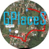
Maps GPS Places 1.8
Registren la empresa donde trabajan:GPlaceS surgió como un proyecto que busca aprovechar al máximolalocalización GPS y Google Map v2. Si eres un empresario osoloalguien que desea registrar una cuenta para una empresa ygestionartodos los servicios que ofrece dicha empresa, ya quetendrás elcontrol de tu cuenta y de los productos o servicios quepublicasserán administrados por el dueño de la cuenta.Pero si eres un usuario que desea calificar o votar porlasempresas que se encuentran registradas, podrás registrar unacuentade usuario la cual te permitirá calificar a lasempresasregistradas desde 1 a 5 estrellas y muy pronta, podrásopinar sobrelas empresas que calificas.GPlaceS se encuentra en fase beta, es por ello que concadapersona que registre su empresa en nuestra base dedatos,lograremos una aplicación estable y con muchos lugaresdondeescoger. por lo que pido a las personas que votan con unaestrella,piensen primero que esta aplicación tiene sus bases dedatosintactas y que entre mas empresarios conozcan esta app,masopciones de búsqueda exitosas tendrán. GPlaces se encuentraendesarrollo y por el momento las cuentas son gratis.Características*Registrar cuenta gratis*Localización GPS de tu empresa en cualquier parte delmundo.(Google Map)*Registro de varias categoría para tu empresa (Hotel,Restaurante,Soda)*Registro de productos o servicios*Estado de empresa open/closed*búsqueda por categoría, distancia, cantidad de resultadoycoordenada.*Calificación a lugares visitados*Información de la empresaMuy pronto se podrán comprar productos y servicios desde lamismaaplicación.Record the companywherethey work:GPlaceS emerged as a project that seeks to maximize theGPSlocation and Google Map v2. If you are a businessman orjustsomeone who wants to register an account for a company andmanageall the services offered by the company, as you will havecontrolof your account and the products or services you post willbeadministered by the account holder.But if you're a user who wishes to qualify or vote forthecompanies that are registered, you can register a useraccountwhich will allow you to qualify from the registered from 1to 5stars and very prompt companies can review the companiesthatqualify.GPlaceS is in beta, which is why each person registeringyourcompany in our database, we will achieve a stable and plentyofplaces to choose application. so I ask people to vote with astar,think first that this application has data bases intact andthatthe more entrepreneurs know this app, more options havesuccessfulsearch. GPlaces is under development and currentlyaccounts arefree.Features* Register Free Account* GPS of your company at any location in the world.(GoogleMap)* Record multiple categories for your business (Hotel,Restaurant,Soda)* Registration of products or services* Company State open / closed* Search by category, distance, number of resultsandcoordinate.* Rated to places visited* Company InfoSoon be able to buy products and services from thesameapplication.

MAPS.ME – Map with Navigation and Directions v14.2.71484-googleRelease
Free, fast, detailed and entirely offlinemapswith turn-by-turn navigation – trusted by over 90milliontravelers worldwide.OFFLINE MAPSSave mobile data, no internet is required.FREE FOREVERAll maps inside and all features are free. Always were andalwayswill be.NAVIGATIONUse driving, walking and cycle navigation anywhere intheworld.INCREDIBLY DETAILEDDirections to points of interest (POI), hiking trails andplacesmissing from other maps.UP-TO-DATEMaps are updated by millions of OpenStreetMap contributorsdaily.OSM is an open-source alternative to Google Maps, MapquestandWaze.FAST AND RELIABLEOffline search, GPS navigation along with optimized mapstoeffectively save memory space.BOOKMARKSSave locations you love and share them with your friends.AVAILABLE WORLDWIDEEssential for home and travel. Paris, France? Check.Amsterdam,Netherlands? Check. Barcelona, Spain? Check. New York,Chicago,Florida, Las Vegas, Nevada, Seattle, San Francisco,California,USA? Check! Rome, Italy? Check. London, UK? Check.TRAFFIC DATANew online city traffic maps. Check out updates on traffic infoandfastest driving routes in 36 countries!AND MORE!– Search through different categories e.g. restaurants,cafes,tourist attractions, hotels, ATMs and public transport(metro,bus…)– Make hotel bookings via Booking.com directly from the app– Share your location via text message or social media– When cycling or walking, the app shows whether the way isuphillor downhillContinued use of GPS running in the background candramaticallydecrease battery life.If you have any questions, visit our HelpCenter:support.maps.me.If you are unable to find the answer to your question, contactusat: [email protected] us on FB: http://www.facebook.com/mapswithme |Twitter:@MAPS_ME

GPS Map 27.0.7
GPS Map is a free, advertising supported app that allows you todoawesome things with a map powered by Google on Android devices.Fora price, you can get GPS Map Pro which is identical withouttheadvertising banner.Activities are organized into the following categories:* Search - Find new Placemarks by address, or coordinates.* My Location - Center or mark your place quickly, toggleReal/Mocklocation, Search nearby, and Share your location.* Layers - Allows you to toggle the visibility of MyLocation,Placemarks, Satellite, Traffic, Track, and Routelayers.* Placemarks - View list, Center, Change location, use asMocklocation, Navigate to, Route to, Search nearby, Street View,andShare* Routes - View list, Change color, Details, Hide, ShowandShare* Tracks - View list, Start/Stop Recording, Change color,Graph,Tour on Google Earth, View at Human, Land, and Plane speed,andShare* Images - View list, set Default for Marker, Import as aMarker,Import location from Image* Markers - View list, Edit/Delete/Hide/Show groups ofPlacemarks,Markers created for each Import* Compass Mode - All visible layers rotate instead of MyLocationarrow rotating towards north* Copyright - All the legal copyright and disclosure stuff* Data Management - Import/Export/Manage data* Help - A quick introduction, the FAQ, and links to otherhelpfulcontent about GPS Map* Preferences - Adjust update time, long press time, thevisibilityof various items and featuresUse almost any image from your Camera, Gallery, or file browsingappto create a Marker for a Placemark on the map. Imagescontaininglocation information can be imported as Placemarks withtheir imageas the Marker on the map.GPS Map has the following features:* Easy to search for a location by address, placemark name,orlatitude, longitude.* Import/Export your Placemarks - GPSMap GPS, Garmin CSV,GeocodeGEO, Google Earth/Google Maps KML,GPS Exchange GPX filesandTomTomASCII* Imports the location and image from a photograph to createaPlacemark on the map with the Image as the Marker* Able to view Placemarks, Routes and Tracks with GoogleEarth* Able to be taken to Google Street View for a Placemark(ifavailable)* Able to use Placemarks to start a navigation app likeGoogleNavigation* Export to Google Drive Fusion Tables with an activeGmailaccount* Creates Tours for Google Earth based upon your recorded TrackWorks best with:* Google Earth, Google Maps, Google Street View installed.GPS location service enabled.Visit https://sites.google.com/site/wrightkeith/gpsmap/formore information.

GPS Route Finder Maps 1.0.21
Now you don't have to worry about finding awayto any place. GPS Route Finder is the best solution toyourproblems. It's your personal GPS navigation App where youcanSearch and track any place in world.It provides youmultipleresults including Shortest route finder to yourdestination.GPS Route Finder Map is a personnel application through whichyoucan easily track all the locations you have visited. It’s asimpleGPS tracking app that helps you to track your own locationson datewise GPS location tracker takes advantage of GPS &Network toget your position on Earth, and obtains map informationnear yourlocation using Google Map and GPS locator and one can alsorequestthe location of his/her friend.It uses Global PositioningSystemfor GPS tracking. GPS Router provides your distance and timetakento reach your destination.GPS Navigation allows users to navigate to there destinationsviadirections and search maps using a number of differentmethods..Itis also a driving route finder app. Google Maps bestfeatures areintegrated in it to give you accurate result.Ithighlights HighlyTraffic areas on Map and save your time. Try itOut !Features:* GPS Route Finder give you best possible route toyourdestination.* This App uses Global Positioning System to giveaccurateresult.* GPS Route Finder Provide multiple route and give you the optiontochoose.* One can find any place or address through this GPS Locator.* Best Navigator app for searching Online Maps in threedifferentModes.* It give accurate result.(try yourself).* Supports different Online maps & Offline maps types :Normal,Satellite, Terrain maps.* Find GPS Driving Route.* Find GPS Walking Route.* Find GPS bicycle Route.* Added GPS location Alarm .* Offline GPS Route Finder Added.Privacy Policy:Your privacy is important to .Sometimes we need informationtoprovide services that you request; this privacy statementappliesto This App only. We Do Not share your Physical Locationwith ThirdParty.

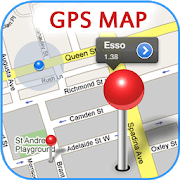


GPS MAP Mobile 1.0
GPS MAP Mobile is mobile mappingserviceapplication and technology provided offering satelliteimagery,street maps, and Street View perspectives, as well asfunctionssuch as a route planner for traveling by foot, car,bicycle or withpublic transportation. Live MAPS locator for urbanbusinesses andother organizations in numerous countries around theworld.One of the neat features of Google Maps / Google Earth istheability to get a street view of many urban and suburban areas.Thestreet view is an actual photograph shot with an ImmersiveMediacamera that delivers a 360 degree image of thesurroundings.Street View - Walk Down Your Street With Google MapsWe all love their traffic alerts, but how exactly doesGoogleMapsknow how clogged the highway is on your way out of townthisweekend?Features,• How to Get Latitude From Google Maps• How to Use Coordinates in Live Maps• How to Find Latitudes & Longitudes forMultipleAddresses• How to Convert Google Maps CoordinatesNOTE : This is Contents Application. It gives youinformationregarding GPS MAP Mobile

GPS Tracker 0.9.9
Tracking over 6,000,000 locationsUse GPS Tracker to locate your family in case of concern,oremergency.The GPS Tracker allows you to locate your family at any time,makingit easier to locate your loved ones in case of emergency.Whateverthe reason for checking up, you can keep a close eye onthe currentand recent locations of your children, your parents andyourpartner.Available to download for iPhone and Android, the GPS Trackerkeepstabs on your device and family's location 24/7, in caseofemergency or concern.Use it:►On a family member’s phone, so that you can log in via yourbrowserto check their current location.►On your own phone, in case it’s lost or stolen.►On an elderly parent’s phone, for peace of mind if they’re pronetowandering.WHAT DOES THE GPS TRACKER DO?Available for Android and Apple smartphones, the GPS Tracker isan‘emergency beacon’ for GPS-enabled mobile devices, that sendsyourlocation to central servers in case of emergency orconcern.Location details can be viewed online by logging in throughtheGridLocate website (https://gridlocate.com), or can be checkedonthe go using the GridLocate Family Locator (*Android only). Seethephone’s last known location, receive ‘low battery’ alerts andviewpinpoints on a zoomable map.The GPS Tracker records 24/7, ready for any emergency.IS THE GPS TRACKER A REAL TIME PHONE TRACKING APP?Not quite! The GPS Tracker sends a location update when there'sachange in your location, and roughly every 15 minutes,withlocation history recorded for up to 30 days.We've done a lot of research, and we've discovered thatteenagersthink of real-time data as ‘invasive’. Many would feellike someonewas spying on them, or watching their every move.People are much more comfortable to have their locationrecordedonly when there's a significant change, instead of feelinglikeevery single step is being followed.Real-time updates would drain a battery quickly, but on iPhoneandAndroid the GPS Tracker uses just 4% battery power per day,andless than 10Mb a month.IS GPS TRACKER ACCURATE?Yes. Following each location update, GPS Tracker requestsanaccurate location usually to within 30 meters. We use GPS, WIFIandLBS positions (mast locations) to find an accurate location inallsituations.A FEW SCENARIOS....It would take forever to list the many ways that our GPS Trackercanhelp. We’ve narrowed it down to just a few examples:►You’re working late. You can use the GPS Tracker to check thatyourteenager is safely home from school.►Your son or daughter is on a night out and promised to be backbymidnight, but they’re late. Use the GPS Tracker to checkthatthey’re at least on their way.►Your elderly father has wandered off once before. You’reworriedthat he’ll do it again. Install GPS Tracker to his phone andyou’llbe able to quickly check whether he’s just popped out forsomemilk, or he’s strolling in the wrong part of town.►There’s a bomb scare somewhere in the city. With the GPSTracker,see if your partner is anywhere nearby.►You lost your phone sometime between the desk and the dinnertable.Did you leave it in the office or is it currently travellingbytrain? Your GPS Tracker will give you the answer.READY TO GO?For instant location information, follow these threesimplesteps:Step 1: Register your FREE GridLocate accountathttps://gridlocate.com.Step 2: Download GPS Tracker onto the phones you want to trackusingthe unique IDs.Step 3: Add the devices to your free GridLocate account, toviewcurrent location and location history.GPS Tracker is free to download and free to use. You can track upto5 devices for free on-line or via our Family Locator App. Totrack 6or more devices, prices start at just $10.00 a month


All-In-One Offline Maps 3.6c
All-In-One OfflineMaps offers you toaccessa wide range of maps for free.Bored to wait for maps to display? Once displayed, mapsarestored and remain available, quickly, even with nonetworkaccess.• Want more than just roads on your maps? You will findwhatyou need here;• Used to go to places with poor network coverage?Everythingwill stay available;• Used to go abroad? You won't be lost anymore;• Have a data allowance limit? It will reduceyourusage.★★ Maps ★★A lot of maps are available, including classical roadmaps,topographic maps, aerial (satellite) maps and various layersthatcan be added over any maps: OpenStreetMap (Roads, Topo),GoogleMaps, Bing Maps, USGS National Map (Hi-res topo, Aerialimagery),Worldwide Military Soviet topo maps, etc.• All maps can be stacked in layers, with preciseopacitycontrol.• Select and store large areas in few clicks.• Stored space is clear and can be easily deleted.★★ Display, store and retrieve unlimited landmarks ★★You can add various items on the map such as waypoints,icons,routes, areas and tracks.You can easily manage them using the powerful SD-CardLandmarksExplorer.★★ On-map GPS Location & Orientation ★★Your real location and direction are clearly displayed on themap,which can be rotated to match your real orientation (dependsondevice capabilities).Easy turn on/off to save battery.And also:• Metric, imperial and hybrid distance units;• GPS Latitude/Longitude and grid coordinate formats (UTM,MGRS,USNG, OSGB Grid, Irish Grid, Swiss Grid, Lambert Grids, DFCIGrid,QTH Maidenhead Locator System, ...);• Ability to import hundreds of coordinate formatsfromhttp://www.spatialreference.org;• On-map grids display;• Full screen map view;• Multi-touch zoom;• ...★★ Need more? ★★If you are a real adventurer, try AlpineQuest GPS Hiking,thecomplete outdoor solution based on All-In-One OfflineMaps,loadedwith a powerful GPS Location Tracker andmore:http://www.alpinequest.net/google-play


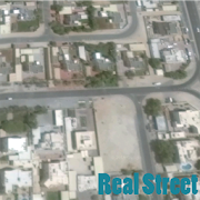
Satellite Live Maps 2.0
Satellite Live Maps view opens up newmethodsofstaying in touch, sharing information, locating addressesandnow, itallows you to view specific addresses from satellitemaplive. MajorInternet entities like Google or TerraServer allowyouto enter anaddress live view satellite of earth, sometimesevendown to aspecific home or building. In many cases, thistechnologyis free,requiring only a fast Internet connection.satellite camera live view requires the installationandcorrectaiming of a satellite dish. Aiming the live satellitedishisaccomplished through gradual up/down and left/rightadjustmentstothe dish while mounted. While many people rely on aprofessionaltoprovide this installation, you can install and aimasatelliteyourself and receive live satellite programming onyourtelevisionso long as you have patience and the help ofanotherindividual.Currently, it is not possible to get livesatelliteimages forevery location by looking online. It isrelatively simpleto accesslive images of interesting and importantplaces in theworld,however, as a few sites are dedicated toproviding livesatellitefeed for these particular sites. who havebeen three bigprovidersof live map satellite view and imagery upuntil 2015,will, nodoubt, work to make a live service available forthe restof theglobe. A live satellite feed is video that isrecorded liveat anevent and then broadcast on the Internet. Byaccessing thesitefrom which the feed is broadcast, you can watch itsatellitemaplive as it is transmitted. All you need to do to watchalivesatellite feed is make sure that you know on which websitethefeedwill be broadcast.Each server and free live satellite maps search engine hasitsownspecific set of rules and guidelines, but theaccessprocessfollows a basic formula.
Mobile Location Tracker Map 1.4
When contemplating your final move from this world, remember itisall about location, location, location. Mobile Location TrackerMapapplication is a strong, proficient and precise areafollowingapplication. It is intended to enable you to discoveryourcompanion's, ATM, Bus stations, Mosque, Church, Airports,Banks,Hospitals, Movie Theater, Cinemas, Hotels, Restaurants andPetrolStations; area in an exceptionally exact and quick way.Theapplication empowers area following amongst loved ones of everyaprivate system. Effectively include an interminable numberoffriends to your system and begin following. Friends gatheringwithMobile Location Tracker Map and end different writings to takeineverybody have evaluated entry time. Friends tracker alarmsyouwhen relatives have checked in at an area and because ofGPSfollowing innovation, family tracker can likewise exhort intheevent that somebody is running late. Mobile Location Tracker Mapisa free Navigation app. It can pinpoint the location ofmobiledevices, Smart Phones, ATM, Bus Station, Mosque, Church,Airports,Banks, Hospitals, Movie Theater, Cinemas, Hotels,Restaurants andPetrol Stations and even old school features phonesvia app, 24/7.All you have to do is to invite your friend whilesharing yourlocation or search his/her location on your phone andstarttracking him/her. Navigation apps free Mobile Location TrackerMap:Location tracker on map by phone number Navigator is hereforthose, who miss original mobile tracker with locationNavigatoricon for easy navigation. So we made this useful mobilelocationtracker navigator app to help gps navigation. This locationtrackeron map by phone number launches Navigation in one click,whichsaves your time and gives you possibility to navigateinstantlywith this amazing gps rout finder. You will enjoy thefeatures ofall gprs location tracker apps like gps navigationworldwide,navigation apps free, live map satellite view, gprslocationtracker, live mob gprs tracker and all other gprs trackerof mobileall in one in this brilliant brand new gps route finderapp. Youwill definitely love this mobile tracker with location appbecausenow we have added the savor of both mobile location trackerand gpsnavigation in this one and only location tracker on map byphonenumber navigator that make your way easy with live mapssatelliteview. You’ll have the features of all gps navigationWorldwide,gprs location tracker, live mob gprs tracker and allother gprstracker of mobile in this brilliant MOBILE LOCATIONTRACKER MAPnavigator app. Now enjoy live map satellite view.Download it freeon Android Play Store! NAVIGATOR WILL LAUNCH GPSNAVIGATION WITHMAPS WITH ACCESS TO: ATM, Bus Station, Mosque,Church, Airports,Banks, Hospitals, Movie Theater, Cinemas, Hotels,Restaurants andPetrol Stations. Free and accurate navigation withworldwide GPSmap coverage From now on you will never get lost withfreeNavigator app. Every traveling for holiday, weekend orbusinesstrip will be easy and you will come home safely. IT WILLWORK ALLOVER THE WORLD, WHEREVER YOU ARE. If you have anysuggestions orideas for the app and games - contact us please: ★Formore detailsvisit to ★ http://www.softnator.com/ ★ ★Like our FBpage to getexciting games and apps★https://www.facebook.com/softnator ★ Ifyou find anything wrong orany copyright things then mail us. Wewould love to hear everyone.

Singapore Map
Hello Everyone,Streetdirectory App comes Offline maps & real-timebustimingExciting Feature★ The most up-to-date Singapore maps★ Bus arrival time★ 2016 Singapore Maps★ 2016 Johor Maps★ latest Bus-stops and train stations with real-time data.★ Free Offline Maps, once you download the offline map, you canusethe map without internet connection.★ Directions by Car, Taxi, Bus & MRT★ Traffic, Bus timing & ERP pricing information★ Complete 2016 Business directory data for SG businessesandretailers.


All-In-One Offline Maps +
All-In-One OfflineMaps+ offers you toaccessa wide range of maps.Bored to wait for maps to display? Once displayed, mapsarestored and remain available, quickly, even with nonetworkaccess.• Want more than just roads on your maps? You will findwhatyou need here;• Used to go to places with poor network coverage?Everythingwill stay available;• Used to go abroad? You won't be lost anymore;• Have a data allowance limit? It will reduceyourusage.This Plus version includes all features of the Standardversionwithout ads, and supports import of professional GPS andgeographiclandmarks file formats (waypoints, routes, tracks, areas)like GPX,Google Earth KML/KMZ (map overlays not supported),OziExplorer WPT,CVS/TSV and Geocaching LOC★★ Maps ★★A lot of maps are available, including classical roadmaps,topographic maps, aerial (satellite) maps and various layersthatcan be added over any maps: OpenStreetMap (Roads, Topo),GoogleMaps, Bing Maps, USGS National Map (Hi-res topo, Aerialimagery),Worldwide Military Soviet topo maps, etc.• All maps can be stacked in layers, with preciseopacitycontrol.• Select and store large areas in few clicks.• Stored space is clear and can be easily deleted.★★ Display, store and retrieve unlimited landmarks ★★You can add various items on the map such as waypoints,icons,routes, areas and tracks.You can easily manage them using the powerful SD-CardLandmarksExplorer.★★ On-map GPS Localization & Orientation ★★Your real location and direction are clearly displayed on themap,which can be rotated to match your real orientation (dependsondevice capabilities).Easy turn on/off to save battery.And also:• Metric, imperial and hybrid distance units;• GPS Latitude/Longitude and grid coordinate formats (UTM,MGRS,USNG, OSGB Grid, Irish Grid, Swiss Grid, Lambert Grids, DFCIGrid,QTH Maidenhead Locator System, ...);• Ability to import hundreds of coordinate formatsfromhttp://www.spatialreference.org;• On-map grids display;• Full screen map view;• Multi-touch zoom;• ...★★ Need more? ★★If you are a real adventurer, try AlpineQuest GPS Hiking,thecomplete outdoor solution based on All-In-One OfflineMaps,loadedwith a powerful GPS Location Tracker andmore:http://www.alpinequest.net/google-play


Voice GPS Navigation & Map
New features added in version 2:- Route Finder (Navigation)- Near by : get near by school, parks, hospital, restaurant,banks,atm, gas stations, shopping malls, railway stationsetc.- Current location: get your current location in text form andshareit with your friends .App features :- Speak to search between 2 places, route, Map andnavigation.- Search is integrated between current location todestinationlocation by default. You can replace the currentlocation withother location too.- Easy and quick to search.- Use of Google Map Service and navigation- Detailed features of Near By search with real user ratingsandcomments.- Get navigation between 2 destination by setting destinationswithin the app in Route Finder. Get shortest and best route withroutefinder.Just speak out California and you'll instantly get the locationandnavigation from your current location to California.