Top 34 Apps Similar to Countries of the World


World atlas & map MxGeo Pro 6.8.10
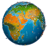
World atlas, world map and educational appforgeography. Contains 240 countries and territories of the worldwithcomprehensive economic and geopolitical data. Political mapswithregional units (provinces), capitals and majorcitiesincluded.Designed for smartphones and tablets.• Maps, flags and comprehensive data for 240 countriesandterritories of the world• Interactive political world, continent and country maps• Shaded relief layer for world and continent maps• Geography quiz challenge for playful learning• Country comparison, favorites and distance calculator• Configurable world clock with time zone display• World-explorer: the smallest, largest, wealthiest, andmostpopulated countries of the world• Selectable color themes for map display• All data and maps included, no online connection required• No advertising or In App Purchases• No permissions requiredExplore the world through political continent and countryofflinemaps. Whether Europe, Africa, Asia, Oceania, South andNorthAmerica: maps of all continents and countries are included.Learnwhere each country in the world is located. View itspositionhighlighted on a digital globe. Create your favorite colortheme orchoose from different color schemes for map display.Do you know the flag of Mauritius? Yes? Perfect. Do you also knowinwhich country the Mount Everest is located? “World atlas &worldmap MxGeo Pro” Quiz helps you acquire a geographic literacyin aplayful manner.Choose from six geo guessing games:• Test your knowledge about the capitals in the world• Recognize the proper country flag based on the outline map• Do you know the top-level domains of the world's countries?• Guess the highlighted country on the virtual globe• Do you know the ISO countries codes of the world?• Do you know the mountains of the world?Each quiz offers seven regional variants: World, Europe,Africa,Asia, Oceania, South or North America.Geo learning app and educational game which is fun foreveryonewhether children, adults, seniors or teachers. Get readyfor yournext stay abroad while enjoying this great world almanacincludingtime zones and statistical data, such as populationgrowth,unemployment rate, average age, gross domestic product (GDP)bysector and other key figures. Or prepare for your nextgeographylesson with this genius digital world map. If nottraveling ourworld atlas lets you explore the world just onlyvirtually.Enjoy the comprehensive atlas of the World including Europe,Asia,North America, Africa, Oceania and South America with allcountriesand regional units, capitals and flags.


Pays du Monde (+Quiz) 2.25.11
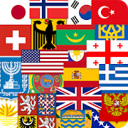
Annuaire autonome de tous les pays du monde.Ilcontient l'information détaillée et fondamentale de tous lespays dumonde.Il contient aussi des renseignements sur les océans, lesmers,toutes les unités monétaires, les types de gouvernement,régions,organisations internationales, langues et de beaucoupd'autreschoses.N'exige pas la connexion Internet. Facile à utiliser. Aunerecherche par le nom du pays et d'autres critères.Convenable pour tout étudiant comme une encyclopédie géographiqueetpour quelqu'un qui veut enrichir leur connaissancedegéographie.Grand pour les voyageurs fréquents et les gens voyageantàl'étranger.Les catégories principales de renseignements :La région dans laquelle le pays est localisé ;Type de gouvernement ;La capitale du pays ;Région ;Données géographiques ;Climat ;Population (nombre, nationalité) ;Religion ;Croissance démographique dans l'année ;Espérance de vie lors de la naissance ;La densité démographique ;Langue formelle et informelle ;Données sur la devise ;Téléphone international ;Organisations internationales ;Mers et océans ;Soutien : countries-info@yandex .ruStandalone directoryofall countries of the world. It contains detailed informationandfundamental of all countries of the world.It also contains information on the oceans, seas, allmonetaryunits, types of government, regions, internationalorganizations,languages and many other things.Does not require internet connection. Easy to use. A search bythename of the country and other criteria.Suitable for any student as a geographical encyclopedia, andforsomeone who wants to enrich their knowledge of geography.Great for frequent travelers and people traveling abroad.The main categories of information:The region in which the land is located;Type of government;The capital of the country;Region;Geographic data;Climate;Population (number, nationality);Religion;Population growth in the year;Life expectancy at birth;The population density;Formal and informal language;Data on the currency;International Phone;International organizations;Seas and oceans;Support: countries-info @ yandex .ru


Atlas 2021 2.6
*** NEW RELEASE *** *** 50% OFF For a Limited Time! ***ViewqualityWorld Maps conveniently and easily on your AndroidDevice!FeaturesUp-To-Date World Maps! Did you know? -------------SouthSudanbecame the world's 195th country following separationfromSudan on9 July 2011 Carry your pocket Atlas wherever you go foraquickreference. *** FEATURES *** - Full Screen maps - OFFLINEmaps.NoInternet connection is required. Contains ========= -DetailedWorldMap - Political World Map - Physical World Map - MapofAsia,Africa, Antarctic, Arctic, Central America, Europe,NorthAmerica -Bonus World Time Zones - Countries Featured:Australia,UnitedStates, United Kingdom, Canada, China, India, andMore. Aquickreference Atlas that will allow you to quicklylocatecountries suchas United Kingdom, United States, Australia,India,France, Germany,Thailand, China, India and many more!Instructions============= -Press the 'Menu' button on your deviceto view theMap SelectionMenu. Users Love Atlas 2021 Download Atlas2021 andexplore worldmaps conveniently on your device today!
