Top 23 Apps Similar to Altitude meter


Elevation Profile 2.5
This application shows the elevation profileofthe path.Create the path by tapping the map. Different modes of pathcreatingare available: direct, driving, walking and bicycling.Direct modedraws straight lines between points. Driving, walkingand bicyclingmodes are able to find and follow roads betweenpoints. Driving modefinds routes using the roads network. Walkingmode uses pedestrianpaths and sidewalks (where available). Bicyclemode uses bicycletracks and preferred streets (this is currentlyavailable only inUS). Every point shows altitude in preferredunit. Distance betweenfirst and last point is shown on the top ofthe screen.Get the elevation profile chart of the path or the track bypressingthe button 'Profile'.It is possible to get your current location. It is also possibletosave and load routes.Ideal for hikers and bikers to assess the level of difficulty oftheterrain before actually going out. Internet access isrequired.Choose between metric and imperial distance units.For feedback and support send email to [email protected] report bugs if found. Improvement suggestionsarewelcomed.Use this application only for informational purposes. Do not useitfor making important decisions.
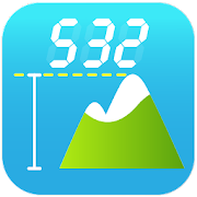


Accurate Altitude measurement 1.1
You can measure altitude level accuratelywithyour mobile without internet connection. Just download thisfreedigital altitude meter App which Turns your phone intoanaltimeter! (An Accurate Altitude measurement). An app youalwaysneed to measure the pressure and height of buildings abovesealevel.Use this Altitude measurement tool to measurebuildingheights. Height of buildings from ground level to top floormay becannot measure with a GPS because of inaccurate altitudeunits.QuestionIs possible Measuring my altitude above sea levelaccurately?I live in a building which sits very high near the top of ahill.I estimate the ground level of the building to be around 700feet, Ilive on the 13th floor, so my altitude is approximately 800~ 850feet. I would like to get an accurate measurement (correct to+- 10feet).How I did the measurement ?★ Measure the ground level altitude at a park with digitalaltitudemeter★ Estimate the height of each floor★ Using a GPS unit in the flat would produce inaccurate resultsusedigital altitude meter★ GPS units are inheritly inaccurate at altitude (comparedtolateral position)★ I cannot access other floors other than the one I live★ I have a good view of the city. By looking at a map, Icanaccurately calculate myground-level distance to certain sea-level landmarks.Theselandmarks are some 5 km away.★ I would like to minimize the cost of purchasingspecialequipment.Features :* Accurate measurement of altitude (elevation) withonlineRuntastic altitude meter* sharing your Altitude online with friends* Altitude units in meters or feet* Sunrise and sunset info* Builtin Compass* GPS coordinates* Current temperature and wind speed* No ads

Altimeter
Altimeter is beautifully designed and easytouse android application for measuring altitude andalmosteverything you want to measure.With Altimeter you can measure everything around you, whetheryouаre in the mountain or in the city. Altimeter is great toolforpeople who love skiing, mountain biking, hiking, traveling,outdooractivities, elevation or just want to checktheircoordinates.Features:With GPS tracker you can track your speed, altitude from allyouroutdoor activities and then check the path that you traveledwithhigh precision. GPS Tracker shows your maximum, minimum andaveragespeed.GPS Tracker also shows your maximum, minimum and averagealtitude.GPS Tracker shows you total elevation during the track. InGPSTracker you can check the duration of your tracks and wheretheywere tracked.To start gps tracker all you need to do is to hit the startbuttonat the top of altimeter app, when it becomes active(startbuttonbecomes active only when receive signal from gps satellite).Tostop the gps traker just hit stop button at the place ofstartbutton at the top of altimeter app.With GPS Altimeter you always can check youraltitude(elevation)with ease. Altitude is measured by your GPSsensor in meters orfeets. The Altimeter works great in offline modethanks to the GPSsensor in your device.GPS Speedometer. Speedometer measures your speed in km/h ormphthrough GPS. In a second you can measure your speed thanks totheGPS speedometer.Barometer tool. Measures atmospheric pressure by the sensor inyourdevice in hPa or psi.Thermometer tool. Ambient temperature measured by the sensorsinyour device in Celsius or Fahrenheit degrees. The thermometerinaltimeter app works in offline mode, so you can always checkthetemperature around you.Hygrometer tool. Ambient relative humidity also measured bysensorin your device.With altimeter app you can easily check thehumidityin your home or anywhere.-Illuminance meter tool. Amount of light on your device measuredinlux or fc. In Altimeter app you can measure the amount oflightbeam from any source.Altimeter app integrates Google Map showing your currentlocationand coordinates. By moving the pin around the map you cancheck thecoordinates of any location.Battery level.In altimeter app you can easily share your measurements withyourfriends, or just export them to save place, by tapping theexportbutton from the menu, any time you want.Feel free to suggest next features!

Altimeter Barometer - Altitude Meter 1.5
This application turns your phone into a barometer or altimeter(AnAccurate Altitude measurement). Greatest barometric tool tomeasureatmosphere pressure It measures height above sea level inaltitudeunits of feet and meters. It calculate atmospheric pressureinbarometric units of psi and bars. Remarkable elevationmeasurementapp to measure height above sea level. Wonderful app forhikingtoolbox on mountains. Cool assistance app in outdooractivities fortourists.

Digital Altimeter 1.2.0
Looking for a simple altimeter? Try this app Nothing butanaltimeterShow your current GPS altitude in feet or meterWithDigital readingYellow dots indicate GPS accuracy If you haveanysuggestions pleasesend them to [email protected]

Easy Altimeter and Compass 2.3.4
With Easy Altimeter and Compass you will get an app that willmakeeasy for you to know your location in a map, your altitude andyourheading in a compass! Easy Altimeter has two methods ofacquiringthe altitude: direct GPS and Altitude Correction. Ouralgorithmwill determine automatically which of the 2 methods isbetter andfaster for determining your altitude based on currentconditions. -Direct GPS altitude: Easy Altimeter will get thealtitude directfrom the feed of your GPS. This mode greatly dependson the qualityof your GPS receiver and atmospheric conditions. Keepin mind thatwalls, vehicle roofs, tall buildings, mountains, andotherobstructions may block line of sight to GPS satellites. -Altitudecorrection: Easy Altimeter calculates the earth surfacealtitude atyour GPS position. Very reliable if you are at groundlevel. Thiscalculation is slower that the direct GPS method andinternetconnection is required to perform the calculation. The maphas alsodifferent modes: - Terrain: Displays a physical map basedonterrain information. - Satellite: Displays Google Earthsatelliteimages. - Map: Displays the default road map view.


Map Distance Meter 2.6
This application allows you to measurethelength of a path on the map. You can also measure the size ofanarea on the map.Measure distance:Create the path by tapping the map. Different modes of pathcreatingare available: direct, driving, walking and bicycling.Direct modedraws straight lines between points. Driving, walkingand bicyclingmodes are able to find and follow roads betweenpoints. Driving modefinds routes using the roads network. Walkingmode uses pedestrianpaths and sidewalks (where available). Bicyclemode uses bicycletracks and preferred streets (this is currentlyavailable only inUS). Distance between first and last point isshown on the top ofthe screen.Measure area:On preferences screen, choose Area in Measure Distance orArea.Create the area by tapping the map. Size of an area andtheperimeter are shown on the top of the screen.It is possible to get your current location. It is also possibletosave and load routes and to export routes in GPX format.Internet access is required. Choose between metric andimperialdistance units.Use this application only for informational purposes. Do not useitfor making important decisions.Please report bugs if found. Improvement suggestionsarewelcome.

Elevation 2.9
Just tap on the map and get elevation!Put as many markers on the map as you like. Choose betweenmetricand imperial elevation units. Altitude is shown for everypoint. Itis possible to save and load points, and to export them inGPXformat. It is also possible to get your current location.Internet connection is required.Please report bugs if found. Improvement suggestionsarewelcomed.Use this application only for informational purposes. Do not useitfor making important decisions.


eGPS Elevation 1.1
eGPS Elevation has greatly improvedaltitudeandelevation readings. In a typical Android GPS, altitudereadingsarenotoriously inaccurate. eGPS Elevation will even showhow deepis thenearest water area.!!!Works with GPS feature turned off!!!eGPS Elevation will come in handy for any fanofoutdooractivities such as hiking, cycling, camping oranylocation-basedsocial networking activities. It also uses themostadvanced maptechnology to give you precise directions andpinpointyourdestination address down to the zip code. Anyone whohas everfoundthemselves on a road trip in an unfamiliar city willbe abletoappreciate the ability to receive such accuratedirectionswheneverthey want to find a restaurant, gas station orhotel.eGPS Elevation app is sure to please fans of our eGPSLite.Likethe eGPS Lite, this app has all the GPS capabilities youcouldaskfor and shows your destination or location down to thelatitudeandlongitude, speed and heading.The biggest difference between this app and the eGPS Liteisthatthis app has greatly improved altitude and elevationreadings.In atypical Android GPS, altitude readings arenotoriouslyinaccurate.People don't always think about things suchas altitudeandelevation when they are deciding on where they wantto go whentheytravel, but it is a bigger factor that many realize.Highaltitudecan have an effect on a person's health if he isn'tusedto it. Thethinner air can result in issues such asshallowerbreathing,insomnia and decreased appetite. These are by nomeanssevere, butthey can be bothersome. Knowing a location'srealaltitude and realelevation can indeed come in handy, and withthisapp you can besure that your GPS altitude and GPS elevationwillbe far moreaccurate than what can be found on any otherAndroidGPS app on themarket. Just touch any part of the map screenon theapp'seasy-to-read interface to know the exact altitudeandelevation ofthat location.


Altitude Retriever Limited 1.09
NOTICE: Development and supportforthisapplication has ceased.Please read this description very carefully!****************************************NOTE : GOOGLE HAS INEXPLICABLY REMOVED TRACK SHARING FROMMYTRACKSSO DO NOT UPDATE TO MY TRACKS 2.0.8 OR HIGHER OR YOU WILLBEUNABLETO CORRECT TRACKS. GPX FUNCTIONS ARE NOT AFFECTED.If you have already updated My Tracks you can very easilyfindacopy of My Tracks 2.0.7 APK (program) to download to yourdeviceanside load it. My Tracks 2.0.7 is available for downloadatapkmirror.(http://www.apkmirror.com/apk/google-inc/my-tracks/my-tracks-2-0-7-apk/).This is all not under my control. Please do not rate myapppoorlybecause of what Google has done. Many other applicationsarealsocrippled by this.****************************************Bummed out by how far off the GPS altitude is on your device?LettheAltitude Retriever fetch for out.NOTICE: Altitude can only be fetched for land surfacesthatlaybetween 60 degrees north latitude and 54 degreessouthlatitude.Countries such as Norway, Sweden, Finland, Iceland,andmost of thestate of Alaska will not work. Refertohttp://1.usa.gov/Mq9AW7 fora coverage image.- Automatically correct and save My Tracks tracks(Version2.0.7or earlier)- Corrected tracks can be uploaded to Google in MyTracks(Version2.0.7 or earlier) just like any other except thealtitudeisCORRECT!- Correct altitude in any GPX file.- It even adds altitude data to GPX files missing altitude dataMobile device GPS altitude data is notoriously errorprone.Thisapplication will use the latitude and longitude values inaMyTracks track, or GPX file, to retrieve more accuratealtitudedatafrom the Internet. Note that if any error in yourphone'salatitude and longitude will affect corrected altitudedata.Thiswill be most noticeable for data related to canyonandmountainside tracks.This is a Limited VERSION. It will let you see thefullycorrectedaltitude data in a before/after chart but will onlysavethe first 3Miles (~5Km) to My Tracks. This will let youverifythat all featureswork on your device. Upgrade to the paidversionto get waypointsupport, remove adds, and work with tracksof anylength.NOTE: In order to use this application you must haveMyTracks(Version 2.0.7 or earlier) installed and enable sharinginMyTracks.Key Words: My Tracks, elevation, altitude,GPX,bicycling,running, hiking, correction

