Top 50 Apps Similar to world map atlas 2023


World atlas & map MxGeo Pro 6.8.10
World atlas, world map and educational appforgeography. Contains 240 countries and territories of the worldwithcomprehensive economic and geopolitical data. Political mapswithregional units (provinces), capitals and majorcitiesincluded.Designed for smartphones and tablets.• Maps, flags and comprehensive data for 240 countriesandterritories of the world• Interactive political world, continent and country maps• Shaded relief layer for world and continent maps• Geography quiz challenge for playful learning• Country comparison, favorites and distance calculator• Configurable world clock with time zone display• World-explorer: the smallest, largest, wealthiest, andmostpopulated countries of the world• Selectable color themes for map display• All data and maps included, no online connection required• No advertising or In App Purchases• No permissions requiredExplore the world through political continent and countryofflinemaps. Whether Europe, Africa, Asia, Oceania, South andNorthAmerica: maps of all continents and countries are included.Learnwhere each country in the world is located. View itspositionhighlighted on a digital globe. Create your favorite colortheme orchoose from different color schemes for map display.Do you know the flag of Mauritius? Yes? Perfect. Do you also knowinwhich country the Mount Everest is located? “World atlas &worldmap MxGeo Pro” Quiz helps you acquire a geographic literacyin aplayful manner.Choose from six geo guessing games:• Test your knowledge about the capitals in the world• Recognize the proper country flag based on the outline map• Do you know the top-level domains of the world's countries?• Guess the highlighted country on the virtual globe• Do you know the ISO countries codes of the world?• Do you know the mountains of the world?Each quiz offers seven regional variants: World, Europe,Africa,Asia, Oceania, South or North America.Geo learning app and educational game which is fun foreveryonewhether children, adults, seniors or teachers. Get readyfor yournext stay abroad while enjoying this great world almanacincludingtime zones and statistical data, such as populationgrowth,unemployment rate, average age, gross domestic product (GDP)bysector and other key figures. Or prepare for your nextgeographylesson with this genius digital world map. If nottraveling ourworld atlas lets you explore the world just onlyvirtually.Enjoy the comprehensive atlas of the World including Europe,Asia,North America, Africa, Oceania and South America with allcountriesand regional units, capitals and flags.


Atlas 2021 2.6
*** NEW RELEASE *** *** 50% OFF For a Limited Time! ***ViewqualityWorld Maps conveniently and easily on your AndroidDevice!FeaturesUp-To-Date World Maps! Did you know? -------------SouthSudanbecame the world's 195th country following separationfromSudan on9 July 2011 Carry your pocket Atlas wherever you go foraquickreference. *** FEATURES *** - Full Screen maps - OFFLINEmaps.NoInternet connection is required. Contains ========= -DetailedWorldMap - Political World Map - Physical World Map - MapofAsia,Africa, Antarctic, Arctic, Central America, Europe,NorthAmerica -Bonus World Time Zones - Countries Featured:Australia,UnitedStates, United Kingdom, Canada, China, India, andMore. Aquickreference Atlas that will allow you to quicklylocatecountries suchas United Kingdom, United States, Australia,India,France, Germany,Thailand, China, India and many more!Instructions============= -Press the 'Menu' button on your deviceto view theMap SelectionMenu. Users Love Atlas 2021 Download Atlas2021 andexplore worldmaps conveniently on your device today!


All-In-One Offline Maps 3.6c
All-In-One OfflineMaps offers you toaccessa wide range of maps for free.Bored to wait for maps to display? Once displayed, mapsarestored and remain available, quickly, even with nonetworkaccess.• Want more than just roads on your maps? You will findwhatyou need here;• Used to go to places with poor network coverage?Everythingwill stay available;• Used to go abroad? You won't be lost anymore;• Have a data allowance limit? It will reduceyourusage.★★ Maps ★★A lot of maps are available, including classical roadmaps,topographic maps, aerial (satellite) maps and various layersthatcan be added over any maps: OpenStreetMap (Roads, Topo),GoogleMaps, Bing Maps, USGS National Map (Hi-res topo, Aerialimagery),Worldwide Military Soviet topo maps, etc.• All maps can be stacked in layers, with preciseopacitycontrol.• Select and store large areas in few clicks.• Stored space is clear and can be easily deleted.★★ Display, store and retrieve unlimited landmarks ★★You can add various items on the map such as waypoints,icons,routes, areas and tracks.You can easily manage them using the powerful SD-CardLandmarksExplorer.★★ On-map GPS Location & Orientation ★★Your real location and direction are clearly displayed on themap,which can be rotated to match your real orientation (dependsondevice capabilities).Easy turn on/off to save battery.And also:• Metric, imperial and hybrid distance units;• GPS Latitude/Longitude and grid coordinate formats (UTM,MGRS,USNG, OSGB Grid, Irish Grid, Swiss Grid, Lambert Grids, DFCIGrid,QTH Maidenhead Locator System, ...);• Ability to import hundreds of coordinate formatsfromhttp://www.spatialreference.org;• On-map grids display;• Full screen map view;• Multi-touch zoom;• ...★★ Need more? ★★If you are a real adventurer, try AlpineQuest GPS Hiking,thecomplete outdoor solution based on All-In-One OfflineMaps,loadedwith a powerful GPS Location Tracker andmore:http://www.alpinequest.net/google-play

Star Chart
Used by over 20 million people world-wide,StarChart provides a magical star gazing experience like noother.*****You can now have a virtual planetarium in your pocket! Lookthroughthe eyes of your Android device to see a virtual window intothewhole visible universe.All you have to do is point your Android deviceº at the sky andStarChart will tell you exactly what you are looking at.Using state of the art GPS technology, an accurate 3D universe,andall of the latest high tech functionality, Star Chart calculates–in real time - the current location of every star andplanetvisible from Earth and shows you precisely where they are;even inbroad daylight!Want to know what that bright star is called? Point your deviceatit – you might just find out it’s a planet!Want to know what the night sky looks like to people on theotherside of the earth? Well just point your device down!Want to know where your star sign is in the sky? Star Chartwilltell you all this and more.Star Chart's features include:- Just point and view. No need to scroll around the screen tofindout what you are looking at*.- Alternatively, look around the sky using finger gestures –perfectfor armchair astronomers!- Voice Control: Explore the solar system with commands like:"Flyme to the Moon" / "Go to Saturn" / "Tour Mars" / "LookatAndromeda" / "Where is the Cigar Galaxy?"[English only]- Supports dynamic device orientation viewing. Allows you toviewthe night sky whilst holding your Android device atanyangle.- Accurately depicts all the visible stars of the northernandsouthern hemispheres - a total of over 120,000 stars!- Fly to and explore all the planets of the solar system,theirmoons and the sun all rendered in beautiful 3D with state oftheart visual effects.- Displays all 88 constellations, with constellation imagerybasedon the beautiful artwork by 17th century astronomerJohannesHevelius.- Includes entire Messier catalogue of exotic deepskyobjects.- Using the powerful Time Shift feature allows you to shift upto10,000 years forward or backward in time.- Tap on anything in the sky and get the facts on what youarelooking at, including distance and brightness.- Very powerful zoom function, lets you view the sky inextradetail, using intuitive finger gestures.- Fully configurable. Star Chart displays only the sky objectsthatyou are interested in.- Allows you to view the sky underneath the horizon. So now youcansee where the sun is, even at night!- Manually set your location to find out what the sky lookslikefrom anywhere in the world.- Full search featureSo point your Android device at the sky and see what'soutthere!------------Star Chart is published by Escape Velocity Ltd and developedbyEscapist Games Ltd. We update Star Chart regularly, so pleasesendus your feedback and feature [email protected] thanks for all your feedback so far!Like us on Facebook: www.facebook.com/starchartFollow Star Chart on Twitter: StarChartAppº Augmented Reality (AR) mode only available if your devicesupportsit, as this feature requires a built-in compass. Manualscrolling issupported on all other devices.* Star Chart does not require internet access for normalusage.Internet access is only required initially to verify thelicenseand subsequently when accessing the support page andexternallinks.


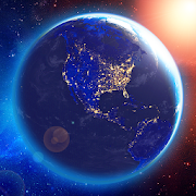
3D EARTH - accurate weather forecast & rain radar 1.1.42
Meet the wonderful 3D Earth. The most beautiful app, ever!Thisunique application combining: weather forecast, clocks, widgetsanda beautiful view from the space to our Earth. Accurateweatherconditions and forecast is the main feature of this app. Theuniqueweather forecast algorithm has access to thousands ofweatherstations. It allows making a mostly accurate forecast foreachlocation around the world! Current weather condition has adetaileddescription, air temperature, wind direction and force,humidity,dew point, pressure, visibility, as well as comfort indexwithreference to current weather conditions. Weatherforecastinformation has a detailed description, day and nightairtemperature, wind direction and force, humidity, UV index,airquality, ozone, geomagnetic storms, the probabilityofprecipitation, and comfort index with reference to currentweatherconditions. FEATURES: - Real-time 3D rendered Earth - RainRadarprovided by Rain Viewer - The world clock for each location-Weather condition for more than 150 000 locations around theworldwith 15 days and hourly forecasts - Beautiful charts for 15daysand 48 hours forecast - Sunrise and Sunset time - Accurate 15dayweather forecast - Weather widgets with weather forecast -Weathernotifications and weather alerts - Weather forecast formultiplelocations all around the world - Fabulous animatedwallpaper with3D Earth - Local time in 12 or 24-hour format -"Feels Like"temperature and weather bug forecast too - Humidityandprecipitation forecast information, pressure in inches, mm ormbar- Fahrenheit or Celsius and Miles or Kilometers - Easynavigationbetween cities - Barometer and pressure forecast for you- UV indexand forecast - Precipitation probability forecast -Visibility onthe roads - Space weather forecast - Dew point inforecast weatherchannel - Share forecast, alerts, by e-mail,Twitter, Facebook,WhatsApp, Telegram, SMS and other ways - LiveWeather notificationindicators in the status bar Paris, London, NewYork, Berlin, Rome,Madrid, Barcelona, Prague, Moscow, Sydney, LosAngeles, Tokyo orany other location worldwide – get accurateweather forecastswherever you go. For assistance, please [email protected]