Top 17 Apps Similar to Lightning@SG

Weather@SG 1.0.17
MSS’ Weather@SG provides the latest warnings, forecastsandobservations at your fingertips. Through this app, users can:•Receive warnings of heavy rain and other hazards • Accessweatherforecasts • View real-time weatherobservations---------------------------------------------------------------------------Fora full suite of weather information, pleasevisithttp://www.weather.gov.sg or follow MetServiceSG on Twittertoreceive more updates. The Meteorological Service Singapore (MSS)isSingapore’s national authority on the weather and climate. It isanoperations division under the National Environment Agency(NEA).Our mission is to observe and understand the weather andclimateaffecting Singapore and to provide services in support ofnationalneeds and international co-operation. The key areas withinthemission include: • Collecting and maintaining of reliablelong-termnational weather records • Providing reliable weather andclimateservices • Conducting high quality research toadvanceunderstanding and prediction of the weather and climateofSingapore and the region • Performing risk and impact assessmentofnatural environmental hazards This application is a service oftheSingapore government.


Blitzortung Lightning Tracker
Utilizes the Blitzortung lightning networktodisplay near-real time lightning strikes and radar from aroundtheworld.Features:* Animated lightning strikes* Lightning station locations and detections* Mark favorite stations to show all their detected strikes* Weather Radar tracks for the US, Europe, and Oceania* Range circles to show how close strikes areOptions:* Animate lightning strikesAll lightning strikes will be shown with an increasing ring* Show detection stationsLines will be drawn from stations detecting a strike to thestrikelocation* Display locationYour location will be displayed on the map* Max strikes displayedMaximum number of strikes to display on the map at asingletime* Time to display strikesLength of time to display the strikes before they fade awayPermissions:* Location permission only used locally on the device to enableyouto zoom to your current location* No personal information is ever sent from the device toanyserversFAQ:* What information is this app collecting on me?No personal information is collected from the device at all.* Why can't I see my station?To reduce the load on the device, stations are clustered whenthemap zoom is very small. By zooming the map in, more stations maybevisible. To always show a certain station, hold down onthestation's icon until the device vibrates. That will set ittoalways be visible.* PortsThe following ports are used; Radar: 4550,Lightning:8050-8090

Weather by WeatherBug
Download WeatherBug®, winner of the2016“Best Weather App” by Appy Awards.“I love using WeatherBug because it is very easy to use andgivesthe most accurate current and future weather reports!” –AndroidUser ReviewWeatherBug, the best free weather app, powered by theworld'slargest network of professional weather stations, providingthefastest weather alerts, real-time weather conditions,accuratehourly forecasts & 10-day forecasts, 18 weather mapsincludingDoppler radar, satellite, lightning alerts, precipitation,localtemperature, local pressure, local radar, wind chill, heatindex,humid, wind, pollen, UV and much more!Join millions of users who depend on WeatherBug, the longestrunningweather app, to help you prepare for all weather conditionsand KnowBefore®.THE WEATHERBUG ADVANTAGE• Spark™ Lightning Alerts: Using WeatherBug's TotalLightningNetwork, receive Dangerous Thunderstorm Alerts 50%quicker and beprepared for severe weather conditions.• World's Largest Professional Weather Network:WeatherBughas the largest professional grade weather stations inNorthAmerica which report hyper-local weather conditionsinreal-time.• 18 Animated Maps: WeatherBug provides the most weathermapsso you have multiple options on what weather conditions youneed tosee.• International Forecasts: Prepare for weather abroadwithWeatherBug's weather forecasts for over 2.6 millionlocationsacross the globe.• Customize Your Weather: Customize your weather data tofityour personal needs with the ability to rearrange weather tilestoyour liking.• Lifestyles Forecasts: Custom weather forecasts for allyourlifestyle activities such as sports games, golf, lawncare,allergies, pollen, outdoors & more.TRACK ANY CONDITION• Alert Notifications: Receive severe weather alertsfromWeatherBug, the NWS & NOAA• Current Weather Conditions: Real-time weatherconditionsfor your local & saved locations• Detailed Weather Forecasts: Reliable hourly forecasts&10-day forecasts• Local Pollen Details: Explore local polled andnationalpollen count & data• Live Doppler Radar: Doppler radar animationforprecipitation information• Real-Time Traffic Conditions: View currenttrafficconditions to better plan your day• Notifications View: See current weather conditions&receive alerts in your notifications area• Precise Weather Details: Get wind speed, UV Index,weatherobservations and more• Weather Widgets: Add weather information to yourhomescreen with weather widgets• Hurricane Center: Track hurricanes using satellite&radar and see the latest hurricane forecastsCUSTOMIZE YOUR WEATHER• Local Conditions: Access to local weatherconditions,weather map & weather radar• Multi-language Support: Get your weather inEnglish,Spanish & Portuguese• Temperature Units: Fahrenheit (°F), Celsius (°C)• Wind Units: MPH, KPH, Knots and MPS• Pressure Units: Inches and millibarsCONNECT WITH US• Facebook: https://www.facebook.com/WeatherBug• Twitter: @WeatherBug• YouTube: https://www.youtube.com/user/EarthNetworks• Know Before Blog: http://knowbefore.weatherbug.com• Pinterest: https://www.pinterest.com/weatherbug/Be prepared. Know Before. Download WeatherBug, the bestfreeweather app today!

Lightning 1.11
The original Android Lightning distance calculator. Pressthetopbutton when you see the flash, press the bottom one whenyouhearthe thunder. The distance is shown in Miles and KM, up to20Miles.If you like, you can also start and stop the timer withtheCamerabutton, trackball, or D-Pad. Fun and educational, it'salsousefulfor outdoor activities where lightning may be a hazard(handyforlifeguards, referees, playground helpers, etc.).Notrecommendedfor artillery spotting... Suggestions welcome -pleaseemail me.This App will never contain annoying ads - ever!****SECURITYNOTICE **** Lightning uses the following permissionsONLY:StorageModify/delete SD card contents. Not that it really*does*anythingwith the SD card... System tools Prevent phonefromsleeping Phonecalls Read phone state and identity The last oneis aresult ofbuilding for Android 1.6 compatibility - Lightningdoes*NOT*actually access the phone information in any way.

Realtime Lightning Detector
This app turns your smartphone or tablet intoareal-time lightning detector. By mapping your smartphone ortabletsGPS to our ZEUS lightning network across Europe we can tellyouexactly where the closest lightning strike has been detectedfromyou.The settings allow you to decide how far you wish todetectstrikes from your location, whether you want a vibrationalert andalso what distance you want a vibration alert. The appalso allowsyou to decide on a range of "quiet times" when the appwill notalert you to close strikes.The default frequency to check the nearby strikes is every2minutes but this can also be changed.The app will then scan around your location and "listen out"fornearby strikes. If any are detected it will display thedistancefrom the strike (and colour code this depending on howclose it is)as well as telling you the direction it was detectedfrom yourlocation.This app is a must have not just for storm chasers but anyonewholoves thunderstorms or takes part in sports or recreationwherebeing outside near a thunderstorm is not a great idea(golfers?;-))


SG Weather 4.9
Singapore weather with radar map display,PSIalert and 24hrs Raining alert/Rain Stop Alert by any locationinSingapore.Features:- Rain start & stop + PSI (hazy day only, psi > 90) +Sumatrahotspot(>120) alert- Weather info like temperature, UV, PSI.- 7 days forecast- 1 Radar Map- Raining cloud radar map in animation- raining cloud movement prediction- Full screen map display- 3 hours nowcast- forecast data every 3 hours- bookmark landmarks/locations- Weather Today, additional weather info like humidity,wind,sunrise and sunset, moon phase and tide.- text to speech for weather highlight- Marquee text (Running text)Widget:- weather nowVIP services:- Remove Advertisement service (yearly ~US$2)Map Button features:Lets start from buttons on the left. First button cantogglefullscreen mode andfullscreen ads will show, banner ads will hide. 2nd button cansetyour bookmark locations. You mayenable rain alert here. 3rd button is the 7days and every 3hrsforecast. Lastbutton showing astronomy info.1st button on the right will toggle the radar image on the maptobe 10mins forecastmode. You will see the raining cloud with shadow, the shadow istheNEXT 10minsmovement base on wind speed. 2nd button on the left will showNEA2hrs nowcast as weather icon on the map.For buttons at the bottom, 1st one from left is theSettingbutton, you can do somesetting and purchase our services here. 2nd button isradaranimation, total siximages start from ~30mins ago. 3rd button will fit your mapviewfocus on whole Singaporeland. 4th button will enable your GPS, your map will keep focusonyour currentlocation, you may disable it by click the button again. Thelastbutton Refreshbutton, it will refresh all data.

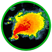
StormEye - Storm Tracking 2.6.4
StormEye provides detailed stormtrackinginformation and weather radar images overlaid on GoogleMaps. Foreach storm, StormEye provides important information suchas thestorm's location relative to your location, where the stormisheading, estimated time of arrival (ETA), the storm'sintensity,hail probabilities, and maximum hail size.StormEye is free, without ads!StormEye functions by downloading data from the NationalWeatherService for the selected WSR-88D weather radar. The radarclosestto your current location is automatically chosen; however,you canquickly switch to any of the 156 NWS WSR-88D radars acrosstheUnited States. The downloaded data is then used to constructaweather radar with markers and tracks for every detectedstorm.StormEye Features:• weather radar and storm tracks overlayed on Google Maps• radar animation• use gestures to zoom, pan, tilt, and rotate the map• quickly switch to any of the 156 NWS WSR-88D radars acrosstheU.S.• tap a storm marker for details about a storm, including:- estimated time of arrival (ETA)- distance and direction from your location- heading direction and speed- max dBZ and rain rate- probability of hail and several hail- max hail size• view a list of all of the storms at the selected radar• average storm heading arrow in the top right corner• your choice of Google Map type to display:- Hybrid- Satellite- Terrain- Map• multiple weather radar types, including:- Base Reflectivity- Composite Reflectivity- Base Velocity- Storm Relative Velocity- Storm Total Precipitation• toggleable layers to choose what is displayed• action bar for quick access to layers and options• automatically finds your location using GPS or network• manually enter your location with an address/zip code• customize the color of the storm tracks• customize the length of the storm tracks• range rings around your location• rotate the map using the compass sensor• display warning polygons:- Tornado Warning- Severe Thunderstorm Warning- Flash Flood Warning• reflectivity strength (dBZ) legend• warnings legend• supports all 50 U.S. states, Puerto Rico, and GuamTo learn more, review StormEye's internal help guide,accessiblevia Help on the menu.StormEye only supports the United States because theNationalWeather Service is the source of the weather radar andstormdata.Please consider emailing me ([email protected])orcontacting me on Twitter (@SmithCodyD) with your issue orquestionbefore giving StormEye a 1 star rating. A good portion ofthe timeI will be able to help you!

MyRadar Weather Radar
MyRadar is a fast, easy-to-use,no-frillsapplication that displays animated weather radar aroundyourcurrent location, allowing you to quickly see what weatheriscoming your way. Just start the app, and your location pops upwithanimated weather!The map has the standard pinch/zoom capability which allows youtosmoothly zoom and pan around the United States and see whattheweather is like anywhere.MyRadar shows animated weather, so you can tell if rain isheadedtoward or away from you, and how fast.In addition to the free features of the app, a fewadditionalupgrades are available; see severe storm warnings foryour area, asprovided by the National Weather Service, andreal-time hurricanetracking - great for the start of hurricaneseason!Download MyRadar today and try it out!


Sg Rain NowCast 1.26
Singapore rain status, Singaporehazecondition, Singapore PSI daily history, Singapore trafficcameras,all in this one simple app!No advertisement, no pro version, no pop up ads. To provideuserswith the current rain status in Singapore. Extremelybeneficial forbikers to plan their route to navigate out of rainareas. PSIhistory table at a glance to know the haze conditionsimmediately.Full view of each expressway at a click of abutton.No battery draining problem, no notification, no GPS. OnlyInternetPermission is required for this application to function.Manualanimation of the rain status so that everything is underyourcontrol.The information provided in this application is extracted fromNEAand LTA website and has complied with the "Terms of Use".