Top 43 Apps Similar to Compass GPS

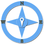
Compass 0.4.5
Smart compass free. Hiking compass sos flashlight. ★Easycalibration ★ Show angle in degrees ★ Small size ★ Clean design★Install on SD ★ SOS FlashLight ★ Night mode - This is a simplebuthigh precision digital compass. - This is a minimal andbeautifulcompass. - you can`t lost yourself when you get a newplace. - Areally beautiful Clock with hours , minutes, seconds,week anddate. - It has beautiful, pure and practical UI design. -It has alot of Skin that you can get all by free. - It has aFlashlight,you use it when you walk in night. - It has a SOSfunction, you canuse it on your outdoor activity. How to use: -Keep your phoneparallel to the ground and turned toward the redarrow that youwant to define - Compass will display on-screendirections anddegrees. - You can change the screen brightness byslide up or downon the screen, so that you can use it morecomfortable. * Note: ***Your mobile device must have a compasssensor can use thisapplication. *** Keep the device away from metalobjects, machineryand where high magnetic field to avoid falseresults Applicationscompass, digital compass to help you determinethe directionquickly and accurately. *** You can move your phone inspace in a ∞figure pattern until the accuracy turns to high. *** Ifyou do nothave a compass sensor, you will not be able to runCompass and thatis not our fault, do not underestimate us on thegoogle play store.- N is north - S is the South - E is east - W isthe West - NE isNorth-East - SE is the Southeast - SW is southwest- NW isnorthwest.

Magnetic GPS Compass 1.3
Magnetic Compass has many features and designs to choose, butmostimportantly, the various digital features, such as magneticfield,GPS and location sensors. In the upper part of the app youwill seethe Magnetic X, Y, Z and the magnetic field intensitycalculatedfrom the upper right in μT (Micro Tesla). The freecompass sets theright position and displays the compass datadigitally from thelocation sensor. In the dark you can turn the LEDflashlight on andoff for fast and bright light. You can save 3 GPSposition andreturn to the stored positions by activating your GPSsensor inyour mobile phone or tablet. The high-precision compass isa simplehelper when traveling, camping, picnic, hiking, outdooractivitiesand boating. You can make your compass app free for yourfavoritecolors and designs.


GPS Status PRO - (legacy key)
NOTE: The main (free) app now supportsin-apppayments to purchase a PRO license. Please purchase alicensefrom the side navigation menu of GPS Status &Toolbox. Toencourage the purchase the in-app license is 50% offcompared tothis price. This app is left here only for users whohavepreviously purchased the key app so they can still downloadit,when they need to reinstall the app.This is a plugin for 'GPS Status & Toolbox' that will removethein-app advertisements from the program and add several PROonlyfeatures. Please consider supporting the development.PRO features:- show/store/edit multiple waypoints and use them on the Radarfornavigation.- pressure, rotation, temperature, humidity values (if supportedbythe device)- removed adsIf you do not have 'GPS Status & Toolbox' installed, visitthe'More by MobiWIA' section and install it from there.If you like GPS Status & Toolbox, please leave a review hereandshare your (hopefully) good experiences.Thank you for your support.NOTE: To avoid polluting your launcher with redundant icons,startGPS Status using the icon for the plugin (PRO). It will startGPSStatus and also will disable itself, so on next phone reboottheicon will disappear.-- MobiWIA - a cooperation with Andrs Studio --


GPS Essentials
The most complete GPS tool available:Navigate,manage waypoints, tracks, routes, build your owndashboard from 45widgets.❧❧❧❧❧ Dashboard ❧❧❧❧❧Shows navigation values such as: Accuracy, Altitude, Speed,Battery,Bearing, Climb, Course, Date, Declination, Distance, ETA,Latitude,Longitude, Max Speed, Min Speed, Actual Speed, TrueSpeed, Sunrise,Sunset, Moonset, Moonrise, Moon Phase, Target,Time, TTG,Turn.❧❧❧❧❧ Compass ❧❧❧❧❧Show the orientation of the earth's magnetic field, showsanarbitrary tracking angle and the current target. Also amarineorienteering compass.❧❧❧❧❧ Tracks ❧❧❧❧❧Record tracks and view them on map. Export KML files and importintoGoogle Maps, Google Earth and others.❧❧❧❧❧ Routes ❧❧❧❧❧Manage routes and view them on map. Import KML files fromGoogleMaps, Google Earth and others. Create turn-by-turninstructionsbetween waypoints.❧❧❧❧❧ Camera ❧❧❧❧❧A camera HUD (heads-up display) view to show your waypoints,takepictures and share them.❧❧❧❧❧ Map ❧❧❧❧❧A map to show your waypoints. Convert mail addresses ofyourcontacts to waypoint so that they can be used within theapp.Supports Google Maps, MapQuest, OpenStreetMap and others.Supports Google Maps v2: Indoor Maps, Traffic, Buildings,Satelliteand Terrain layers and map rotation.❧❧❧❧❧ Waypoints ❧❧❧❧❧A list of all your waypoints with export and import (KML, KMZ,GPXand LOC format).❧❧❧❧❧ Satellites ❧❧❧❧❧A sky view of the current positions that shows satellitesinview.❧❧❧❧❧ Features ❧❧❧❧❧Supported position formats: UTM, MGRS, OSGB,Degree-Minute-Second,Degree-Minute-Fractions, Decimal, Mils.Supports over 230datums.Waypoints, routes and tracks can be exported as KML or GPX filesandsent by email or uploaded to Google Docs or DropBox.Please open the web page below for more info, send me emailsforsupport. I CANNOT HELP IF YOU SIMPLY PLACE A COMMENT HERE.Purchase the "GPS Essentials Donation Plugin" on Android Marketifyou want to support development.The latest beta release is available athttp://www.gpsessentials.comfor download. Try out the latestfeatures and help us improve GPSEssentials!If you are on Facebook, come and join GPS Essentials for thelatestinfo: http://www.gpsessentials.comTHIS APP WILL SHOW ADVERTISING. IF YOU DON'T LIKE THIS,PLEASEREFRAIN FROM INSTALLING/UPDATING.GPS Essentials is not affiliated with any political party norwithany other organization mentioned in the ads, and it hasnoconnection with any economic interests. If you don't like theads,please contact AdMob.WHAT ARE THE PERMISSIONS GOOD FOR?✓ Coarse/Fine location: To access network locations and GPS✓ Full internet access: To read map tiles, send bug reports✓ Modify/delete USB storage contents: To write waypoints, tracksandimages onto the SD card✓ Read phone state and identity: To tag pictures with the deviceID(can be switched off in settings)✓ Take pictures and videos: Camera HUD, take pictures✓ Your accounts: Required to run Google Maps v2


AlpineQuest GPS Hiking
AlpineQuest is the complete solution foralloutdoor activities and sports, including hiking,running,trailing, hunting, sailing, geocaching, off-road navigationandmuch more.You can access and store locally a large range ofon-linetopographic maps, which will remain available evenwhile beingout of cell coverage. AlpineQuest also supportson-board filebased maps, like MemoryMap(c) maps.By using the GPS and the magnetic sensor of your device(withcompass display), getting lost is part of the past: youarelocalized in real-time on the map, which can alsobeoriented to match where you are looking at.Save and retrieve landmarks, share them with yourfriends.Track your path, get advanced statisticsandinteractive graphics. You won't have anymore questionsaboutwhat you can accomplish.By staying fully operational out of cell coverage (as ofteninmountain or abroad), AlpineQuest assists you in all your desiresofdeep wilderness exploring...Don't hesitate, try the free Lite version right now!PLEASE report suggestions and issues on our dedicatedforumhttp://www.alpinequest.net/forum (no registration needed,allquestions answered) and not in comments.Key features are:★★ Maps ★★• Built-in online maps (with automatic localstorage;road, topo and satellite maps included);• Built-in online layers (road names andhillsshading);• Get more online maps and layers in one click from theincludedcommunity map list (Nokia maps, Yahoo! Maps, local topomaps,...);• Complete area storage of online maps foroff-lineuse;• On-board offline maps support (visit our website to getthefree map creator MOBAC);• Memory-Map support (QuickChart .QCT maps only, .QC3mapsnot compatible, test your maps using the free Liteversionfirst);• Multiple maps in layers display, with per-mapopacitycontrol;• Advanced SD memory card Map Explorer and Scanner.★★ Landmarks ★★• Create, display, save, restore unlimited number ofwaypoints,routes, areas and tracks;• Import/export GPX files, Google Earth KML/KMZfiles,CSV/TSV files;• Support OziExplorer WPT and GeocachingLOCwaypoints;• Save and share online locations with other users usingCommunityLandmarks;• Details, advanced statistics and interactive graphics onvariousitems;• Time Controller to replay time-tagged tracks;• Routes, tracks and areas creator;• Advanced SD memory card Landmarks Explorer.★★ GPS Position / Orientation ★★• On-map geolocation using GPS or Network;• Map orientation, compass and target finder;• Built-in GPS/Barometric track recorder (longtrackingcapable, running in a separate and light process);• Proximity alerts and leave path alerts;• Barometer support (for compatible devices).★★ And more: ★★• Metric, imperial and hybrid distance units;• GPS Latitude/Longitude and grid coordinate formats (UTM,MGRS,USNG, OSGB, Irish Grid, Swiss Grid, Lambert Grids, DFCI Grid,QTHMaidenhead Locator System, ...);• Ability to import hundreds of coordinate formatsfromhttp://www.spatialreference.org;• On-map grids display;• Full screen map view;• Multi-touch zoom;• ...About the "Phone state and identity" Android permission: due tothebackward compatibility of AlpineQuest with Android 1.5,thispermission is automatically added by Google Play.

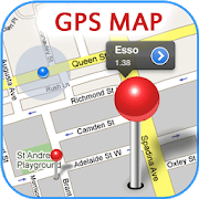
GPS Map 27.0.7
GPS Map is a free, advertising supported app that allows you todoawesome things with a map powered by Google on Android devices.Fora price, you can get GPS Map Pro which is identical withouttheadvertising banner.Activities are organized into the following categories:* Search - Find new Placemarks by address, or coordinates.* My Location - Center or mark your place quickly, toggleReal/Mocklocation, Search nearby, and Share your location.* Layers - Allows you to toggle the visibility of MyLocation,Placemarks, Satellite, Traffic, Track, and Routelayers.* Placemarks - View list, Center, Change location, use asMocklocation, Navigate to, Route to, Search nearby, Street View,andShare* Routes - View list, Change color, Details, Hide, ShowandShare* Tracks - View list, Start/Stop Recording, Change color,Graph,Tour on Google Earth, View at Human, Land, and Plane speed,andShare* Images - View list, set Default for Marker, Import as aMarker,Import location from Image* Markers - View list, Edit/Delete/Hide/Show groups ofPlacemarks,Markers created for each Import* Compass Mode - All visible layers rotate instead of MyLocationarrow rotating towards north* Copyright - All the legal copyright and disclosure stuff* Data Management - Import/Export/Manage data* Help - A quick introduction, the FAQ, and links to otherhelpfulcontent about GPS Map* Preferences - Adjust update time, long press time, thevisibilityof various items and featuresUse almost any image from your Camera, Gallery, or file browsingappto create a Marker for a Placemark on the map. Imagescontaininglocation information can be imported as Placemarks withtheir imageas the Marker on the map.GPS Map has the following features:* Easy to search for a location by address, placemark name,orlatitude, longitude.* Import/Export your Placemarks - GPSMap GPS, Garmin CSV,GeocodeGEO, Google Earth/Google Maps KML,GPS Exchange GPX filesandTomTomASCII* Imports the location and image from a photograph to createaPlacemark on the map with the Image as the Marker* Able to view Placemarks, Routes and Tracks with GoogleEarth* Able to be taken to Google Street View for a Placemark(ifavailable)* Able to use Placemarks to start a navigation app likeGoogleNavigation* Export to Google Drive Fusion Tables with an activeGmailaccount* Creates Tours for Google Earth based upon your recorded TrackWorks best with:* Google Earth, Google Maps, Google Street View installed.GPS location service enabled.Visit https://sites.google.com/site/wrightkeith/gpsmap/formore information.

MAPS.ME – Map with Navigation and Directions v14.2.71484-googleRelease
Free, fast, detailed and entirely offlinemapswith turn-by-turn navigation – trusted by over 90milliontravelers worldwide.OFFLINE MAPSSave mobile data, no internet is required.FREE FOREVERAll maps inside and all features are free. Always were andalwayswill be.NAVIGATIONUse driving, walking and cycle navigation anywhere intheworld.INCREDIBLY DETAILEDDirections to points of interest (POI), hiking trails andplacesmissing from other maps.UP-TO-DATEMaps are updated by millions of OpenStreetMap contributorsdaily.OSM is an open-source alternative to Google Maps, MapquestandWaze.FAST AND RELIABLEOffline search, GPS navigation along with optimized mapstoeffectively save memory space.BOOKMARKSSave locations you love and share them with your friends.AVAILABLE WORLDWIDEEssential for home and travel. Paris, France? Check.Amsterdam,Netherlands? Check. Barcelona, Spain? Check. New York,Chicago,Florida, Las Vegas, Nevada, Seattle, San Francisco,California,USA? Check! Rome, Italy? Check. London, UK? Check.TRAFFIC DATANew online city traffic maps. Check out updates on traffic infoandfastest driving routes in 36 countries!AND MORE!– Search through different categories e.g. restaurants,cafes,tourist attractions, hotels, ATMs and public transport(metro,bus…)– Make hotel bookings via Booking.com directly from the app– Share your location via text message or social media– When cycling or walking, the app shows whether the way isuphillor downhillContinued use of GPS running in the background candramaticallydecrease battery life.If you have any questions, visit our HelpCenter:support.maps.me.If you are unable to find the answer to your question, contactusat: [email protected] us on FB: http://www.facebook.com/mapswithme |Twitter:@MAPS_ME

Geo Tracker - GPS tracker 5.1.5.2972
You can find answers to most commonquestionsin the FAQ section of mywebsite:https://geo-tracker.org/faq/?lang=enIf you're looking for an excellent gps tracker, if you're a fanofaction sports and long distance travel - this app is foryou!Record tracks of your trips and share them with your friends!Geo Tracker can help:• making the reverse journey in an unfamiliar area withoutgettinglost
• tell your friends how to repeat your route
• use someone else's route that is stored in GPX or KML• mark important or interesting points of your trip.The application is able to record, even when switched off. Verylongtracks could be recorded without problems - you are limitedbystorage memory only. Recorded tracks are saved in GPX orKMLformat, so they can be used in certain applications such asOziExplorer or Google Earth.When showing track on the map, the application keepsdevicebacklight, which simplifies track navigation usage.Geo Tracker is based on public API of Yandex.Maps, so in tripsoverRussia and CIS countries you'll have the most detailed map ofthearea.Application can calculate track statistics - boldly show offyourachievements to your friends :)Geo Tracker calculates:• Max & average speed on the track;• Time and average speed moving;• Max & min altitude, altitude difference;• Vertical distance, ascent & speed;• Min, max & average slope;There are also some fine charts of speed & elevation;If you have a proposal how to enchance the application or facedsomeproblem - please feel free to contactme:[email protected]. Thanks!Useful tips & tricks to solve common GPS issues withyoursmartphone:• If you start the tracking please wait with recording youractivityuntil the GPS signal is found.• Restart your smartphone and make sure that you have "clearview"of the sky before you start (no disturbing objects likehighbuildings, forest, etc.).• The reception conditions are permanently changing because theygotinfluenced by the following factors: weather, season,positioning ofsatellites, areas with bad GPS coverage, highbuildings, forest,etc.).• Go to phone settings, choose "Location" and activate it.• Go to phone settings, choose "Date & time" and activatethefollowing options: "Automatic date & time" and "Automatictimezone". It may occur that it takes longer until the GPS signalisfound if your smartphone is set to the wrong time zone.• Deactivate the airplane mode in your phone settings.If none of these tips & tricks helped to solve yourissues,deinstall the app and reinstall it again.Be aware that Google uses in their Google Maps app not only theGPSdata but also additional data of the current locationfromsurrounding WLAN networks and/or mobile networks.

Offline Maps & Navigation
Here we created another great navigationappbased on offline maps.You can enjoy unlimited navigation features, lifetime freemapupdates with no hidden costs. Our real-time traffic helps youtoavoid traffic jams. Features: - Free offline GPS navigation- Offline maps- Lifetime free map updates- Speed limit warnings- 3D buildings - Large POI database- Pedestrian, car, or even bee-line navigation- Night mode based on local sunset time Advanced:- Real-time traffic- Multi-language voice navigation- Speed camera warnings- Lane guidance- Track recording- Navigate to photo- Travelbook- Support Free version includes 90 days Advanced features with voiceguidednavigation. After 90 days use offline maps and trip planningforfree or upgrade to unlimited voice guided premiumnavigation.


GPS MAP Mobile 1.0
GPS MAP Mobile is mobile mappingserviceapplication and technology provided offering satelliteimagery,street maps, and Street View perspectives, as well asfunctionssuch as a route planner for traveling by foot, car,bicycle or withpublic transportation. Live MAPS locator for urbanbusinesses andother organizations in numerous countries around theworld.One of the neat features of Google Maps / Google Earth istheability to get a street view of many urban and suburban areas.Thestreet view is an actual photograph shot with an ImmersiveMediacamera that delivers a 360 degree image of thesurroundings.Street View - Walk Down Your Street With Google MapsWe all love their traffic alerts, but how exactly doesGoogleMapsknow how clogged the highway is on your way out of townthisweekend?Features,• How to Get Latitude From Google Maps• How to Use Coordinates in Live Maps• How to Find Latitudes & Longitudes forMultipleAddresses• How to Convert Google Maps CoordinatesNOTE : This is Contents Application. It gives youinformationregarding GPS MAP Mobile


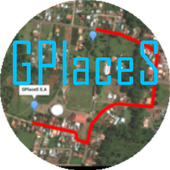
Maps GPS Places 1.8
Registren la empresa donde trabajan:GPlaceS surgió como un proyecto que busca aprovechar al máximolalocalización GPS y Google Map v2. Si eres un empresario osoloalguien que desea registrar una cuenta para una empresa ygestionartodos los servicios que ofrece dicha empresa, ya quetendrás elcontrol de tu cuenta y de los productos o servicios quepublicasserán administrados por el dueño de la cuenta.Pero si eres un usuario que desea calificar o votar porlasempresas que se encuentran registradas, podrás registrar unacuentade usuario la cual te permitirá calificar a lasempresasregistradas desde 1 a 5 estrellas y muy pronta, podrásopinar sobrelas empresas que calificas.GPlaceS se encuentra en fase beta, es por ello que concadapersona que registre su empresa en nuestra base dedatos,lograremos una aplicación estable y con muchos lugaresdondeescoger. por lo que pido a las personas que votan con unaestrella,piensen primero que esta aplicación tiene sus bases dedatosintactas y que entre mas empresarios conozcan esta app,masopciones de búsqueda exitosas tendrán. GPlaces se encuentraendesarrollo y por el momento las cuentas son gratis.Características*Registrar cuenta gratis*Localización GPS de tu empresa en cualquier parte delmundo.(Google Map)*Registro de varias categoría para tu empresa (Hotel,Restaurante,Soda)*Registro de productos o servicios*Estado de empresa open/closed*búsqueda por categoría, distancia, cantidad de resultadoycoordenada.*Calificación a lugares visitados*Información de la empresaMuy pronto se podrán comprar productos y servicios desde lamismaaplicación.Record the companywherethey work:GPlaceS emerged as a project that seeks to maximize theGPSlocation and Google Map v2. If you are a businessman orjustsomeone who wants to register an account for a company andmanageall the services offered by the company, as you will havecontrolof your account and the products or services you post willbeadministered by the account holder.But if you're a user who wishes to qualify or vote forthecompanies that are registered, you can register a useraccountwhich will allow you to qualify from the registered from 1to 5stars and very prompt companies can review the companiesthatqualify.GPlaceS is in beta, which is why each person registeringyourcompany in our database, we will achieve a stable and plentyofplaces to choose application. so I ask people to vote with astar,think first that this application has data bases intact andthatthe more entrepreneurs know this app, more options havesuccessfulsearch. GPlaces is under development and currentlyaccounts arefree.Features* Register Free Account* GPS of your company at any location in the world.(GoogleMap)* Record multiple categories for your business (Hotel,Restaurant,Soda)* Registration of products or services* Company State open / closed* Search by category, distance, number of resultsandcoordinate.* Rated to places visited* Company InfoSoon be able to buy products and services from thesameapplication.


GPS Navigation 20.0
Navigating from one place to the other has become easy with thehelpof GPS devices that gets its information directly fromsatellites.This interesting Android application GPS Navigationhelp users toget access to links that connect to websites thatprovide them withlive maps of locations they intend to navigateto. Users candownload softwares that can provide them with thecorrect directionsalong with accurate landmarks as they receivelive information fromsatellites. One can use this applicationwhile driving and it willautomatically direct to the desiredlocation.

GPS Fix 1.33
GpsFix helps to decrease the time required to obtain a positionfix.It keeps GPS/AGPS receiver turned on until location is fixed.It isuseful when your navigation app says "waiting for location"toooften. It shows the GPS, network and Google PlayServiceslocationproviders status. It helps to work with any map,navigation, fitnesssoft. Tiles: © Mapbox, © OpenStreetMap
Voice GPS Navigation Advice 3.0.0
Navigating from one place to the otherhasbecome easy with the help of GPS devices that gets itsinformationdirectly from satellites. This interesting Androidapplication GPSNavigation help users to get access to links thatconnect towebsites that provide them with live maps of locationsthey intendto navigate to.GPS Navigation Satellite systems have become so widespread thattheyare almost taken for granted. However, the fact that they aresouseful is leading to an expansion of available systems.This application will show your location and with applicationsuchas GPS NavigationGPS Navigation for car may be able to answer:- the roads or paths available,- traffic congestion and alternative routes,- roads or paths that might be taken to get tothedestination,- if some roads are busy (now or historically) the best routetotake,- The location of food, banks, hotels, fuel, airports orotherplaces of interests,- the shortest route between the two locations,- the different options to drive on highway or back roads.GPS Navigation app can work with data connection or with GPSalone.Navigator has in a way improved the lifestyles of people bymakingtravelling easy especially to unknown places. This androidappcontains content that provide users with information onGPSnavigation and its uses. App developers are exerting efforttoprovide users with an amazing array of features. Open StreetMapsupport, turn by turn voice guidance, high quality map, 3Dviews,precision positioning, and integrated social media are justsome ofthe amazing features.This app advise you to find the roads or paths availablefrominterest GPS directions apps and voice directions have becomesowidespread.This is the best voice GPS Navigation Advice. We do not provideanyvoice GPS navigation service or route finder serviceinanyway.


GPS Trip Recorder 2.3.18
GPS Trip Recorder, Record your tripsusingGPS!Drive, walk or ride your bike or even fly on an airplane whileGPSTrip Recorder recording your movements and keep trackingyourlocation in real time on the map, and showing your speedanddistance in real time!At the end of trip, user can choose to save it so it can beseenlater.GPS Trip Recorder saves your trip route and other details aboutyourtrip such as:Duration, Average Speed, Distance and more..!And yes, this app is completely free!! Free free!GPS Trip Recorder has free Caller ID. Caller ID will showcallinformation during/after calls - even for contacts that are notinyour phone book. Enable, disable or configure Caller ID at anytimein the settings menu.


GPS Without Internet 1.0.0
"GPS No Internet" is a GPS with you'll never be lost. NoneedInternet. There are more full browsers but with "GPS NoInternet"does not need Internet. You'll always know where to go.Are you abroad? Do not have Internet?Quiet! With "GPSNoInternet" you'll never miss.How to use?- Insert the points that you want to go before you leave yourhotel.(Required Internet)- Choose where you want to go and "GPS No Internet" tells youwhereyou should walk (Without Internet).Do you have internet? Use Google Maps.Do not have Internet? Use "GPS No Internet"

Sygic Truck & RV GPS Navigation 21.3.0
High-quality GPS navigation designed for professional drivers&their large vehicles. Trusted by 3 million drivers ofTrucks,Camions, HGVs, RVs, Caravans, Campers, Vans, Buses, Cars& manyof the world’s leading delivery fleets. Lots of smartfeatures,beautiful 3D offline maps, and easy to use interfaceprovide aproductive and enjoyable navigation experience. SygicTruck GPSNavigation is the best copilot on your routes! TRUCKSPECIFIC MAPS& ROUTING • Special routing for Truck / Camion /LGV / HGV/Delivery Van calculated for the vehicle & load. •High quality3D offline maps. Free map updates several times peryear. Maps arestored offline on your device so internet connectionis notrequired, works with GPS signal. • 3 route alternativesaredisplaying total time, distance, and elevation of the route.•Profiles for 3 different trucks. Set the parameters suchasdimensions, weight, transported material (HAZMAT), numberoftrailers, and the app will select the best route for the vehicle.•Last-mile functionality displaying restricted part of the routeina different color POIs • Millions of Truck specific PointsofInterests • Include gas stations, weigh stations, and restareas.PROFESSIONAL PLANNING & OPTIMALISATION • Advancedrouteplanning to avoid toll roads, U-turns, hazards such as lowbridges,narrow roads, or restricted areas (emission zones, schoolzones).Set preferences such as right turns or arrival with thedestinationon the right side. • Plan & optimize your Multi-Stoproute. Addup to 150 waypoints, and they will be re-arranged toachieve thebest efficiency. • Plan your route with Google Maps& easilydispatch to the app with Sygic Truck Route Sender -free extensionin Chrome and Firefox browser. DESIGNED FOR RV /CARAVAN / CAMPER /BUS • Profile configuration for RV / Caravan /Camper / Motorhome /Bus • Special routing for RV / Caravan / Camper/ Motorhome / Buscalculated for the vehicle & load. • Routesand directionsdesigned for RVs based on your vehicle size • RVspecific POIs:Campgrounds, parking stations, rest areas and moreSAFETY FEATURES• Spoken voice instructions with road indication •Dynamic LaneAssistant & Junction View • Speed Limits &Speed CamerasWarnings ADD-ONS • Live Services include Real-timeTrafficinformation + Mobile Speed Cameras Database + Fuel Prices +ParkingPlaces • Head-Up Display (HUD): Projects navigationinstructionsonto your windshield AVAILABLE MAP REGIONS • NorthAmerica • Europe(with Russia) • Australia & New Zealand •Brazil • Middle East• Africa You can test-drive Premium feature forthe first 14 daysafter installation. After 14 days, you cancontinue using the basicfeatures or upgrade to the Premium license.Also available fromSygic: Should you have any questions, pleasevisitsygic.com/support. We are here for you 7 days a week. If youlikeour app, please leave a review. Thank you for your support.PrivacyPolicy: www.sygic.com/company/privacy-policy Terms ofUse:www.sygic.com/company/terms-of-use By installing, copying orusingall or any portion of this software you accept all the termsandconditions of this agreement: https://www.sygic.com/company/eula

AlpineQuest GPS Hiking (Lite) 2.2.8b
AlpineQuest Lite is the free solutionforall outdoor activities and sports, including hiking,running,trailing, hunting, sailing, geocaching, off-road navigationandmuch more.You can access and store locally a large range ofon-linetopographic maps, which will remain available evenwhile beingout of cell coverage. AlpineQuest also supportson-board filebased maps, like MemoryMap(c) maps.By using the GPS and the magnetic sensor of your device(withcompass display), getting lost is part of the past: youarelocalized in real-time on the map, which can alsobeoriented to match where you are looking at.By staying fully operational out of cell coverage (as ofteninmountain or abroad), AlpineQuest assists you in all your desiresofdeep wilderness exploring...Don't hesitate, use it right now for free!PLEASE report suggestions and issues on our dedicatedforumhttp://www.alpinequest.net/forum (no registration needed,allquestions answered) and not in comments.Key features (for the full/paid version) are:★★ Maps ★★• Built-in online maps (with automatic localstorage;road, topo and satellite maps included);• Built-in online layers (road names andhillsshading);• Get more online maps and layers in one click from theincludedcommunity map list (Nokia maps, Yahoo! Maps, local topomaps,...);• Complete area storage of online maps foroff-lineuse;• On-board offline maps support (visit our website to getthefree map creator MOBAC);• Memory-Map support (QuickChart .QCT maps only, .QC3mapsnot compatible, test your maps using the free Liteversionfirst);• Multiple maps in layers display, with per-mapopacitycontrol;• Advanced SD memory card Map Explorer and Scanner.★★ Landmarks ★★• Create, display, save, restore unlimited number ofwaypoints,routes, areas and tracks;• Import/export GPX files, Google Earth KML/KMZfiles,CSV/TSV files;• Support OziExplorer WPT and GeocachingLOCwaypoints;• Save and share online locations with other users usingCommunityLandmarks;• Details, advanced statistics and interactive graphics onvariousitems;• Time Controller to replay time-tagged tracks;• Routes, tracks and areas creator;• Advanced SD memory card Landmarks Explorer.★★ GPS Position / Orientation ★★• On-map geolocation using GPS or Network;• Map orientation, compass and target finder;• Built-in GPS/Barometric track recorder (longtrackingcapable, running in a separate and light process);• Proximity alerts and leave path alerts;• Barometer support (for compatible devices).★★ And more: ★★• Metric, imperial and hybrid distance units;• GPS Latitude/Longitude and grid coordinate formats (UTM,MGRS,USNG, OSGB, Irish Grid, Swiss Grid, Lambert Grids, DFCI Grid,QTHMaidenhead Locator System, ...);• Ability to import hundreds of coordinate formatsfromhttp://www.spatialreference.org;• On-map grids display;• Full screen map view;• Multi-touch zoom;• ...About the "Phone state and identity" Android permission: due tothebackward compatibility of AlpineQuest with Android 1.5,thispermission is automatically added by Google Play.

Navitel Navigator GPS & Maps v11.11.917
Navitel Navigator is a precise offlineGPSnavigation with free geosocial services and detailed maps of64countries. Try popular navigation for 7 day free!______________________________* 20M DOWNLOADS WORLDWIDE ** TOP 5 NAVIGATION IN 12 COUNTRIES!*ADVANTAGES• Offline navigation. No Internet connection required for the useofthe program and maps: No additional expenses on roamingordependency on mobile connection.• Access to maps at any time: Maps are downloaded to theinternalmemory of a device or an SD-card.• Map subscription: Map purchase for a limited period (1 year)withprices starting at 10.99$.SPECIAL FEATURES• 3 alternative routes with display of time and distance for eachofthem.• Navitel.Traffic. Information on all traffic jams in thecoveredarea, available in real time.• Navitel.Friends/Cloud. Messaging with friends, trackingtheirlocation and routing towards them. Program settings andwaypointsare stored in the NAVITEL cloud storage. Log intoNavitel.Friends/Cloud service using your social networkprofile(Facebook, Twitter, VKontakte)• Navitel.Weather. Weather forecast information for the nextthreedays anywhere in the world.• Dynamic POI. Fuel prices, movie showtimes and otherusefulinformation.• Navitel.Events. Road accidents, road works, speed cams andotherevents marked on the map by users.• Navitel.SMS. Message exchange with friends whilenavigating.• SpeedCam warnings. Information on radars, video recordingcamerasand speed bumps.• 3D Mapping. Three-dimensional maps with texture and numberoffloors support.• 3D Road interchanges. Displaying multilevel road interchangesin3D mode.• Line Assist. Route calculations taking multilane trafficintoaccount and visual prompts while following the route.• Multilanguage support. Support of the interface and voicepromptsin multiple languages.• Turn-by-turn voice guidance. Voice guidance while moving alongtheroute, warnings on battery charge and connection tothesatellites.• Dashboard. More than 100 different gauges: time, speed,weatherand other parameters.• Fast route calculation. Instant calculation and routing ofanylength and complexity.• Unlimited number of waypoints for routing. Easy routingwithunlimited number of waypoints.• Customizable user interface. Ability to adapt theprograminterface and map display mode for your own needs.• Multitouch support. Quick access to map scaling androtationfunctions via the multitouch input.• Purchase through the program menu.• GPS / GLONASS.OFFLINE NAVIGATION MAPS FOR PURCHASEAlbania, Andorra, Armenia, Austria, Azerbaijan, Cilumbia,Belarus,Belgium, Bosnia and Herzegovina, Brazil, Bulgaria, Croatia,Cyprus,Czech Republic, Denmark, Estonia, Finland, France,Georgia,Germany, Gibraltar, Greece, Hungary, Iran, Iceland, Isle ofMan,Italy, Kazakhstan, Kyrgyzstan, Latvia, Liechtenstein,Lithuania,Luxembourg, Macedonia, Maldives, Malta, Mexico, Moldova,Monaco,Montenegro, Netherlands, Norway, Peru, Poland,Portugal,Philippines, Romania, Russia, San Marino, Serbia,Slovakia,Slovenia, Spain, Sweden, Switzerland, Tajikistan, Turkey,Ukraine,United Kingdom, Uzbekistan, Vatican.If you have any questions contact us: [email protected]. We willbehappy to help you.CONNECT WITH USFacebook: http://www.facebook.com/NavitelWorldTwitter: https://twitter.com/NavitelNInstagram: http://instagram.com/navitel_en


Voice GPS Navigation & Map
New features added in version 2:- Route Finder (Navigation)- Near by : get near by school, parks, hospital, restaurant,banks,atm, gas stations, shopping malls, railway stationsetc.- Current location: get your current location in text form andshareit with your friends .App features :- Speak to search between 2 places, route, Map andnavigation.- Search is integrated between current location todestinationlocation by default. You can replace the currentlocation withother location too.- Easy and quick to search.- Use of Google Map Service and navigation- Detailed features of Near By search with real user ratingsandcomments.- Get navigation between 2 destination by setting destinationswithin the app in Route Finder. Get shortest and best route withroutefinder.Just speak out California and you'll instantly get the locationandnavigation from your current location to California.


Wisepilot - GPS Navigation
With Wisepilot's free turn-by-turnnavigation,voice guide, and speed signs as well as speed limitalerts you canbe sure to feel safe and sound all the way to yourdestination. Theapp will automatically keep track of your traveldata, likedistance, time and average speed.Wisepilot covers the entire world using OpenStreetMap, whichisfrequently updated to always contain the latest info. The appneedsinternet access but don't worry, it's designed to use lessdatathan other online GPS apps.If you like Wisepilot, become a Premium user! Get theupgradeincluding live traffic information and speed camerawarnings, bothperfect additions to your free navigation.Questions, comments, concerns? We welcome all kinds offeedback!You'll reach us through any of the followingchannels:http://www.appello.com/supporthttp://www.facebook.com/Wisepilothttps://twitter.com/WisepilotGPS

MEO Drive 13.30.07
O MEO Drive é uma aplicação denavegaçãogratuita com mapas de Portugal gratuitos (incluindoilhas), quetransforma o seu smartphone ou tablet num verdadeironavegador. Como MEO Drive tem acesso a milhares de conteúdos e,como os mapas sãogravados no seu telemóvel, é possível navegar semqualquer ligaçãoà internet.Com o MEO Drive pesquise Pontos de Interesse através do FoursquareeWikipédia e partilhe-os através do Facebook e Twitter._______________________________________PRINCIPAIS CARACTERÍSTICAS:= Navegação premium = - Navegação automóvel e pedestre passo-a-passo, cominstruçõesvisuais e de voz, incluindo o recálculo automático darota; - Visualização do mapa e edifícios em 3D, com renderizaçãodosedifícios mais emblemáticos; - Instruções de voz completas com a indicação do nome dasruas(TTS); - Visualização e possibilidade de escolha derotasalternativas; - Indicação precisa da faixa de rodagem a seguir, comintegraçãode placas de sinalização; - Mapa totalmente interativo, mesmo durante a navegação; - Acesso a milhares de Pontos-de-Interesse organizadosporcategorias; - Informação de trânsito em tempo real (disponível na loja doMEODrive); - Radares de trânsito e indicação de limites de velocidadeGrátis,com atualizações permanentes; - Pesquisa e navegação para qualquer contacto gravado noseutelefone, ou qualquer contacto do Facebook ou Foursquare*; - Pesquisa e Partilha de conteúdos no Foursquare,Facebook,Twitter e LinkedIn*; - Saiba mais sobre o serviço em meo.pt.= Interface melhorada = - Pesquisa rápida, acessível diretamente a partir do ecrãdomapa; - Navegação no mapa com possibilidade multi-touch; - Mapa e Edifícios em 3D; - Histórico de pesquisa; - Transforme qualquer local num “Favorito” com umsimplesgesto; - Loja dentro da aplicação com mais conteúdos disponíveis; - Acesso a locais da Wikipedia;* - Integração de Facebook, LinkedIn, Twitter e Foursquareparapesquisar e partilhar;* - Telefone diretamente para um ponto-de-interesse ou visiteorespetivo site*._______________________________________Por favor tenha em consideração o seguinte:- Na primeira utilização da aplicação, certifique-se que oseutelefone está ligado a uma rede Wi-Fi.- Nunca deixe que as instruções de navegação interfiram com asuacondução.- Ao utilizar o MEO Drive enquanto conduz, não segure o telefonenamão. Coloque-o num suporte, onde não perturbe a visão.- Permitir o funcionamento do GPS em background porperíodosprolongados, pode levar a uma redução significativa da vidadabateria.*esta funcionalidade requer acesso à internet; poderãoaplicar-secustos de transferência de dados.Ao efetuar o download do MEO Drive está a concordar com ostermoslegais do mesmo.Para usar a aplicação terá de concordar com os termos econdiçõesdisponíveis no site meo.ptSAPO, MEO, MOCHE e PT EMPRESAS são marcas do GrupoPTPortugal.MEO Drive is afreenavigation application with free maps of Portugal(includingislands), which turns your smartphone or tablet into arealbrowser. With MEO Drive has access to thousands of content and,asthe maps are stored on your phone, you can browse withoutanyinternet connection.With MEO Drive search for Points of Interest via FoursquareandWikipedia and share them via Facebook and Twitter._______________________________________KEY FEATURES:= Premium Navigation =- Car navigation and pedestrian step-by-step instructionswithvisual and voice, including automatic recalculation oftheroute;- Map View and 3D buildings, with rendering of the mostemblematicbuildings;- Full voice instructions with street name indication (TTS);- View and choice of alternative routes;- Precise indication of the following lane, with integration ofroadsigns;- Fully interactive map, even during navigation;- Access to thousands of Points-of-Interest organizedbycategories;- Traffic information in real time (available in MEODrivestore);- Speed cameras and speed limits indication Free withpermanentupdates;- Search and navigation to any recorded contact on your phone,orany contact from Facebook or Foursquare *;- Search and content sharing on Foursquare, Facebook, TwitterandLinkedIn *;- Learn more about the service at meo.pt.= Improved interface =- Quick Search, accessible directly from the map screen;- Navigation map with possible multi-touch;- Map and 3D buildings;- Search history;- Turn any location into a "favorite" with a simple gesture;- Store within the application with more available content;- Access to local Wikipedia; *- Integration of Facebook, LinkedIn, Twitter and Foursquaretosearch and share; *- Phone directly to a point of interest or visit therespectivewebsite *._______________________________________Please note the following:- In the first use of the application, make sure that your phoneisconnected to a Wi-Fi network.- Never let the navigation instructions interfere withyourdriving.- When using the MEO Drive while driving, do not hold the phoneinhand. Place it on a stand, which does not disturb thevision.- Enable GPS running in the background for extended periods canleadto a significant reduction in battery life.* This feature requires Internet access; data transfer costsmayapply.By downloading the MEO Drive you agree to the legal terms ofthesame.To use the application will have to agree to the termsandconditions available on site meo.ptSAPO, MEO, MOCHE and PT ENTERPRISES are trademarks ofPTPortugal.

GPS Route Finder Maps 1.0.21
Now you don't have to worry about finding awayto any place. GPS Route Finder is the best solution toyourproblems. It's your personal GPS navigation App where youcanSearch and track any place in world.It provides youmultipleresults including Shortest route finder to yourdestination.GPS Route Finder Map is a personnel application through whichyoucan easily track all the locations you have visited. It’s asimpleGPS tracking app that helps you to track your own locationson datewise GPS location tracker takes advantage of GPS &Network toget your position on Earth, and obtains map informationnear yourlocation using Google Map and GPS locator and one can alsorequestthe location of his/her friend.It uses Global PositioningSystemfor GPS tracking. GPS Router provides your distance and timetakento reach your destination.GPS Navigation allows users to navigate to there destinationsviadirections and search maps using a number of differentmethods..Itis also a driving route finder app. Google Maps bestfeatures areintegrated in it to give you accurate result.Ithighlights HighlyTraffic areas on Map and save your time. Try itOut !Features:* GPS Route Finder give you best possible route toyourdestination.* This App uses Global Positioning System to giveaccurateresult.* GPS Route Finder Provide multiple route and give you the optiontochoose.* One can find any place or address through this GPS Locator.* Best Navigator app for searching Online Maps in threedifferentModes.* It give accurate result.(try yourself).* Supports different Online maps & Offline maps types :Normal,Satellite, Terrain maps.* Find GPS Driving Route.* Find GPS Walking Route.* Find GPS bicycle Route.* Added GPS location Alarm .* Offline GPS Route Finder Added.Privacy Policy:Your privacy is important to .Sometimes we need informationtoprovide services that you request; this privacy statementappliesto This App only. We Do Not share your Physical Locationwith ThirdParty.

Car GPS Navigation 2.0
GPS systems for cars can save you a lotofheadache. That is if you know how to use one. Learn how to useyourcar's GPS navigation system today!This application provided information for GPS Navigationasfollowing;- How to Select a GPS Car Navigation System ?- Difference Between a GPS & a Navigation System?- How to Install a GPS Car Navigation System?- How to Use a GPS Car Navigation System?- Car Navigation System Tutorial- How Does a GPS Car Navigation System Work?- How to Buy the Best GPS Navigation System for Your Car?- How to Set Up a Bluetooth GPS Car Navigation System?