Top 50 Apps Similar to AR GPS Compass Map 3D


3D Compass Plus 5.46
This application is a compass appwithaugmented reality view, real time map update, and providesGPSinformation. It is a fun app to play with and a useful toolwhentravelling.FEATURES★ Record video (Android 5+ only)★ Show augmented reality view, 3D compass, map,coordinates,address, speed and time in the same view★ Take screenshots★ Support portrait and landscape mode★ Auto rotate map according to direction★ Show speed and true north direction★ Show altitude★ Show map/address of current location★ Embed date, time and location EXIF tags in thescreenshotfile★ Fast bright with one tap when you are in outdoor★ Support marine, rose and artificial horizon compasses★ Zoom in/out reality view★ No ads (PRO-only)NOTES★ Only as good as your hardware. Beware surrounding metalandmagnetic fieldsSONY DEVICES★ support xperia-camera-addonsWe have been selected as a Google I/O 2011 DeveloperSandboxpartner, for its innovative design and advancedtechnology.Credits★ Czech - Jiří Fila★ Italian - Michele Mondelli★ Japanese - Yuanpo Chang★ Persian - اسماعیل شمسی آسیابری★ Polish - Grzegorz Jabłoński★ Romanian - Stelian Balinca★ Russian - Идрис a.k.a. Мансур (IDris a.k.a.MANsur),Ghost-Unit★ Slovak - Patrik Žec★ Spanish - Jose Fernandez, Alfredo Ramos (Abaddon Ormuz)★ Thai - Pimlada SingsangaPlease send me an email if you'd to help the translation.


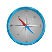
Compass Steel 3D
FEATURES:• Choose from multiple color themes• Choose between 2 heading modes - True heading (based onTruenorth) and Magnetic heading (based on Magnetic north).• Sun direction indicator• Moon direction indicator• Sunrise and sunset times• Moonrise and moonset times• Self-calibrates as you use• Marine-style compassPERMISSIONS:• Requires access to location coordinates to calculateTrueheading.


Compass Level & GPS
Take advantage of accurate andintegratedcompass, level and gps tools in one screen.For lovers of D.I.Y. and fans of self-assembling: this makes youanexpert in placing furniture, hanging up a shelf or frame.For tracking, hiking and camping fanatics: now you will never beoffcourse, always having the right position and direction.This tool is handy and very accurate - try it yourself!Advice: for a better accuracy, first calibrate once.✓ Compass Usage• Find and keep track of the right heading• Get information of your current position or atargetposition• Find your parked car through the target position feature.✓ Level Usage• Proper positioning of furniture• Straight installation of a shelf or a frame• Quickly level out your motor home or caravan✓ Features• Automatic horizontal and vertical level display• Choose Sound and/or Vibration when level• Manual compass and level calibration available• 'Hold / Release' button, for easy readout• Screen Capture: no notes, just copy• Sensor sensitivity and update-cycle adaptable• Powerful GPS feature: set target position, and find thedirectionand distance.✓ Remarks (Compass)• Sensor accuracy may differ depending on the device used• For better accuracy, keep away from magnetic fields andelectronicdevices.** Usermanual:http://lemonclip.blogspot.kr/2014/02/compass-level-user-manual.html• If you encounter any problem with this App or incorrectwording,please contact us via:- https://www.facebook.com/CompassLevel- [email protected]


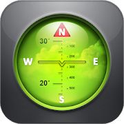
Compass Maps Pro - Digital Compass 360 Free 3.5
✦ "Compass Maps Pro - Digital Compass 360 Free"supportclassiccompass, fengshui compass and compass on the map. ✦Classiccompasssupport: - Show basic results with metrics anddirectionnames. -Lock / unlock compass - Screenshot result. -Change thecompass,direction arrow. - Zoom in / out compass. ✦Compass in map:-Locate or calculate direction at anywhere appearson map. -Searcha place via address name. Locate your location viaGPS,alsonavigate with magnetic compass. - Move the compass bytouchingthelocation you want on the map. - Assist the compass viewanywhereonthe map you want. ✦ The Feng shui compass type: -CompassFengshuidefault - Compass Fengshui 24 Mountains - CompassFengshui60 Jiazi - Compass Fengshui 72 Dragons - Compass FengshuiHeavenEarthHuman ✦ Compass Fengshui Measure the direction of thehouse,thedirection of the door ... ✦ "Compass Maps Pro - DigitalCompass360Free" support the following languages: English,VietnameseWarning:❋ To use compass for Android, your device musthavemagnetic sensorequipmented to read Earth magnetic field.Somephones do notsupport compass sensor so it can not use thecompass.❋ Some times,your magnetic sensor maybe not work well, youhave tocalibrate thedevice with 8-directions manually.


Dioptra™ Lite - a free camera tool 1.0.10
Dioptra™ Lite - a camera position and angle measurementtoolfornavigation, surveying, positioning, and measurement - -withover35,000 users! Stay tuned for an enhanced Dioptra app in2020withmore features, better sharing integration, andsupportingmorephones and devices! Instructions: Press the on-screencamerabuttonto save an image. View saved images in your device'sgalleryapp.[⊹] Dioptra™ Lite provides the following informationlikeatheodolite optical instrument - • yaw indicator (compass)•pitchindicator (tilt degrees) • roll indicator (tilt degrees)alongwith- • GPS position • azimuth and bearing to photo subjectTheancientgreek "dioptra" was a classical astronomicalandsurveyinginstrument, dating from the 3rd century BCE. Thedioptrawas asighting tube or, alternatively, a rod with a sight atbothends,attached to a stand. If fitted with protractors, it couldbeusedto measure angles. [⊹]


DSO Planner Free (Astronomy) 3.8.2
DSO Planner Free is an astronomy observation planningtoolwithexcellent star charting capabilities made by activeandexperiencedamateur observers with a passion forvisualobservations. FreeEdition comes equipped with Yale brightstarcatalog (9 000 starsto 6.5m) and 220 deep sky objects (MessierandCaldwell catalogscontaining the brightest galaxies,nebula,globular clusters, openclusters and planetary nebula).Considerother Editions for morestars / objects. Applicationfeatures: +Planning tool. Filter anyobjects database by observerlocation, skycondition, astronomicalequipment, time range ofobservation andobject features (type,dimension, magnitude, minimalaltitude,visibility and other fieldsof own custom catalogs).Removeduplicate objects when searching inintersecting databases.Createup to 4 observation lists. Easilytrack observed and remainingto beobserved objects with notetaking tool + Double Star catalog.50brightest double stars fromYale catalog. Info Panel with PAandseparation for each component.+ Unique visibility tool.Onlyobjects that are visible withselected equipment in the currentskyconditions could be shown onthe Star Chart + Cross-matchnamesdatabase. Search objects by lesscommon names + FamousSteveGottlieb Notes attached to NGCICobjects + Offlineimages.Integrated set of deep sky object images+ DSS imagerysupport.Download DSS (Digitized Sky Survey) imagesof any skyportion intooffline cache and overlay it on the starchart + PushTofordobsonian mounts with setting circles. Levelyour dobsonianmountand perform one star alignment. The programwillautomaticallyrecalculate az/alt numbers to easily hunt theobject +Nebulacontours. Contours of famous nebulae + Objectcontours.Ellipse inreal dimension and orientation on the skychart + BrightSolarSystem objects. Sun, Moon, Mercury, Venus,Mars, Jupiter,Saturnshown on the sky chart + Night mode. Redkeyboard and menus +Notetaking. Take text and/or audio notes +Observing places. GPS,manualcoordinates, custom lists. Databasewith 24 000 citiesworldwide +Equipment. Keep track of all yourtelescopes andeyepieces. Use themfor object visibilitycalculation and starcharting + Twilightcalculator. Sun, Moon rise/ transit / set. MoonPhase. Civil,Nautical, Astronomicaltwilights. + 2 visual themes(bright anddark) + Powerfulshare/export/import capabilities (ofdatabases,observation lists,notes) Disclaimer


Compass Steel
FEATURES:• Ad-free compass app.• Choose from multiple color themes.• Choose between 2 heading modes - True heading (based onTruenorth) and Magnetic heading (based on Magnetic north).• Sun direction indicator.• Moon direction indicator.• Set and save a target direction.• Tilt-compensated and self-calibrates as you use.• High contrast design improves readability.PERMISSIONS:• Requires access to location coordinates to calculateTrueheading.Any suggestions or feedback are warmly welcomed.


GPS Essentials
The most complete GPS tool available:Navigate,manage waypoints, tracks, routes, build your owndashboard from 45widgets.❧❧❧❧❧ Dashboard ❧❧❧❧❧Shows navigation values such as: Accuracy, Altitude, Speed,Battery,Bearing, Climb, Course, Date, Declination, Distance, ETA,Latitude,Longitude, Max Speed, Min Speed, Actual Speed, TrueSpeed, Sunrise,Sunset, Moonset, Moonrise, Moon Phase, Target,Time, TTG,Turn.❧❧❧❧❧ Compass ❧❧❧❧❧Show the orientation of the earth's magnetic field, showsanarbitrary tracking angle and the current target. Also amarineorienteering compass.❧❧❧❧❧ Tracks ❧❧❧❧❧Record tracks and view them on map. Export KML files and importintoGoogle Maps, Google Earth and others.❧❧❧❧❧ Routes ❧❧❧❧❧Manage routes and view them on map. Import KML files fromGoogleMaps, Google Earth and others. Create turn-by-turninstructionsbetween waypoints.❧❧❧❧❧ Camera ❧❧❧❧❧A camera HUD (heads-up display) view to show your waypoints,takepictures and share them.❧❧❧❧❧ Map ❧❧❧❧❧A map to show your waypoints. Convert mail addresses ofyourcontacts to waypoint so that they can be used within theapp.Supports Google Maps, MapQuest, OpenStreetMap and others.Supports Google Maps v2: Indoor Maps, Traffic, Buildings,Satelliteand Terrain layers and map rotation.❧❧❧❧❧ Waypoints ❧❧❧❧❧A list of all your waypoints with export and import (KML, KMZ,GPXand LOC format).❧❧❧❧❧ Satellites ❧❧❧❧❧A sky view of the current positions that shows satellitesinview.❧❧❧❧❧ Features ❧❧❧❧❧Supported position formats: UTM, MGRS, OSGB,Degree-Minute-Second,Degree-Minute-Fractions, Decimal, Mils.Supports over 230datums.Waypoints, routes and tracks can be exported as KML or GPX filesandsent by email or uploaded to Google Docs or DropBox.Please open the web page below for more info, send me emailsforsupport. I CANNOT HELP IF YOU SIMPLY PLACE A COMMENT HERE.Purchase the "GPS Essentials Donation Plugin" on Android Marketifyou want to support development.The latest beta release is available athttp://www.gpsessentials.comfor download. Try out the latestfeatures and help us improve GPSEssentials!If you are on Facebook, come and join GPS Essentials for thelatestinfo: http://www.gpsessentials.comTHIS APP WILL SHOW ADVERTISING. IF YOU DON'T LIKE THIS,PLEASEREFRAIN FROM INSTALLING/UPDATING.GPS Essentials is not affiliated with any political party norwithany other organization mentioned in the ads, and it hasnoconnection with any economic interests. If you don't like theads,please contact AdMob.WHAT ARE THE PERMISSIONS GOOD FOR?✓ Coarse/Fine location: To access network locations and GPS✓ Full internet access: To read map tiles, send bug reports✓ Modify/delete USB storage contents: To write waypoints, tracksandimages onto the SD card✓ Read phone state and identity: To tag pictures with the deviceID(can be switched off in settings)✓ Take pictures and videos: Camera HUD, take pictures✓ Your accounts: Required to run Google Maps v2


GPSTest
GPS Test displays real-time informationforsatellites in view of your device. A vital open-source testtoolfor platform engineers, developers, and power users, GPS Testcanalso assist users in understanding why their GPS/GNSS is orisn'tworking.Start/stop monitoring via the on/off switch. After a latitudeandlongitude has been acquired, you can share your location usingtheShare button.Supports:• GPS (USA Navstar)• GLONASS (Russia)• QZSS (Japan)• BeiDou/COMPASS (China)• Galileo (European Union)GLONASS satellites are shown as squares on the Sky view,U.S.NAVSTAR satellites are shown as circles, Galileo andQZSSsatellites are shown as triangles, and BeiDou satellites areshownas pentagons.Menu options:• Inject Time - Injects Time assistance data for GPS intotheplatform, using information from a Network Time Protocol(NTP)server• Inject XTRA Data - Injects XTRA assistance data for GPS intotheplatform, using information from a XTRA server(seehttp://goo.gl/3RjWX for details on gpsOneXTRA)• Clear Aiding Data - Clears all assistance data used forGPS,including NTP and XTRA data (Note: if you select this option tofixbroken GPS on your device, for GPS to work again you may needto‘Inject Time’ and ‘Inject XTRA’ data)• Settings - Change map tile type, auto-start GPS onstartup,minimum time and distance between GPS updates, keepscreenon.Beta versions:https://play.google.com/apps/testing/com.android.gpstestOpen-source on Github:https://github.com/barbeau/gpstest/wikiFAQ:https://github.com/barbeau/gpstest/wiki/Frequently-Asked-Questions-(FAQ)GPSTest discussion forum:https://groups.google.com/forum/#!forum/gpstest_androidNostalgic for old releases? Don't have Google Play Services onyourdevice? Download old versions here:https://github.com/barbeau/gpstest/wiki/Release-NotesIf you want to see the map on the Map tab, you'll need toinstallGoogle Play Services.-----------------------------------Want to measure the *true* accuracy of your GPS?Check out GPS Benchmark:https://play.google.com/store/apps/details?id=com.gpsbenchmark.android


