Top 50 Apps Similar to Earthquake Network PRO

SASSLA: Sismos en tiempo real 5.2.1
SASSLA es la app #1 de monitoreo sísmico en tiempo realenMéxico.Descárgala GRATIS y protégete de los peligros sísmicos.¿Quéteofrece SASSLA? · Te avisa hasta 120 seg antes de un sismo.·SASSLAte dice la intensidad esperada en tu ubicación cuandoocurreunsismo así como el tiempo estimado de llegada. · Puedesseguirelrecorrido de las ondas sísmicas desde un mapa inteligente.· Laappno te alarmará si el sismo no representa riesgo paratulocalidad.· Cuando ocurre un sismo fuerte, SASSLA es capazdeinterrumpircualquier actividad del celular (llamadas,videos,juegos, pantallade bloqueo) para avisarte del peligro. ·Lasnotificaciones porsismos peligrosos pueden sonar incluso enmodosilencio.¡Descárgala y descubre más funciones!

My Earthquake Alerts 3.2.1
My Earthquake Alerts is a powerfulearthquakeinformation app which delivers all of the information youneed,with push notifications included, all free of charge. Italsoincludes a beautifully simple design optimized for thelatestversions of Android.FEATURES- Live earthquake information from all around the world.- Free push alerts customized for you, with no restrictions.- Powerful search feature to find earthquakes dating backto1970!- Beautiful & simple design, view earthquakes on a map and inalist.- Find the exact location, the depth and the distance awayfromyou.If you need information or notifications about thelatestearthquakes near to you, download My Earthquake Alertstoday.


My Earthquake Alerts Pro
My Earthquake Alerts Pro is apowerfulearthquake information app which delivers all of theinformationyou need, with push notifications included, all free ofcharge. Italso includes a beautifully simple design optimized forthe latestversions of Android.FEATURES- Live earthquake information from all around the world.- Free push alerts customized for you, with no restrictions.- Powerful search feature to find earthquakes dating backto1970!- Beautiful & simple design, view earthquakes on a map and inalist.- Find the exact location, the depth and the distance awayfromyou.- No advertisements!If you need information or notifications about thelatestearthquakes near to you, download My Earthquake AlertsProtoday.


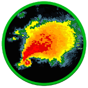


RadSat HD 1.0.13
RadSat HD is a weather app that allows the integration ofaweatherradar mosaic with GOES-16 satellite imagery,lightning,forecastsmaps and other products. You can view current orfutureweatherradar imagery from the United States, Europe,Australia,Argentina,Brazil and other countries. In addition,satelliteimagery, globallightning (requires subscription) and GFSproductscan be added.With a forecast, we can know the probabilityof rainorthunderstorms for a given day or hour, but with a weatherradarorsatellite, we can know the exact moment that will rain ineachareaand what risks can be expected (heavy lightning,hail,tornadoes,flash flooding). When lightning occurs near yourdevice'slocation,the app will notify you to seek shelter. Formoreinformation or tosuggest improvements, visittheExtendedForecast.net website or ourFacebookpage:/extendedforecast.

RadarNow! 6.3
Weather radar in your pocket!Use RadarNow! to quickly see an animated radar imageandcurrentconditions! No digging through menus to see if a storm isontheway!RadarNow! provides National Weather Service (NWS)EnhancedRadar"Base" (N0R) images from the NOAA WSR-88D NEXRADRadarsiteslocated around the US. Radar images are downloadeddirectlyfromNWS servers so are always the most current available.Whenyoustart the app, the radar images are from the site closesttoyourlocation.New Clutter suppression feature added in version 6.3!Now on iTunes! Get RadarNow! for your iPad and iPhone.NWS Alerts included with the free mode starting inv4.0.Onlyalerts issued to the your current county are sent andthealertscan be filtered so only the ones that interest youareused.RadarNow! is a free download with access to Premiumfeatures.Usethe FREE Standard version to monitor your local radarandreceiveNWS Alerts or choose to upgrade through the app toPremiumif youwant to activate the enhanced features. You may trythepremiumfeatures with our free 5 day trial or purchasepremiumaccess for$5.99 for a "RadarNow! Lifetime" pass.The 5 day free trial gives you free access tothepremiumfeatures. Once the 5 day trial has passed, the apprevertsback tothe free "standard" mode. You will not be charged touse thefreetrial under any circumstances.RadarNow! is designed to be fast, efficient and havegreatfreeoptions. If you want a full featured weather app thatshowsthingslike ski conditions or tide reports, we suggestusingWeatherBug orWeather Channel. RadarNow! Standard (Free)providesanimated radar,local conditions and NWS Alerts centered onyourcurrent location.Radar Now! Premium provides more zoomlevels,range rings,selectable locations and a pannable map ofthecontinental US witha looping weather radar.RadarNow! uses US radars only, therefore is activeforentireU.S., Puerto Rico, Guam and areas of Canada, MexicoandtheCaribbean that border the U.S. New! Canadian radars arenowinexperimental mode.Please use the "Contact us" forminsideRadarNow!(menu-setting-contact us) if you encounter a problemorhave asuggestion for improvement.We value your input! It was suggestions andconstructivecritiquesfrom users just like you that led to the new,improvedRadarNow!.This new version of RadarNow! was created byUSNaviguideincooperation with Mighty Pocket.

Disaster Alert
Disaster Alert (by PDC), Active Hazards onaninteractivemap and in a list as they are occurring around the globe.Additional hazard information can be viewed and shared.The term "Active Hazards" refers to a collection of currentandreal-time incidents (compiled from authoritative sources)whichhave been designated "potentially hazardous to people,property, orassets" by the PDC DisasterAWARE™ application.The application is a free download.PDC Active Hazards currently includes:-Hurricane/Tropical Cyclone (global)-Earthquake (global)-Flood (global)-National Weather Service High Surf (for Hawaii)-National Weather Service High Wind (for Hawaii)-National Weather Service Flood (for Hawaii)-Manmade (global)-Marine (global)-Storm (global)-Tsunami (global)-Volcano (global)-Wildfire (global)- coming soon!Other hazards will be added over time.Application features include:√ View Active Hazards on an interactive map or in theAlertlist√ Search for location (quick zoom)√ Choose background map√ Get "more info" for most Active Hazards√ Receive automatic updates every five minutes√ Choose a preferred time zone

Radar Express - Weather Radar 2.5.11
Radar Express gives you instant access toahigh resolution animated weather radar and all the localweatherinformation you need provided by the NOAA NWS. It's clear,simple,and fast-loading.• Quickly view an HD animated doppler weather radar for anywhereinthe United States.• Check the current temperature and other weather conditions inanyU.S. city.• Read the latest alerts and hazardous weather discussion fromtheNOAA NWS in your area.• Weather radar, alerts, and forecast all come directly fromyourlocal NOAA NWS office.• Forecasts from the NOAA NWS are some of the mostaccurateavailable.Whether you want to know when it will rain, or you need to knowhowstrong the storms are on the horizon and which directionthey'removing, install the Radar Express weather radar app on yourmobilephone or tablet now.Radar Express is neither affiliated with nor endorsed bytheNational Oceanic and Atmospheric Administration or theNationalWeather Service.

Alarm.com
With an Alarm.com-enabled security system,youcan monitor and control your home or business in real-time andfromanywhere. Alarm.com’s interactive security, videomonitoring,energy management, and home automation solutions giveyou instantawareness and remote control for the places you careaboutmost.Note: This app requires a compatible system and aninteractiveAlarm.com service plan. Feature availability variesbased onsystem, equipment, and service plan. Visit www.alarm.comfor moreinformation.Remote features:✓ See what’s happening at your property✓ Arm or disarm your security panel✓ Watch live video and recorded clips from yoursecuritycameras✓ Turn on or off lights✓ Set the ideal temperature✓ Lock or unlock doors✓ View images of important activity captured by Alarm.comimagesensors✓ Search your complete system event history✓ And much more!With Alarm.com, you can also receive real-time email, textmessage,and push notifications for the specific events that matterto you.Beyond important emergency related events, you can alsoimmediatelyknow when:• Your kids get home from school• You left for work or vacation and forgot to arm your system• The housekeeper arrives or leaves• The garage door is left open• The dog walker or cat sitter arrives• There's flooding or a water leak in your basement• Your children open your medicine or liquor cabinets• Someone changes your thermostat settings• Your security system is disarmed (and who disarmed it)• Someone attempts to log into your account• And much more!


3D Earthquake
Visualize recent earthquakes on a 3Dhollowglobe.Visualization of:★ Earthquake magnitude, depth and age★ Tectonic plates★ Earthquake ticker showing strongest earthquakes★ Tap quake label for more info and sharingSpin the globe and pinch to zoom. Tap a label to see depth andtimein ticker.View earthquakes from last hour, day, 7 days or 30 days.Data is from USGS.NOTE: If the "time ago" is wrong for you - then check yourphonetime AND timezone in your phone settings.OPTIONAL: In app payment to remove the advert and supportdev.(If you have any issue please email your device, OS version andfulldescription of the problem).


NOAA Weather International
Retrieve real-time 7-day hyperlocalpointweather forecasts and current weather conditions forworldwidelocations from NOAA NWS, Environment Canada & Dark Skybased onyour current location or any location in the world.Not only are NOAA forecasts the most accurate, they provideuniquepoint forecasts for every square mile which take intoconsiderationall the variables affecting the weather at that point,such asaltitude. This is especially useful in locations withhighlydynamic weather patterns and is a great tool forbeingoutdoors.-View forecast & current conditions for yourcurrentlocation.-View forecast & current conditions for any location intheworld by map.-Save favorite locations to quickly retrieve forecastsforthem.-Hourly forecast-Animated radar, cloud cover, precipitation & wind imageryoverGoogle Maps-Map measuring tool to measure distance and elevation-Hazardous weather alerts-Current conditions notification-Home screen widget-Light and Dark Material themes-Optimized for tablets-Android Wear supportIn-app purchase is available to remove ads.Please e-mail me below with any bug reports or featuresrequests.Thanks!


NOAA Weather Unofficial (Pro)
This weather app is not affiliated with NOAAorthe National Weather Service. Products provided by NOAA are inthepublic domain, and this app's use of those products iscompliantwith NOAA/NWS terms of use.This app provides forecasts, animated radar, hourly forecast,andcurrent conditions, all in an intuitive and easy to useinterface.Just the information you need, provided accurately,quickly, andfor your exact location.★ "A no-nonsense approach to show weather data on your phone,butdone well and great looking" - Android CentralThis app uses NOAA point forecasts from your GPS location to getthemost localized weather available. Point forecasts are greatforclimbing, hiking, skiing, or any outdoor activity whereweatherfrom a nearby city isn't accurate enough.GPS on the phone will provide the most accurate location,butusually isn't needed. Nearby cell towers and Wi-Fi networkscanalso provide this information, and will be checked first tosavetime and battery. You can also enter a location manually.To provided highly localized forecasting, this app usespointforecasts from the National Weather Service (NOAA/NWS), andistherefore only available in the US.If there is severe weather you will see a red warning icon inthecorner of the current conditions icon. You can press this iconformore details. This app currently does NOT support severeweatheralerts or notifications. NOAA is providing this servicedirectlythrough cell carriers. You can read more about the serviceathttp://www.nws.noaa.gov/com/weatherreadynation/wea.html.There are also several differently sized widgets available whichcanbe placed on your homescreen to provide some basicweatherinformation, without the need to open the app.Forecast discussion is available through the menu button.Permission: LocationThis app requires your location to provide you with themostaccurate weather. This is fundamental to how the app works. Youcanstill add manual locations as well if you prefer.Permission: Photos/Media/FilesThis permission is required by Google Maps so that it can cachemaptiles for faster loading. It sounds like the app is doingsomethingwith your photos or media, but it is not. The permissionmeans thatthe app has permission to access your files (whichincludes photosand media), but does not mean they are actuallybeing accessed. Itis a subtle but important distinction. Contact meif you havefurther questions about this.These are the non-simplified permissions as listed in theAndroidmanifest:android.permission.ACCESS_FINE_LOCATION" (location accesslistedabove)android.permission.ACCESS_NETWORK_STATE" (check fornetworkconnection)android.permission.INTERNET" (download weather)android.permission.VIBRATE" (for zoom feedback on old radar)android.permission.WRITE_EXTERNAL_STORAGE" (thisisPhotos/Media/Files listed above)com.google.android.providers.gsf.permission.READ_GSERVICES"(requiredby google maps)FAQ (Frequently asked questions):http://www.paulnadler.com/nstudio/faq.htmlPlease contact me at [email protected] if you have anyfurtherquestions or problems.This is the premium version and is 100% Ad free, and hasnolimitations.NOAA Weather on Facebookhttps://www.facebook.com/pages/NOAA-Weather/416785575001525Google+https://plus.google.com/110174676619325230446Beta Channel (for newest features)https://plus.google.com/u/0/communities/111259910356071652569


Earthquake -American Red Cross 3.15.3
Be ready for an earthquake with Earthquake by American RedCross.Getnotified when an earthquake occurs, prepare your familyandhome,find help and let others know you are safe even if thepoweris out –a must have for anyone who lives in anearthquake-pronearea or hasloved ones who do. Ahora disponible enespañol.FEATURES: • Easy touse Spanish language toggle toswitchtranslation directly inside theapp. •Step-by-stepinstructions letyou know what to do evenbefore/during/after anearthquake, even ifno data connectivity. •Getnotified when anearthquake occurs; seethe intensity impact to yourarea or those ofloved-ones withnotifications generated by theUnited StatesGeological Survey(USGS). •Let family and friends knowyou are okaywith thecustomizable “I’m Safe” alert for Facebook,Twitter, emailandtext. •Find open Red Cross shelters in your areawhen youneedhelp. •Stay safe when the lights are out withtheToolkit,including a strobe light, flashlight and audiblealertfunctions.•Prepare for the worst by learning how to assembleanemergency kitfor your family in the event of power outageorevacuation.•Empower your family to stay safe and remain calm inanemergencyby learning how to make and practice an emergencyplan.•Earnbadges that you can share with your friends and showoffyourearthquake knowledge with interactive quizzes. •Seeanillustratedhistory of earthquakes in your area. •Know how towhatto do aboutfood and drinking water when your area has beenimpactedby floodsand power outages. Permissions: DIRECTLY CALLPHONENUMBERS: Weneed this to allow you to call emergency numbersfromwithin theapp CAMERA: We need to be able to use the camera toallowus to usethe flashlight in Tool Kit GPS LOCATION: We need toserveyouearthquake alerts based on your current location PHONECONTACTS:Weneed this for the Make a Plan view to allow you toaddemergencycontacts straight from your address bookPrivacypolicy:http://www.redcross.org/privacy-policyEULA:http://www.redcross.org/m/mobile-apps/eulaCopyright ©2012-2014The American National Red Cross