Top 22 Apps Similar to My Places for Google Maps™


Google Trips - Travel Planner
Google Trips makes exploring the worldeasierby organizing your essential info in one place and makingitavailable even offline. Get activity suggestions based onwhat’snearby, customizeable day plans, and your travel reservationsfromGmail.AUTOMATIC TRIP ORGANIZATIONYour travel reservations are automatically gathered from Gmailandorganized into individual trips. Each trip contains dayplans,things to do, food and drink suggestions, and more.BUNDLED RESERVATIONSSee your flight, hotel, rental car, and restaurant bookings inoneplace without having to search for them individually.DAY PLANSFor several hundred of the world’s top places, find populardayplans organized on a map that you can customize based onyourinterests and available time.NEARBY ATTRACTIONSFind out when you’re near popular attractions (and whetherthey’reopen) as well as reviews and ratings from othertravelers.THINGS TO DOEvery trip contains ideas for things to do automaticallyorganizedinto useful categories like Top Spots and Indoors orOutdoors. Formany of the world’s top places, you’ll get curatedlocalsuggestions and travel tips.OFFLINE ACCESSNo Internet? No problem. Google Trips is available offline,soyou’ll always have access to your info.


Delhi Public Transport Offline 0.1.113548702
The Delhi Public Transport offline appwillsearch for Delhi Metro and bus directions and scheduleswithoutrequiring Internet data. It will also notify you of DelhiMetro andbus transit news and major delays through the app (thisfeaturerequires Internet).Features:• Get directions for Delhi Metro and bus while offline.Getdirections to any DMRC metro station or Delhi bus stop.SupportsDMRC Metro, DTC bus, Gurgaon Rapid Metro, and DIMTS Orangebuses.Bus travel durations use Google’s historical trafficinformationfor improved accuracy. (works offline, with option to goonline formore results)• Look up timings and schedules for any Delhi Metro line orBusnumber. (works offline)• Get notified about Delhi transit news and majordisruptions.(requires Internet)This is an experimental app from the Google Maps teamdesignedfrom the ground up to make it easier for New Delhiresidents to getaround on public transit.We would love to hear your feedback. Please let us know howwellthe app is working for you and what we can do to make itmoreuseful by clicking the feedback button at the top of the app.Ifyou like the app, there is a button to share it withyourfriends.

Zagat
PLEASE NOTE: This download is the 2014version.It has coverage in selected US cities only (see coveragelistbelow). A new version of the app is currently in the works,withdeeper and broader coverage across the entire US, plus a hostofcool new features. We'll let you know when we’re ready to serveourfresh app.Zagat is your guide to discovering the best restaurants acrosstheUS.Features of this version:• Ratings and reviews for Zagat-rated restaurants in keyUScities• Concise trustworthy reviews based on users' opinions• Selected lists of places to go for nearly any occasion, mood,andcraving• Stream of helpful articles and videos delivered throughouttheday• Filter by Zagat ratings, cost, cuisine, features,neighborhoodsand more• Menus to read before you go• Reservations through OpenTable• Google Street View panoramasSupported locations (subject to change between app updates):AtlantaAustinBaltimoreBostonCape CodCharlestonCharlotteChicagoCincinattiClevelandClevelandColumbusConnecticutDallasDenverDetroitHawaiiHoustonIndianpolisKansas CityLas VegasLondonLong IslandLos AngelesMiamiMilwaukeeMinneapolisNashvilleNew JerseyNew OrleansNew York CityOrlandoPhiladelphiaPhoenix-ScottsdalePittsburghPortland, ORProvidenceSalt Lake CitySan AntonioSan DiegoSan FranciscoSavannahSeattleSt LouisTampaTorontoVancouverWashington DCWestchester-Hudson Valley, NY

myDirection - Google map API's 1.32
myDirection is a smartphoneapplicationavailable for Android and other smartphones. myDirectionuses your3G or WiFi (when available) to use various features ofGoogle MapAPI's.myDirection is using various Google map API's integrated withthelatest Jquery Mobile framework to provide the bestexperience.Currently, myDirection is providing four application -LandElevation, Direction, Places and Geocoding.★ NO HIDDEN COST: Once you download the application, you can usetofind location, direction, elevation and Geocode.★ KNOW THE ELEVATION: Use this application to know theelevation.You just has to tap to know the elevation.★ GET THE DIRECTION: Know the direction from the SourceandDestination.★ PLACES: Just enter the location to know some common places.ThisApplication is using Google geocode for theautocompletefunction.★ GEOCODE: Know the Geocode of any location.---------------------------------------------------------We’re always excited to hear from you! If you have anyfeedback,questions, or concerns, please email us at:[email protected]

GPS MAP Mobile 1.0
GPS MAP Mobile is mobile mappingserviceapplication and technology provided offering satelliteimagery,street maps, and Street View perspectives, as well asfunctionssuch as a route planner for traveling by foot, car,bicycle or withpublic transportation. Live MAPS locator for urbanbusinesses andother organizations in numerous countries around theworld.One of the neat features of Google Maps / Google Earth istheability to get a street view of many urban and suburban areas.Thestreet view is an actual photograph shot with an ImmersiveMediacamera that delivers a 360 degree image of thesurroundings.Street View - Walk Down Your Street With Google MapsWe all love their traffic alerts, but how exactly doesGoogleMapsknow how clogged the highway is on your way out of townthisweekend?Features,• How to Get Latitude From Google Maps• How to Use Coordinates in Live Maps• How to Find Latitudes & Longitudes forMultipleAddresses• How to Convert Google Maps CoordinatesNOTE : This is Contents Application. It gives youinformationregarding GPS MAP Mobile

GPS Map 27.0.7
GPS Map is a free, advertising supported app that allows you todoawesome things with a map powered by Google on Android devices.Fora price, you can get GPS Map Pro which is identical withouttheadvertising banner.Activities are organized into the following categories:* Search - Find new Placemarks by address, or coordinates.* My Location - Center or mark your place quickly, toggleReal/Mocklocation, Search nearby, and Share your location.* Layers - Allows you to toggle the visibility of MyLocation,Placemarks, Satellite, Traffic, Track, and Routelayers.* Placemarks - View list, Center, Change location, use asMocklocation, Navigate to, Route to, Search nearby, Street View,andShare* Routes - View list, Change color, Details, Hide, ShowandShare* Tracks - View list, Start/Stop Recording, Change color,Graph,Tour on Google Earth, View at Human, Land, and Plane speed,andShare* Images - View list, set Default for Marker, Import as aMarker,Import location from Image* Markers - View list, Edit/Delete/Hide/Show groups ofPlacemarks,Markers created for each Import* Compass Mode - All visible layers rotate instead of MyLocationarrow rotating towards north* Copyright - All the legal copyright and disclosure stuff* Data Management - Import/Export/Manage data* Help - A quick introduction, the FAQ, and links to otherhelpfulcontent about GPS Map* Preferences - Adjust update time, long press time, thevisibilityof various items and featuresUse almost any image from your Camera, Gallery, or file browsingappto create a Marker for a Placemark on the map. Imagescontaininglocation information can be imported as Placemarks withtheir imageas the Marker on the map.GPS Map has the following features:* Easy to search for a location by address, placemark name,orlatitude, longitude.* Import/Export your Placemarks - GPSMap GPS, Garmin CSV,GeocodeGEO, Google Earth/Google Maps KML,GPS Exchange GPX filesandTomTomASCII* Imports the location and image from a photograph to createaPlacemark on the map with the Image as the Marker* Able to view Placemarks, Routes and Tracks with GoogleEarth* Able to be taken to Google Street View for a Placemark(ifavailable)* Able to use Placemarks to start a navigation app likeGoogleNavigation* Export to Google Drive Fusion Tables with an activeGmailaccount* Creates Tours for Google Earth based upon your recorded TrackWorks best with:* Google Earth, Google Maps, Google Street View installed.GPS location service enabled.Visit https://sites.google.com/site/wrightkeith/gpsmap/formore information.

Maps GPS Places 1.8
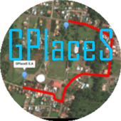
Registren la empresa donde trabajan:GPlaceS surgió como un proyecto que busca aprovechar al máximolalocalización GPS y Google Map v2. Si eres un empresario osoloalguien que desea registrar una cuenta para una empresa ygestionartodos los servicios que ofrece dicha empresa, ya quetendrás elcontrol de tu cuenta y de los productos o servicios quepublicasserán administrados por el dueño de la cuenta.Pero si eres un usuario que desea calificar o votar porlasempresas que se encuentran registradas, podrás registrar unacuentade usuario la cual te permitirá calificar a lasempresasregistradas desde 1 a 5 estrellas y muy pronta, podrásopinar sobrelas empresas que calificas.GPlaceS se encuentra en fase beta, es por ello que concadapersona que registre su empresa en nuestra base dedatos,lograremos una aplicación estable y con muchos lugaresdondeescoger. por lo que pido a las personas que votan con unaestrella,piensen primero que esta aplicación tiene sus bases dedatosintactas y que entre mas empresarios conozcan esta app,masopciones de búsqueda exitosas tendrán. GPlaces se encuentraendesarrollo y por el momento las cuentas son gratis.Características*Registrar cuenta gratis*Localización GPS de tu empresa en cualquier parte delmundo.(Google Map)*Registro de varias categoría para tu empresa (Hotel,Restaurante,Soda)*Registro de productos o servicios*Estado de empresa open/closed*búsqueda por categoría, distancia, cantidad de resultadoycoordenada.*Calificación a lugares visitados*Información de la empresaMuy pronto se podrán comprar productos y servicios desde lamismaaplicación.Record the companywherethey work:GPlaceS emerged as a project that seeks to maximize theGPSlocation and Google Map v2. If you are a businessman orjustsomeone who wants to register an account for a company andmanageall the services offered by the company, as you will havecontrolof your account and the products or services you post willbeadministered by the account holder.But if you're a user who wishes to qualify or vote forthecompanies that are registered, you can register a useraccountwhich will allow you to qualify from the registered from 1to 5stars and very prompt companies can review the companiesthatqualify.GPlaceS is in beta, which is why each person registeringyourcompany in our database, we will achieve a stable and plentyofplaces to choose application. so I ask people to vote with astar,think first that this application has data bases intact andthatthe more entrepreneurs know this app, more options havesuccessfulsearch. GPlaces is under development and currentlyaccounts arefree.Features* Register Free Account* GPS of your company at any location in the world.(GoogleMap)* Record multiple categories for your business (Hotel,Restaurant,Soda)* Registration of products or services* Company State open / closed* Search by category, distance, number of resultsandcoordinate.* Rated to places visited* Company InfoSoon be able to buy products and services from thesameapplication.


Voice GPS Navigation & Map
New features added in version 2:- Route Finder (Navigation)- Near by : get near by school, parks, hospital, restaurant,banks,atm, gas stations, shopping malls, railway stationsetc.- Current location: get your current location in text form andshareit with your friends .App features :- Speak to search between 2 places, route, Map andnavigation.- Search is integrated between current location todestinationlocation by default. You can replace the currentlocation withother location too.- Easy and quick to search.- Use of Google Map Service and navigation- Detailed features of Near By search with real user ratingsandcomments.- Get navigation between 2 destination by setting destinationswithin the app in Route Finder. Get shortest and best route withroutefinder.Just speak out California and you'll instantly get the locationandnavigation from your current location to California.

3D Maps Street panorama view 1.0
3D Mapsgoogle maps street view and share the world panoramaStroll through the streets of the worldCustomized street viewand more of themGermany : BerlinAndorra in Andorra La VellaAlbania: TiranaAustria : ViennaBelarus : MinskBelgium : BrusselsBosnia and Herzegovina: SarajevoBulgaria : SofiaBbritany and dirty Agenda: LondonCzech Republic: PragueDenmark : CopenhagenEstonia : Tailor 'sFinlandia HelsinkiFrance ParisCroatia : ZagrebNetherlands: AmsterdamRepublic of Ireland: DublinSpain: MadridSweden: StockholmSwitzerland : BernItaly : RomeIceland : ReykjavikCyprus : NicosiaGCA : NicosiaLettony in RigaThe Principality of Liechtenstein VaduzLithuania: VilniusLuxembourg : LuxembourgHungary : BudapestMacedonia : SkopjeMalta : VallettaMoldova: ChisinauMonaco: MonacoNorway : OsloPoland : WarsawPortugal : LisbonRomania : BucharestRussia : MoscowSan Marino Republic of San MarinoSerbia and Montenegro : BelgradeSlovakia : BratislavaSlovenia : LjubljanaTurkey AnkaraUkraine : KievGreece : Athens

Geo Tracker - GPS tracker 5.1.5.2972
You can find answers to most commonquestionsin the FAQ section of mywebsite:https://geo-tracker.org/faq/?lang=enIf you're looking for an excellent gps tracker, if you're a fanofaction sports and long distance travel - this app is foryou!Record tracks of your trips and share them with your friends!Geo Tracker can help:• making the reverse journey in an unfamiliar area withoutgettinglost
• tell your friends how to repeat your route
• use someone else's route that is stored in GPX or KML• mark important or interesting points of your trip.The application is able to record, even when switched off. Verylongtracks could be recorded without problems - you are limitedbystorage memory only. Recorded tracks are saved in GPX orKMLformat, so they can be used in certain applications such asOziExplorer or Google Earth.When showing track on the map, the application keepsdevicebacklight, which simplifies track navigation usage.Geo Tracker is based on public API of Yandex.Maps, so in tripsoverRussia and CIS countries you'll have the most detailed map ofthearea.Application can calculate track statistics - boldly show offyourachievements to your friends :)Geo Tracker calculates:• Max & average speed on the track;• Time and average speed moving;• Max & min altitude, altitude difference;• Vertical distance, ascent & speed;• Min, max & average slope;There are also some fine charts of speed & elevation;If you have a proposal how to enchance the application or facedsomeproblem - please feel free to contactme:[email protected]. Thanks!Useful tips & tricks to solve common GPS issues withyoursmartphone:• If you start the tracking please wait with recording youractivityuntil the GPS signal is found.• Restart your smartphone and make sure that you have "clearview"of the sky before you start (no disturbing objects likehighbuildings, forest, etc.).• The reception conditions are permanently changing because theygotinfluenced by the following factors: weather, season,positioning ofsatellites, areas with bad GPS coverage, highbuildings, forest,etc.).• Go to phone settings, choose "Location" and activate it.• Go to phone settings, choose "Date & time" and activatethefollowing options: "Automatic date & time" and "Automatictimezone". It may occur that it takes longer until the GPS signalisfound if your smartphone is set to the wrong time zone.• Deactivate the airplane mode in your phone settings.If none of these tips & tricks helped to solve yourissues,deinstall the app and reinstall it again.Be aware that Google uses in their Google Maps app not only theGPSdata but also additional data of the current locationfromsurrounding WLAN networks and/or mobile networks.

All-In-One Offline Maps 3.6c
All-In-One OfflineMaps offers you toaccessa wide range of maps for free.Bored to wait for maps to display? Once displayed, mapsarestored and remain available, quickly, even with nonetworkaccess.• Want more than just roads on your maps? You will findwhatyou need here;• Used to go to places with poor network coverage?Everythingwill stay available;• Used to go abroad? You won't be lost anymore;• Have a data allowance limit? It will reduceyourusage.★★ Maps ★★A lot of maps are available, including classical roadmaps,topographic maps, aerial (satellite) maps and various layersthatcan be added over any maps: OpenStreetMap (Roads, Topo),GoogleMaps, Bing Maps, USGS National Map (Hi-res topo, Aerialimagery),Worldwide Military Soviet topo maps, etc.• All maps can be stacked in layers, with preciseopacitycontrol.• Select and store large areas in few clicks.• Stored space is clear and can be easily deleted.★★ Display, store and retrieve unlimited landmarks ★★You can add various items on the map such as waypoints,icons,routes, areas and tracks.You can easily manage them using the powerful SD-CardLandmarksExplorer.★★ On-map GPS Location & Orientation ★★Your real location and direction are clearly displayed on themap,which can be rotated to match your real orientation (dependsondevice capabilities).Easy turn on/off to save battery.And also:• Metric, imperial and hybrid distance units;• GPS Latitude/Longitude and grid coordinate formats (UTM,MGRS,USNG, OSGB Grid, Irish Grid, Swiss Grid, Lambert Grids, DFCIGrid,QTH Maidenhead Locator System, ...);• Ability to import hundreds of coordinate formatsfromhttp://www.spatialreference.org;• On-map grids display;• Full screen map view;• Multi-touch zoom;• ...★★ Need more? ★★If you are a real adventurer, try AlpineQuest GPS Hiking,thecomplete outdoor solution based on All-In-One OfflineMaps,loadedwith a powerful GPS Location Tracker andmore:http://www.alpinequest.net/google-play

GPS Route and Maps Navigaton 1.1.2
GPS Route and Maps Navigator is one of thebestapps available on play store for navigation and locationsearch.With this app you can experience the Google Maps differenceandoutsmart the traffic with the world’s best Google mapsandnavigation option.It has offline maps option, get directions and usenavigationwithout an Internet connection.It has comprehensive, accurate maps in 200+ countriesandterritories.All you need to do is just start the service and track locationsonthe map. When you don’t require tracking you can switch offtheservice.Some of the app features:- Live routing with real-time traffic & road map info- Voice guided navigation for easy navigation- Live maps, consistently edited and updated by GoogleLivemaps- Automatic rerouting as conditions change on the road- Find GAS stations and Restaurants for quick stops- Keeps track of your visited locations for easy reference- It’s very simple to use and easy to find locations.
