Top 38 Apps Similar to SEEDN


The Colorado Trail Hiker 6.0.19
The Colorado Trail Hiker is a smartphoneguidefor your Colorado Trail hiking or mountain biking trip.NO CELL OR INTERNET CONNECTION REQUIRED for the app toworkon-trail. After initial setup, the app uses your GPS andofflinemaps to guide you along the trail.The free demo is a fully functional version of the app withSegment1 of The Colorado Trail (Miles 0 to 16.8 from the WatertonCanyonTrailhead outside Denver). In-app purchases include (1)TheColorado Trail, which includes the hiking route, the fivemountainbike wilderness detours, the Collegiate West Alternativeroute andthe Collegiate Loop (775.2 miles of trail in total) and(2) astandalone version of the Collegiate Loop route (a 161-mileloopcomposed of the 82.3-mile Collegiate West Alternative route anda78-mile portion of The Colorado Trail).The app has been built in partnership with Jerry Brown of BearCreekSurvey Service. Each waypoint in the Colorado Trail MapBook,written by Jerry Brown and offered by The ColoradoTrailFoundation, is plotted and described in The Colorado TrailHikerapp. A portion all proceeds from the sale of The ColoradoTrailHiker app will go to The Colorado Trail Foundation.The Colorado Trail Hiker uses a combination of your phone'sGPS,downloaded topo maps, and the Google Maps interface toaccuratelylocate your position on the trail. No phone service? Nota problem-- your phone's GPS pinpoints your location on top of topomapsdownloaded as part of the app.A bright red line indicates the location of The Colorado Trailonthe map. Alternate routes are indicated in other colors.Anelevation profile shows trail distance vs elevation and plotsyourcurrent location on the trail. Each waypoint is plotted ontheprofile. Each waypoint is clickable, opening to thewaypoint'sdetail page.The guidebook lists every waypoint in order by distance alongthetrail.Each waypoint includes a detail page, providing furtherdetailsabout that particular waypoint. Details include thewaypoint'smileage point and elevation, photographs of many of thewaypoints,distance to the next trailhead, a Trail Register whereyou may postcomments and read other users' comments, and otherdetails thatwill help you during your hike, and help you plan yourhike.The types of waypoints include:-->Trailheads and parking areas-->Water sources-->Resupply towns/services-->Trail junctions-->Road crossings-->Powerlines, fences, gates, toilets-->Other Landmarks and points of interest


Guthook's Appalachian Trail Guide 8.3.8
Please download "Guthook Guides: Hike & Bike Offline" toaccessthe Appalachian Trail, Pinhoti, Benton MacKaye, Long Trail,and MidState Trail guides. Existing customers may transfer theirpurchasesto the Guthook Guides: Hike & Bike Offline app.Guthook's Guideto the Appalachian Trail is a detailed, map-basedsmartphone guidefor your hike on the Appalachian Trail or the LongTrail. It mapsand lists thousands of important hiker waypoints onthe AT (andhundreds for the Long Trail) such as water sources,shelters,tenting sites, road crossings, resupply locations, andmany others.The free demo covers the 8.8-mile Springer MountainApproach Trailfrom Amicalola Falls State Park to Springer Mountainsouthernterminus. In-app purchases include 9 sections of the AT andtheLong Trail in Vermont. Key features: - No mobile orinternetconnection is required after initial setup -- works inAirplaneMode - Detailed maps with your GPS location - Elevationprofileview - Custom route creator - Multiple offline map choices-Real-time comments from other hikers - Send your currentlocationand a message to friends or family via Checkin featureTheguidebook lists every waypoint in order by distance along thetrailand how far away you are from each waypoint. The guidebookalsoincludes a detailed town guide for major resupply points,towns,and services along the AT. Waypoint details include: -Mileagepoint and elevation - Photographs - Distance to the nextwatersource and tent site - Comments section where you may postcommentsand read other hikers’ comments Types of waypoints: - Watersources(including the reliability of each water source) -Detailedresupply and town information: - post offices and otherpackageservices - restaurants - grocery stores and conveniencestores -gear shops and hardware stores - laundromats - lodging,publicshowers, public restrooms - public libraries -Tentingsites/camping sites - Trail junctions - Parking areas alongthetrail - Picnic areas, campgrounds, ranger stations -Roads,railroad tracks, power lines, fences, gates - Naturallandmarks(e.g. mountain passes) - Privies/restrooms - Views AbouttheAppalachian Trail: The Appalachian Trail, or AT, is one oftheUnited States' most treasured national trails. The 2,168-miletrailstretches from Springer Mountain in Georgia to Mount KatahdininMaine. Along the way it passes through 14 states,includingGeorgia, North Carolina, Tennessee, Virginia, WestVirginia,Maryland, Pennsylvania, New Jersey, New York,Connecticut,Massachusetts, Vermont, New Hampshire, and Maine. Muchof the LongTrail overlaps the AT through the State of Vermont. Manyhikerscomplete the entire trail in one season ("thru-hikers"),andcountless others enjoy hiking anywhere from a few miles tohundredsof miles each year. Appalachian Trail, AT


BackCountry Nav Topo Maps GPS
Use your Android as an offroad topo mappingGPSwith the bestselling outdoor navigation app for Android! TrythisDEMO to see if it is right for you, then upgrade to thepaidversion.Use offline topo maps and GPS on hike trails without cellservice!The GPS in your Android phone can get its position fromsatellites,and you don’t have to rely on your data plan to getmaps. Have morefun and safe GPS adventures in thebackcountry.Preload FREE offline topo maps, aerial photos, and road maps onyourstorage memory, so they are ready when you need them.Add custom GPS waypoints in longitude and latitude, UTM or MGRSgridreference. Import GPS waypoints from GPX files. Choose iconsforwaypoints much like in MapSource. (This app uses the WGS84datum,NAD27 is available in settings).Use GPS for hunting a waypoint or geocache, for recording tracksandGPS waypoints on your trip, all the while tracking your questontopographic maps.About topo (topographic) maps: Topo maps show terrain throughcolorand contours, and are useful for navigation offroad. Topo mapsandGPS can be used for hiking, hunting, kayaking, snowshoeing,&backpacker trails.The app has many built in map sources and allows you to createyourown maps with Mobile Atlas Creator. Built in sourcesinclude:OpenStreetMaps and NASA landsat data worldwide.OpenCyle Maps are topo maps that show terrain worldwide.USGS Color Aerial photography.Topographic Maps of Spain and Italy.Outdoor maps of Germany and AustriaTopo maps of New ZealandHere are some of the outdoor GPS activities BackCountryNavigatorhas been used for:Hiking both on hiking trails and off trail.Camping, to find the perfect camping site or the way backtocamp.Hunting trips for hunting wild game in rugged areas, includingreconfor the hunt.Bait fishing or fly fishing with a buddy.Search and Rescue (SAR) with GPS.Kayak and canoe trips on inland lakes and streams or marine,coastalwaters.Backpacker trips: using topo maps of wilderness areas andnationalforests to navigate on trails with the GPS.Snow adventures including snowmobiling, skiing (alpine orcrosscountry) and snowshoeing. Create a memory. Map it out.This a great addition to the outdoor gear you bought atCabelas,REI, or another outdoor store. Your android phone couldsubstitutefor a Garmin or Magellan outdoor handheld GPS! Youstorage hasmemory for maps.Find your own ways to have fun in the outdoors. Be a maverickbyventuring into new territory beyond cell service boundaries.Becomea pro at navigation with GPS.BackCountry Navigator has been previously available on WMdevicesand preloaded on the Trimble Nomad outdoor rugged device.ThisAndroid version is more flexible, featured, and fun.


Australian Mammals 5.78
A field guide to terrestrial and marinemammalsfound in Australia and its territories. Descriptionsincludeidentification images, distribution information,colourationdetails, and a growing amount of behaviouraldetail.Use the app. to capture your own records. Records can be uploadedtothe Gaia Guide website (http://www.gaiaguide.info/), alongwithphotos and sound files, to help you and others keep track ofwherethese species are being seen.The field guide includes images for 261 of the 366 species. Ifyoucan, please contribute photos via http://www.gaiaguide.info/toenhance this unique field guide to Australian mammals. Size dataisavailable for about 100 species. If you can contributesizeinformation for any of the species, that would also beappreciatedbecause it will enhance the app's accuracy when usingsize as asearch criterion.


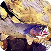
GoWild Hunting Fishing Outdoor 10.32
GoWild is a free social community that helps outdoorenthusiastsimprove their skills, find better gear and earn rewards.GoWildmembers unlock rewards as you share your story and purchasegear.Download today and see why hundreds of thousands ofoutdoorsmen andwomen have joined GoWild. • EARN REWARDS • As youearn points forsharing trophies, outdoor trips, gear reviews andpurchases,, youget points on your profile. Those points help unlockRewards, suchas gift cards, knives, gun cleaning kits, tshirts,stickers, andeven free fishing trips. • FIND THE BEST GEAR •Members in ourcommunity tag the gear they’re using, which helps youfind the bestoutdoor gear on the market. You can show off your GearSetups, orjust browse to see what other members are using to findsuccess inthe field. Best of all? You earn points every time youshare yourgear in a post. • TROPHIES WELCOME• Save your fishing andhuntingmemories, along with your unique stats. Load in your PBTrophieswithout harassment. Trophies rack up BIG points. • FINDLOCALEXPERTS • The Near Me feature connects you to local expertanglers,hunters and outdoor enthusiasts. Filter across 60+ topics.• GREATCONTENT, EASIER TO FIND • Followers are not necessary onGoWild. Asa forum, GoWild makes it easy to find content about thetopics youlove. The app’s content is fully customizable—see thekind ofcontent you want, nothing you don’t.

