Top 22 Games Similar to Clinometer with Compass
Altimeter Offline Pro 1.3
Altimeter not need phone signal orinternetconnection to work with high elevation accuracy. Accuracyimprovedgeoid compensation. Ideal for hiking, treking and climbs inmediumand high mountain, where the telephone is often lacking and3ghedge.Improved Altimeter Offline Version. Improvements: more precisely, to write data to yourroutes(maximum height, initial height, climbed, cumulative height,date...), record your historical record of maximum height andadjuststhe refresh rate of the sensor to save battery.Geographical coordinates displayed(longitude and latitude).This application saves your highest elevation automatically.Only need a phone/tablet with GPS sensor.Know your altitude always.Elevation showed in meters and feet. High accuracy inelevationdata.
PHOTOMOD GeoCalculator 1.3.001
PHOTOMOD GeoCalculator performs coordinate transformationsaccordingto Russian State Standard GOST R 51794-2001 andInterstate StandardsGOST 32453-2013 (GOST R 51794-2008) and GOST32453-2017. Itimplements transformations between Cartesiangeocentric and geodetic(latitude, longitude, height above theellipsoid) reference framesbased upon geodetic datums WGS 84,Pulkovo 42, Pulkovo 95, GSK-2011,PZ-90, PZ-90.02, PZ-90.11 andITRF-2008, as well as projectedcoordinate systems SK-42, SK-95 andGSK-2011 (based on Gauss-Krugermap projection). In addition sometransformations not covered by thestandards are supported, namelyones involving WGS 84/UTM referencesystem and EGM96 geoid model.Coordinates to be transformed can betyped-in manually, measured inGoogle Maps or set to the currentdevice location.
Bubble Level - Spirit Level
Bubble level also known as spirit level is a free,handy,accurate,simple to use and incredibly useful tool for yourAndroiddevice. Aspirit level or bubble level is an instrumentdesigned toindicatewhether a surface is horizontal (level) orvertical(plumb). Vialson modern level meter have a slightly curvedglasstube which isincompletely filled with a liquid, usually acoloredspirit oralcohol, leaving a bubble in the tube. Atslightinclinations thebubble travels away from the center position,whichis usuallymarked. Bubble Level app tries to mimic the reallevelmeter anddisplays the data as real level meter would. Anextensionof thespirit level is the bull's eye level: acircular,flat-bottomeddevice with the liquid under a slightlyconvex glassface with acircle at the center. It serves to level asurfaceacross a plane,while the tubular level only does so inthedirection of the tube.Bubble Level app tries to mimic therealbull's eye level anddisplays the data as real bull's eyelevelwould. Where any why useBubble Level? A bubble level is adeviceused in construction,carpentry and photography thatdetermines ifobjects on whichyou're working are level. Usedproperly, a bubblelevel can helpyou create flawlessly level piecesof furniture,staircases andhomes. A bubble level is also helpfulwhen setting upa tripod forphotographs or when hanging paintings orother items onthe wall.
Compass & Spirit Level Pro 2.0
A very reliable compass combined with a spirit level. No ads!Evenif you hold your device in an upright position in front of you,theexact cardinal point will be displayed. The rotation inhorizontalposition can be measured with the compass. The precisionof thecompass depends on your sensor. Magnets and electric fieldshave amagnetic field and thus have an influence on the compass.Manygreat features: * Set layout colors the way you like it *Choosebetween portrait and landscape mode (optimized for tablets) *Movethe app to your sd-card Spirit level: * Acoustic andvisualfeedback when the angles are in the set range * Values canbedisplayed with decimal places * Easy calibration (i.e.forlevelling out the bulge of your camera) * Adjust the sensibilityofthe measurement * X and Y values can be swapped ONLY IN THISPROVERSION: * No ads * Display the magnetic field in micro Tesla(µT)* The range for visual feedback can be customized Somefeedbackwould make me happy :) Please write an email to reportanyproblems.
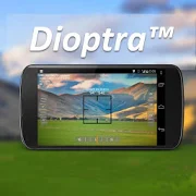
Dioptra™ Lite - a free camera tool 1.0.10
Dioptra™ Lite - a camera position and angle measurementtoolfornavigation, surveying, positioning, and measurement - -withover35,000 users! Stay tuned for an enhanced Dioptra app in2020withmore features, better sharing integration, andsupportingmorephones and devices! Instructions: Press the on-screencamerabuttonto save an image. View saved images in your device'sgalleryapp.[⊹] Dioptra™ Lite provides the following informationlikeatheodolite optical instrument - • yaw indicator (compass)•pitchindicator (tilt degrees) • roll indicator (tilt degrees)alongwith- • GPS position • azimuth and bearing to photo subjectTheancientgreek "dioptra" was a classical astronomicalandsurveyinginstrument, dating from the 3rd century BCE. Thedioptrawas asighting tube or, alternatively, a rod with a sight atbothends,attached to a stand. If fitted with protractors, it couldbeusedto measure angles. [⊹]
Compass Pro - with camera view 2.0
A very accurate compass withmanyfunctions:Spirit level, magnetic field, geo data (location).With the camera function you can 'look through' your device,focuson a point and get the exact cardinal point.No ads!Features:* Choose individual layout colors* Portrait and landscape mode (optimized for tablets)* Location (GPS or network)* Spirit level: acoustic and visiual feedback, decimalplaces,calibration, x and y values can be swapped* The rotation in horizontal position can be measured withthecompass* Strength of the magnetic field is displayed* App can be moved to sd-card* ...ONLY IN PRO VERSION:* No ads!* Set visual and acoustic indicator with a tolerance* Location can be displayed in decimal format* ...INFO:- You can't take pictures with this compass. If you want totakepictures as well, get the 'Level Camera' app in thePlayStore.- The precision of the compass depends on your sensor. Magnetsandelectric fields have a magnetic field and thus have an influenceonthe compass.PERMISSIONS:'Location': only used to display your location.'Camera': camera view can be set as background.


