Top 21 Games Similar to Dynavix našim

GPS Navigation
FREE GPS navigation & offline mapsFREE map updatesFREE trip planning & POI searchGPS Navigation is a free offline gps navigation based onPremiumMaps, with multiple map updates per year. Free versionincludes 7days Premium with voice guided navigation. After 7 daysuse offlinemaps and trip planning for free or upgrade to unlimitedvoiceguided Premium navigation.Free features:~ car & pedestrian navigation~ speed limit warnings~ 3D mapsPremium:~ multi language voice guided navigation~ lane guidance~ HUD~ travelbook~ support~ speed camera warnings~ navigate to photoAvailable maps:AfricaAlgeria, Angola, Benin, Botswana, Burkina Faso, Burundi,Cameroon,Capeverde, Central African Republic, Chad, Comoros,DemocraticRepublic of Congo, Congo, Djibouti, Egypt, EquatorialGuinea,Eritrea, Ethiopia, Gabon, Gambia, Ghana, Guinea,Guinea-Bissau,Kenya, Lesotho, Liberia, Libya, Madagascar, Malawi,Mali,Mauritania, Mauritius, Mayotte, Morocco, Mozambique,Namibia,Niger, Nigeria, Reunion, Rwanda, Saint Helena, SaotomeandPrincipe, Senegal, Seychelles, Sierra Leone, Somalia, SouthAfrica,South Sudan, Sudan, Swaziland, United Republic of Tanzania,Togo,Tunisia, Uganda, Western Sahara, Zambia, ZimbabweAsiaAfghanistan, Armenia, Azerbaijan, Bangladesh, Bhutan, BritishIndianOcean Territory, Brunei Darussalam, Burma, Cambodia, China,EastTimor, Georgia, Hong Kong, India, Indonesia, Japan,Kazakhstan,Kyrgyzstan, Laos, Macau, Malaysia, Maldives, Mongolia,Nepal, NorthKorea, Northern Mariana Islands, Philippines,Singapore, SouthKorea, Sri Lanka, Taiwan, Tajikistan, Thailand,Turkmenistan,Uzbekistan, VietnamEuropeAlbania, Andorra, Austria, Belarus, Belgium, Bosnia andHerzegovina,Bulgaria, Croatia, Cyprus, Czech Republic, Denmark,Estonia, FaroeIslands, Finland, France, Germany, Gibraltar,Greece, Guernsey,Hungary, Iceland, Ireland, Italy, Jersey, Latvia,Liechtenstein,Lithuania, Luxembourg, Macedonia, The FormerYugoslav Republic of,Malta, Moldova, Republic of, Monaco,Montenegro, Netherlands,Norway, Poland, Portugal, Romania, RussianFederation, San Marino,Serbia, Slovakia, Slovenia, Spain, Sweden,Switzerland, Turkey,Ukraine, United Kingdom, Vatican, KosovoMiddle EastBahrain, Iran (Islamic Republic of), Iraq, Israel, Jordan,Kuwait,Lebanon, Oman, Pakistan, Palestine, Qatar, Saudi Arabia,Syria,United Arab Emirates, YemenNorth AmericaAnguilla, Antigua and Barbuda, Bahamas, Barbados, AmericanSaoma,Belize, Bermuda, British Virgin Islands, Canada, CaymanIslands,Costarica, Cuba, Dominica, Dominican Republic, ElSalvador,Greenland, Grenada, Guatemala, Haiti, Honduras, Jamaica,Mexico,Montserrat, Nicaragua, Panama, Puerto Rico, Saint Kitts andNevis,Saint Luca, Saint Pierre and Miquelon, Saint Vincent,Trinidad andTobago, Turks and Caicos Islands, Virgin IslandsUnited StatesAlabama, Alaska, Arizona, Arkansas, California,Colorado,Connecticut, Delaware, District of Columbia, Florida,Georgia,Hawaii, Idaho, Illinois, Indiana, Iowa, Kansas,Kentucky,Louisiana, Maine, Maryland, Massachusetts, Michigan,Minnesota,Mississippi, Missouri, Montana, Nebraska, Nevada, NewHampshire,New Jersey, New Mexico, New York, North Carolina, NorthDakota,Ohio, Oklahoma, Oregon, Pennsylvania, Puerto Rico, RhodeIsland,South Carolina, South Dakota, Tennessee, Texas, Utah,Vermont,Virgin Islands (U.S.), Virginia, Washington, WestVirginia,Wisconsin, WyomingOceaniaAustralia, Cook Islands, Fiji, French Polynesia, Kiribati,MarshallIslands, Micronesia, Nauru, New Caledonia, New Zealand,Niue,Palau, Papua New Guinea, Pitcairn, Samoa, Solomon Islands,Tokelau,Tonga, Tuvalu, Vanuatu, Wallis and Futuna, Cocos islands,ChristmasislandsSouth AmericaArgentina, Bolivia, Brazil, Chile, Colombia, Ecuador,FalklandIslands, French Guiana, Guadeloupe, Guyana, Martinique,Paraguay,Peru, Saint Barthelemy, Saint Martin, Suriname,Uruguay,Venezuela

TomTom GO Navigation 3.2.12
Get Offline Navigation, Online Experience with TomTomGONavigation:Downloadable GPS Sat Nav offline maps, preciselivetraffic, andspeed camera alerts*, both updated inreal-time.Download now usingthe 30-DAY FREE TRIAL offer to get thebestdriving experience. 😎KEEP YOUR MAPS UPDATED WHILE SAVINGYOURMOBILE DATA • Maps À LaCarte: Save your mobile data withofflinemaps available in 150countries, always ad-free. You decidewhichmap to download, basedon what you need. • Weekly Map Updates:Helpyou steer clear ofblocked roads and drive within speedlimits,even when you areoffline. • Moving Lane Guidance: Endtheguesswork - know what laneis yours and what exit totake.Proprietary maps coming from 20+years of experience, provideyouhigh-quality turn-by-turn guidanceon your ways. STAYCONNECTEDWITH REAL-TIME UPDATES: • TomTomTraffic: Avoid traffic anddangerzones in real-time withintelligent route • Speed CameraWarnings*:Helping you drive saferand hassle-free with speed alertsandwarnings for fixed and mobilespeed cameras. • Online Search:Yourgo-to destinations, as well aspopular attractions andessentialPOIs, are stored on the app. Onceconnected, you cansearchdestinations from the catalogue of TomTom.• Share ETA: Shareyourestimated time of arrival with coworkers,friends, and familyviathe messaging platform of your choice. DRIVESAFELY AND BE AWAREOFSPEED CAMERAS: • Points of Interest: Searchand finddestinations,scenic areas, and attractions on the way andwhen youarrive atyour destination. • Alternative Routes: See waysaroundtrafficcongestion backed by precise distance and timecalculations •Driveto Photo: Remember the name of that place?! Ifyou geotaggedthephotos you took there, the app will take youthere! • DrivetoContacts: Get easier route planning to the peopleyou know,withthe contacts stored on your phone. • Ad-Free: Avoidannoyingadsfor the most efficient journey without interruption. •NEW! :Nowworks with Android Auto After the free trial, you canselect oneofthe following auto-renewing subscription plans: $1.99- 1month$8.99 - 6 months $12.99 - 12 months Cancel or changeyourplananytime. Drive with TomTom Go Navigation, thestate-of-the-artGPSSat Nav around! 💯 If you have questions,feedback, or inputonsomething we may have missed, please follow us& share on:+Facebook @ TomTom + Twitter @ TomTom + Instagram@TomTomDriversDisclaimers: · The use of this app is governed bytheTerms andConditions at tomtom.com/en_us/legal/. ·Additionallaws,regulations, and local restrictions may apply. Youuse thisapp atyour own risk. * The Speed Camera Services must onlybe usedinaccordance with laws and regulations of the country whereyouaredriving. This functionality is specifically prohibitedinsomejurisdictions. It is your responsibility to comply withsuchlawsbefore activating the services. You can enable anddisableSpeedCamera warnings on TomTom GO Navigation. Learnmoreat:tomtom.com/en_us/navigation/mobile-apps/go-navigation-app/disclaimer/**Offerlimited to one free trial period per user. At the end ofthetrial,your subscription will be charged unless you cancel itatleast 24hours in advance.


GPS Navigation & Live Map 1.0
GPS Navigation & Map is theworld’smostInstalled turn-by-turn GPS navigation App forAndroid.Travelaround the globe or look around the world with aswipe ofyourfinger and get live Maps, GPS Navigation,Directionsandstreetview. Find your current location or search for anaddressandnavigate using google maps or Open Street Map (OSM)toyourdestination.

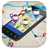
Maps, Navigation & Directions
Maps, Navigation & Directions lets youplanyour trips, route your travel and find restaurants nearby.Find yourcurrent location or search for an address andnavigate.Whether you need city, satellite, traffic, public transit,cyclingor even hiking maps, you can always find your location withMaps,Navigation & Directions uses the fastes link to popularMapsapplication!Maps, Navigation & Directions: World best knowMapsapplication.Travel around the world and navigate using any methodoftransportation:• Route planner for cars, bikes and walking to anyglobaladdress• GPS navigation with local traffic help you find the fastesttriproute• Voice GPS for step-by-step travel directions from the mosttrustedmaps• Location tracker via GPS (latitude, longitude) or IP-addressifavailable• Itinerary manager for bus schedules, nearby hotels and more• Navigation maps with GPS for city, traffic and publictransportroutesMAPS - Maps range from satellite maps to bike maps and streetview.Traffic conditions and transit maps are also available:• Street view – See exteriors for museums, restaurantsandmore• Traffic maps – See current traffic conditions to avoidtrafficjams• Cycling map with bike routes and contour lines - Plan yournextcycling tour• Walking maps – Explore your city on-foot withdetailedwalk-friendly maps• Hiking GPS – Find hiking trails or plan your nextbackpackingtrip• Satellite view – Enjoy the view from the space• Maps, Navigation & DirectionsTRANSIT – Get Maps, Navigation & Transit for Over 15,000Towns& Cities:• Bus routes & tracker – Get directions and maps in over15Kareas• Train station locations and schedules• Bike paths for cycling• Subway maps and stationsFIND NEAR ME – Search to Find:• Food near you• Hotels• Bars near you• Gas stations• ATMs• Addresses (street name & house number, city)• Nearby city and neighborhood zip codesPlaces Around Me: Find hotels, restaurants, shopping,museums,stations, hospitals and more ‘near me’REAL TIME TRAFFIC:• get the best real time traffic information and see traffic flowonthe roads to get you faster to the destinationGAS PRICES• find the bes price of gas on your route or nearestgasstationMAPS COVERAGE:Maps of New York, NYMaps of Los Angeles, CAMaps of Chicago, ILMaps of Brooklyn, NYMaps of Queens, NYMaps of Houston, TXMaps of Manhattan, NYMaps of Philadelphia, PAMaps of Phoenix, AZMaps of San Antonio, TXMaps of Bronx, NYMaps of San Diego, CAMaps of Dallas, TXMaps of San Jose, CAMaps of East San Gabriel Valley, CAMaps of Austin, TXMaps of Jacksonville, FLMaps of San Francisco, CAMaps of Indianapolis, INMaps of Columbus, OHMaps of Fort Worth, TXMaps of Charlotte, NCMaps of Detroit, MIand many many more

Dynavix Central EU 1.4.9
Vyzkoušejte chytrou navigaci sintuitivnímovládáním a vtipnými hlasovými pokyny herce Pavla Lišky.Mapa střední Evropy (10 zemí) je uložena ve vnitřnípamětizařízení, což umožňuje plánovat trasu nebo vyhledávat bodyzájmubez nutnosti internetového připojení.Navigace je určena pro chytré telefony s operačnímsystémemAndroid 2.3 a vyšším.KLÍČOVÉ FUNKCE:• Chytrá trasa - navigace využívá zkušenosti milionů řidičůanalezne tu nejlepší cestu v jakýkoli den nebo čas• Rychlý panel - okamžité vyhledání nejbližší čerpacístanice,ubytování nebo občerstvení na Vaší trase• Možnost volného importu vlastních bodů zájmu (formáty .csva.ov2)• Jednoduché plánování trasy s podporou průjezdních bodů• Navigace do jízdních pruhů a zobrazování dálničních návěštíHLAVNÍ FUNKCE:• Google lokální vyhledávání• Alternativní trasa a funkce zakázaných úseků• Funkce rychlé navigace „Domů“• Vyhledávání bodů zájmu blízko aktuální pozice, podél trasyneboblízko cíle• Hlasové navigační pokyny na pozadí• Asistence v případě problému díky dialogu Pomoc• Navigace na kontakty v telefonu• Přímé volání bodu zájmu (např. restaurace)• Sdílení pozice přes e-mail• Upozornění na radary• Široký výběr 3D modelů aut• Automatický denní nebo noční mód• Široké možnosti nastavení pozadí, barvy mapy, tématu neboauta• Mapové podklady TomTomREGIONÁLNÍ FUNKCE:• 99% pokrytí čísel popisných v ČR• Hlasové pokyny herců Pavla Lišky a Ilony Svobodové - originálníavtipné pokyny Pavla Lišky Vás zaručeně pobaví nadlouhýchcestách• Databáze rizikových míst v ČROBSAHUJE MAPY:Rakousko, Chorvatsko, Česká republika, Německo,Polsko,Slovensko, Slovinsko, Švýcarsko, Lichtenštejnsko,MaďarskoTECHNICKÁ PODPORA & KONTAKTY:http://www.dynavix.czhttp://android.dynavix.comSOCIÁLNÍ SÍTĚ:http://www.twitter.com/dynavixhttp://www.facebook.com/dynavixTry smart navigationwithan intuitive interface and voice guidance humorous actorPavelLiska.Map of Central Europe (10 countries) is stored in theinternalmemory of the device, which allows you to plan a route orsearchfor points of interest without an Internet connection.Navigation is designed for smart phones running Android 2.3andhigher.KEY FEATURES: • Smart route - Navigation uses the experience ofmillionsof drivers and finds the best route on any day ortime • Fast panel - instantly find the nearest gasstation,accommodation or refreshments along the route • Possibility of free import custom points ofinterest(formats. Csv and. OV2) • Easy route planning with the support of waypoints • Navigate lane highway and displaying labelsMAIN FEATURES: • Google local search • Alternative route a function of prohibited sections • The quick navigation "Home" • Searching for POIs near your current location, alongyourroute or close to target • Voice navigation instructions in the background • Assistance in case of problems through dialogue Help • Navigation to contacts in your phone • Direct call a point of interest (eg restaurants) • Sharing positions through e-mail • Warning Radars • Wide selection of 3D car models • Automatic day and night mode • Extensive set the background, map colors, theme or car • TomTom Map dataREGIONAL FEATURES: • 99% coverage of house numbers in Czech Republic • Voice instructions actors Pavel Liska and Ilona Svobodové-original and humorous instructions by Pavel Liska willsurelyentertain you on long trips • Database vulnerabilities in the Czech RepublicContains maps:Austria, Croatia, Czech Republic, Germany, Poland,Slovakia,Slovenia, Switzerland, Liechtenstein, HungaryTECHNICAL SUPPORT & CONTACTS:http://www.dynavix.czhttp://android.dynavix.comSocial Networks:http://www.twitter.com/dynavixhttp://www.facebook.com/dynavix

Navmii GPS World (Navfree) 3.7.22
Navmii is a free navigation and traffic appfordrivers.Navmii combines FREE voice-guided navigation, livetrafficinformation, local search, points of interest and driverscores.Offline maps stored locally, for use without aninternetconnection. Over 24 million drivers use Navmii and our mapsareavailable for more than 150 countries.• Real voice-guided navigation• Real-time traffic and road information• Works with GPS only – internet not needed• Offline and Online Address search• Driver Scoring• Local Place search (powered by TripAdvisor, FoursquareandWhat3Words)• Fast routing• Automatic rerouting• Search using Postcode/ City/ Street/ Points of interest• Heads-Up Display (HUD) – upgrade• Community map reporting• HD accurate maps• + Much, much moreWe have thousands of 5-STAR REVIEWS:- why buy a satnav when navmii does it all- unbeatable value and functionality- love, love this app!Navmii features on-board OpenStreetMap (OSM) maps, which arestoredon your device and therefore you don’t need no dataconnection(unless of course you use the connected services). UseNavmiiabroad to avoid high roaming costs!We're always eager to hear about your experience of usingNavmii.You can contact us anytime by email, on Twitter or Facebookusingthe details below:- Twitter: @NavmiiSupport- Email: [email protected] Facebook: www.facebook.com/navmiigpsNote: continued use of GPS running in the backgroundcandramatically decrease battery life.

GPS Navigation & Map Tracker 0.2
GPS map finder and route finder is a freeappwhich provide you a best alternative and demo of defaultmapdirection system of you mobile.Gps navigation and tracker location is an gps map which trackyourride and provide you the map where you are, gps map is andirectionlocator app which has own location system of trackingyourway.GPS navigation and maps sygic position map route finder whichupdateevery latitude of earth and give you the right path bydistrict todistrict also,gps tracker is one of the best trafficcontrol appwhich receive the directions from radar and update yourmap when youstuck at anywhere.Gps navigation and direction tracker is an car gps which informsyouthat where did I park the car,Also an phone gps that has unlimited traffic tracker systemwhichprovide you the best tracking app.GPS location finder & tracker also locate your directionsandgive you the right track or way,with gps navigator anddirectionfinder provide the the info of different street routes andalsothis wise dil lane saint system remove issues and provideyourplaces according to your route.GPS navigator location and tracker is an accurate and mostadvancedapplication which find your routes and navigate your mapthroughtraffic control systems,gps navigation locator is a timetrackingbest tool which give you the fastest and easy way pointfrom eastto west and north to south worldwide,gps direction finderclearyour routes & reduce your miles and time through radarbasesystem.Gps direction tracker in an tracker studio which copy themapdirection & paste it into to your middle map directionreceivesystem.

Tank Navigator - Ceny Benzínu 2.1.12
Aplikace Tank Navigator vyhledáváčerpacístanice s akceptací karet CCS v ČR a SR a zobrazuje nanichaktuální ceny PHM ve vašem okolí nebo ve vámi určenémmístě.Aplikace vyhledává i další akceptační místa CCS.Hlavní funkce:- Vyhledání čerpacích stanic dle ceny nebo vzdálenosti- Zobrazení čerpacích stanic na mapě- GPS navigace k vybrané čerpací stanici- Detailní informace o čerpací stanici: adresa, telefon,otevíracídoba, dostupné služby- Denní aktualizace cen PHM- Možnost výběru oblíbených čerpacích stanic- Volba typu paliva- Vyhledávání v nastavitelném okruhu až 30 km- Filtrování stanic podle značky řetězce a podledostupnýchslužeb- Vyhledání parkovišť a autoservisů akceptujících karty CCSTank ApplicationNavigatorsearches pumping stations with CCS card acceptance in theCzechRepublic and Slovakia, and displays them on current fuelprices inyour area or in your preferred location. The applicationalso seeksadditional acceptance locations CCS.Main functions:- Finding gas stations by price or distance- Display of petrol stations on the map- GPS navigation to the selected gas station- Detailed information about petrol station address, phonenumbers,opening hours, services available- Daily updates prices PHM- Choice favorite gas stations- Select the type of fuel- Search in adjustable radius up to 30 km- Filtering stations by brand chain and the availableservices- Finding parking lots and garages accepting cards CCS

Dynavix Europe 1.4.7
Vyzkoušejte chytrou navigaci sintuitivnímovládáním a vtipnými hlasovými pokyny herce Pavla Lišky.Mapa Evropy (44 zemí) je uložena ve vnitřní paměti zařízení,cožumožňuje plánovat trasu nebo vyhledávat body zájmu beznutnostiinternetového připojení.Navigace je určena pro chytré telefony s operačnímsystémemAndroid 2.3 a vyšším.KLÍČOVÉ FUNKCE:• Chytrá trasa - navigace využívá zkušenosti milionů řidičůanalezne tu nejlepší cestu v jakýkoli den nebo čas• Rychlý panel - okamžité vyhledání nejbližší čerpacístanice,ubytování nebo občerstvení na Vaší trase• Možnost volného importu vlastních bodů zájmu (formáty .csva.ov2)• Jednoduché plánování trasy s podporou průjezdních bodů• Navigace do jízdních pruhů a zobrazování dálničních návěštíHLAVNÍ FUNKCE:• Google lokální vyhledávání• Alternativní trasa a funkce zakázaných úseků• Funkce rychlé navigace „Domů“• Vyhledávání bodů zájmu blízko aktuální pozice, podél trasyneboblízko cíle• Hlasové navigační pokyny na pozadí• Asistence v případě problému díky dialogu Pomoc• Navigace na kontakty v telefonu• Přímé volání bodu zájmu (např. restaurace)• Sdílení pozice přes e-mail• Upozornění na radary• Široký výběr 3D modelů aut• Automatický denní nebo noční mód• Široké možnosti nastavení pozadí, barvy mapy, tématu neboauta• Mapové podklady TomTomREGIONÁLNÍ FUNKCE:• 99% pokrytí čísel popisných v ČR• Hlasové pokyny herců Pavla Lišky a Ilony Svobodové - originálníavtipné pokyny Pavla Lišky Vás zaručeně pobaví nadlouhýchcestách• Databáze rizikových míst v ČROBSAHUJE MAPY:Podrobné pokrytí: Andorra, Česká republika, Rakousko,Belgie,Dánsko, Estonsko, Finsko, Francie, Německo, Gibraltar,Řecko,Maďarsko, Itálie, Irsko, Lichtenštejnsko, Litva,Lucembursko,Malta, Monako, Nizozemsko, Norsko, Slovensko,Slovinsko, Španělsko(včetně Kanárských ostrovů), Polsko,Portugalsko, San Marino,Švédsko, Švýcarsko, Spojené království,VatikánČástečné pokrytí: Turecko, Bulharsko, Chorvatsko,Lotyšsko,Rumunsko, UkrajinaSpojující komunikace: Albánie, Bělorusko,Bosna-Hercegovina,Makedonie, Moldávie, Černá Hora, SrbskoTECHNICKÁ PODPORA & KONTAKTY:http://www.dynavix.czhttp://android.dynavix.comSOCIÁLNÍ SÍTĚ:http://www.twitter.com/dynavixhttp://www.facebook.com/dynavixTry smart navigationwithan intuitive interface and voice guidance humorous actorPavelLiska.Map of Europe (44 countries) is stored in the internalmemory,allowing you to plan a route or search for points ofinterestwithout an Internet connection.Navigation is designed for smart phones running Android 2.3andhigher.KEY FEATURES: • Smart route - Navigation uses the experience ofmillionsof drivers and finds the best route on any day ortime • Fast panel - instantly find the nearest gasstation,accommodation or refreshments along the route • Possibility of free import custom points ofinterest(formats. Csv and. OV2) • Easy route planning with the support of waypoints • Navigate lane highway and displaying labelsMAIN FEATURES: • Google local search • Alternative route a function of prohibited sections • The quick navigation "Home" • Searching for POIs near your current location, alongyourroute or close to target • Voice navigation instructions in the background • Assistance in case of problems through dialogue Help • Navigation to contacts in your phone • Direct call a point of interest (eg restaurants) • Sharing positions through e-mail • Warning Radars • Wide selection of 3D car models • Automatic day and night mode • Extensive set the background, map colors, theme or car • TomTom Map dataREGIONAL FEATURES: • 99% coverage of house numbers in Czech Republic • Voice instructions actors Pavel Liska and Ilona Svobodové-original and humorous instructions by Pavel Liska willsurelyentertain you on long trips • Database vulnerabilities in the Czech RepublicContains maps:Detailed coverage: Andorra, Czech Republic, Austria,Belgium,Denmark, Estonia, Finland, France, Germany, Gibraltar,Greece,Hungary, Ireland, Italy, Liechtenstein, Lithuania,Luxembourg,Malta, Monaco, Netherlands, Norway, Slovakia, Slovenia,Spain(including the Canary Islands), Poland, Portugal, SanMarino,Sweden, Switzerland, United Kingdom, Vatican CityPartial coverage: Turkey, Bulgaria, Croatia, Latvia,Romania,UkraineCombining communication: Albania, Belarus,Bosnia-Herzegovina,Macedonia, Moldova, Montenegro, SerbiaTECHNICAL SUPPORT & CONTACTS:http://www.dynavix.czhttp://android.dynavix.comSocial Networks:http://www.twitter.com/dynavixhttp://www.facebook.com/dynavix

Dynavix Europe Voucher 1.4.7
Upozornění: Verzi Dynavix VoucherEditionmůžeteaktivovat pouze pomocí zakoupeného aktivačního klíče.Vyzkoušejte chytrou navigaci s intuitivním ovládánímavtipnýmihlasovými pokyny herce Pavla Lišky.Mapa Evropy (44 zemí) je uložena ve vnitřní pamětizařízení,cožumožňuje plánovat trasu nebo vyhledávat body zájmubeznutnostiinternetového připojení.Navigace je určena pro chytré telefony soperačnímsystémemAndroid 2.3 a vyšším.KLÍČOVÉ FUNKCE:• Chytrá trasa - navigace využívá zkušenosti milionůřidičůanalezne tu nejlepší cestu v jakýkoli den nebo čas• Rychlý panel - okamžité vyhledání nejbližšíčerpacístanice,ubytování nebo občerstvení na Vaší trase• Možnost volného importu vlastních bodů zájmu (formáty.csva.ov2)• Jednoduché plánování trasy s podporou průjezdních bodů• Navigace do jízdních pruhů a zobrazování dálničních návěštíHLAVNÍ FUNKCE:• Google lokální vyhledávání• Alternativní trasa a funkce zakázaných úseků• Funkce rychlé navigace „Domů“• Vyhledávání bodů zájmu blízko aktuální pozice, podéltrasyneboblízko cíle• Hlasové navigační pokyny na pozadí• Asistence v případě problému díky dialogu Pomoc• Navigace na kontakty v telefonu• Přímé volání bodu zájmu (např. restaurace)• Sdílení pozice přes e-mail• Upozornění na radary• Široký výběr 3D modelů aut• Automatický denní nebo noční mód• Široké možnosti nastavení pozadí, barvy mapy, tématu neboauta• Mapové podklady TomTomREGIONÁLNÍ FUNKCE:• 99% pokrytí čísel popisných v ČR• Hlasové pokyny herců Pavla Lišky a Ilony Svobodové -originálníavtipné pokyny Pavla Lišky Vás zaručeně pobavínadlouhýchcestách• Databáze rizikových míst v ČROBSAHUJE MAPY:Podrobné pokrytí: Andorra, Česká republika,Rakousko,Belgie,Dánsko, Estonsko, Finsko, Francie, Německo,Gibraltar,Řecko,Maďarsko, Itálie, Irsko, Lichtenštejnsko,Litva,Lucembursko,Malta, Monako, Nizozemsko, Norsko,Slovensko,Slovinsko, Španělsko(včetně Kanárských ostrovů),Polsko,Portugalsko, San Marino,Švédsko, Švýcarsko, Spojenékrálovství,VatikánČástečné pokrytí: Turecko, Bulharsko, Chorvatsko,Lotyšsko,Rumunsko,UkrajinaSpojující komunikace: Albánie,Bělorusko,Bosna-Hercegovina,Makedonie, Moldávie, Černá Hora,SrbskoTECHNICKÁ PODPORA & KONTAKTY:http://www.dynavix.czhttp://android.dynavix.comSOCIÁLNÍ SÍTĚ:http://www.twitter.com/dynavixhttp://www.facebook.com/dynavixNote: TheversionDynavixVoucher Edition can be activated only by thepurchasedactivationkey.Try smart navigation with an intuitive interfaceandvoiceguidance witty actor Paul Fox.Map of Europe (44 countries) is stored in theinternalmemory,allowing you to plan a route or search for pointsofinterestwithout having internet connection.Navigation is designed for smart phones running Android2.3andhigher.KEY FEATURES: • Smart route - Navigation uses the experienceofmillionsof drivers and finds the best route on any dayortime • Fast panel - instantly find the nearestgasstation,accommodation or refreshment along your route • Possibility of free import custom pointsofinterest(formats. Csv and. OV2) • Easy route planning with the support of waypoints • Navigate to the lane motorway and display labelsMAIN FEATURES: • Google local search • Alternative route and restricted features sections • The quick navigation "Home" • Searching for POIs near your current location,alongyourroute or close to target • Voice navigation instructions in the background • Assistance in case of problems through dialogue Help • Navigate to the contacts in your phone • Direct call a POI (eg restaurants) • Sharing positions through e-mail • Warning Radars • Wide selection of 3D car models • Automatic day and night mode • Extensive set the background, map colors, theme or car • TomTom Map dataRegional functions: • 99% coverage of house numbers in Czech Republic • Voice instructions actors Pavel Liska and IlonaSvobodové-original and humorous instructions by Pavel Liskawillsurelyentertain you on long journeys • A database of vulnerabilities in the Czech RepublicContains maps:Detailed coverage of Andorra, the CzechRepublic,Austria,Belgium, Denmark, Estonia, Finland, France,Germany,Gibraltar,Greece, Hungary, Ireland, Italy,Liechtenstein,Lithuania,Luxembourg, Malta, Monaco, Netherlands,Norway, Slovakia,Slovenia,Spain (including the Canary Islands),Poland, Portugal,San Marino,Sweden, Switzerland, United Kingdom,VaticanPartial coverage: Turkey, Bulgaria, Croatia,Latvia,Romania,UkraineConnecting communication: Albania,Belarus,Bosnia-Herzegovina,Macedonia, Moldova, Montenegro,SerbiaTechnical support & contact:http://www.dynavix.czhttp://android.dynavix.comSocial Networks:http://www.twitter.com/dynavixhttp://www.facebook.com/dynavix

SNAV navigator free
Features: - Address Book - Home and 4 shortcut keys -QuickVoiceSearch - Selection of navigation type: car, bicycle,walking,train/ bus - Avoid motorways and tolls SNAV Google™Navigatorsimplifiesthe use of Google Maps™ or Waze™ thanks to thequickstart of thenavigation process, simply by using your voice,withoutusing yourhands when you are driving. Snav Navigator isuseful foruse in thecar. You can program your home address, fivefavoritesand canremember the latest destinations, which makes iteasy toreach yourdestination while also avoiding motorways andtolls.Great fordrivers who don't want to be distracted too much bythesmartphonewhile driving, SNAV Navigator will make theplanningprocess of atrip much easier and less annoying when engagedin thesteeringwheel. Snav Navigator does not use any "Google API".GoogleMaps™and Google Voice™ must be installed to work. Remember -Don'tdrinkand drive!

Map of Czech Republic 1.22
This is an application that turns yourAndroiddevice into a GPS navigator with offline maps. You cansearcheasily locations in Czech Republic and you can add them toyourroute.Discover interesting places near you: accommodation,parking,restaurants, bars, clubs, cinemas, theatres, auto services,shops,parks, schools, hospitals, sport areas.You can download different regions: Praha, Střední Čechy,Jihozápad,Severozápad, Severovýchod, Jihovýchod, StředníMorava,Moravskoslezsko.It includes detailed maps of the biggest cities in CzechRepublic:Prague (Praha), Brno, Ostrava, Plzen, Liberec, Olomouc,Usti nadLabem, Ceske Budejovice, Hradec Kralove, Pardubiceandothers.This application is based on Osmand project under the GNUGPLv3license and uses high quality data from OSM.


Map of Slovakia 1.24
This application turns your Android deviceintoa GPS navigator with off-line maps.You can search easily locations in Slovakia and you can add themtoyour route.Discover interesting places near you: accommodation,parking,restaurants, bars, clubs, cinemas, theaters, auto services,shops,parks, schools, hospitals, sport areas.It includes detailed maps of the biggest cities inSlovakia:Bratislava, Kosice, Presov, Zilina, Banska Bystrica,Nitra, Trnava,Martin, Trencin, Poprad and others.This application is based on Osmand project under the GNUGPLv3license and uses high quality data from OSM.

Free Navigation 1.2.5
You can keep your hands on the steeringwheelof your car and navigate safely on roads that do notknow.To operate the navigator ONLINE, you first need to download themapof the affected area.Enable GPS and speaks with your voice, navigation willstartimmediately.Features:- Address House Fast- Phone book (you can delete all data stored at one time oreverysingle address with swipe)- POI (you can delete all data at once or individually with eachPOIswipe)- Where 'my car? Very useful to find the car in large parkinglots,or unfamiliar places.If you are tired of all the icons in the form of maps, GPS,compass,cars and roads, download this simple and easyapplication!Navigator does not use "Google APIs."

Dynavix Central EU Voucher 1.4.9
Upozornění: Verzi Dynavix VoucherEditionmůžete aktivovat pouze pomocí zakoupeného aktivačního klíče.Vyzkoušejte chytrou navigaci s intuitivním ovládáním avtipnýmihlasovými pokyny herce Pavla Lišky.Mapa střední Evropy (10 zemí) je uložena ve vnitřnípamětizařízení, což umožňuje plánovat trasu nebo vyhledávat bodyzájmubez nutnosti internetového připojení.Navigace je určena pro chytré telefony s operačnímsystémemAndroid 2.3 a vyšším.KLÍČOVÉ FUNKCE:• Chytrá trasa - navigace využívá zkušenosti milionů řidičůanalezne tu nejlepší cestu v jakýkoli den nebo čas• Rychlý panel - okamžité vyhledání nejbližší čerpacístanice,ubytování nebo občerstvení na Vaší trase• Možnost volného importu vlastních bodů zájmu (formáty .csva.ov2)• Jednoduché plánování trasy s podporou průjezdních bodů• Navigace do jízdních pruhů a zobrazování dálničních návěštíHLAVNÍ FUNKCE:• Google lokální vyhledávání• Alternativní trasa a funkce zakázaných úseků• Funkce rychlé navigace „Domů“• Vyhledávání bodů zájmu blízko aktuální pozice, podél trasyneboblízko cíle• Hlasové navigační pokyny na pozadí• Asistence v případě problému díky dialogu Pomoc• Navigace na kontakty v telefonu• Přímé volání bodu zájmu (např. restaurace)• Sdílení pozice přes e-mail• Upozornění na radary• Široký výběr 3D modelů aut• Automatický denní nebo noční mód• Široké možnosti nastavení pozadí, barvy mapy, tématu neboauta• Mapové podklady TomTomREGIONÁLNÍ FUNKCE:• 99% pokrytí čísel popisných v ČR• Hlasové pokyny herců Pavla Lišky a Ilony Svobodové - originálníavtipné pokyny Pavla Lišky Vás zaručeně pobaví nadlouhýchcestách• Databáze rizikových míst v ČROBSAHUJE MAPY:Rakousko, Chorvatsko, Česká republika, Německo,Polsko,Slovensko, Slovinsko, Švýcarsko, Lichtenštejnsko,MaďarskoTECHNICKÁ PODPORA & KONTAKTY:http://www.dynavix.czhttp://android.dynavix.comSOCIÁLNÍ SÍTĚ:http://www.twitter.com/dynavixhttp://www.facebook.com/dynavixNote: The versionDynavixVoucher Edition can be activated only by the purchasedactivationkey.Try smart navigation with an intuitive interface andvoiceguidance witty actor Paul Fox.Map of Central Europe (10 countries) is stored in theinternalmemory, allowing you to plan a route or search for pointsofinterest without an Internet connection.Navigation is designed for smart phones running Android 2.3andhigher.KEY FEATURES: • Smart route - Navigation uses the experience ofmillionsof drivers and finds the best route on any day ortime • Fast panel - instantly find the nearest gasstation,accommodation or refreshment along your route • Possibility of free import custom points ofinterest(formats. Csv and. OV2) • Easy route planning with the support of waypoints • Navigate to the lane motorway and display labelsMAIN FEATURES: • Google local search • Alternative route and restricted features sections • The quick navigation "Home" • Searching for POIs near your current location, alongyourroute or close to target • Voice navigation instructions in the background • Assistance in case of problems through dialogue Help • Navigate to the contacts in your phone • Direct call a POI (eg restaurants) • Sharing positions through e-mail • Warning Radars • Wide selection of 3D car models • Automatic day and night mode • Extensive set the background, map colors, theme or car • TomTom Map dataRegional functions: • 99% coverage of house numbers in Czech Republic • Voice instructions actors Pavel Liska and Ilona Svobodové-original and humorous instructions by Pavel Liska willsurelyentertain you on long journeys • A database of vulnerabilities in the Czech RepublicContains maps:Austria, Croatia, Czech Republic, Germany, Poland,Slovakia,Slovenia, Switzerland, Liechtenstein, HungaryTechnical support & contact:http://www.dynavix.czhttp://android.dynavix.comSocial Networks:http://www.twitter.com/dynavixhttp://www.facebook.com/dynavix
GPS Navigator and Maps Tracker 1.6
Enter starting and ending location andgetnearest walking route and driving route information. GPSnavigationsystem helping you to save your quality time.GPSNavigator and MapsTracker explore your needed travel planning &GPS navigationsystem provide information about your walkingdistance Places.Explore through navigation app your currentlocation information,discover around addresses and bicyclenavigation view yourdestination information. with GPS navigationsystem GPS testexplore Streets , motorway , highway informationwant to discoveraround you as per your travel planning. Whetheryour needed city,satellite, traffic, public transit, bicycleNavigation or evenwalking around, you can always view or reviewyour locationinformation with Maps & GPS Navigationsystem.Travel planning:World Maps with GPS navigation system, bicycle navigation&Location TrackerTravel around the world and navigate using any methodoftransportation:Location tracker via GPS app ( latitude , longitude) orIP-addressif availablewith GPS navigation system local traffic help you explorethefastest trip route worldwide information.Navigation maps with GPS for city, traffic and publictransportroutes view.Route planner for cars, bikes and walking to any globalneededaddress review.FEATURES:Discribe Exact GPS Location informationFind Location information .Things to do & trips.Very Quick SearchExplore Shortest Route information on MapGet Latitude From Google MapsDistance to the Target Addresses include Time and KilometersDescribe Latitudes & Longitudes information fordiscoverMultiple countries worldwide AddressesWith navigation apps free find museums, airport transports,walkingtravel planning,fast food, Wine Trails, bike tours,nationalparks,fishing tours, jungle, parking, canoe tours,hotels,restaurants, gas stations.Use Coordinates in Live MapsExplore Direction information: by Foot, by Bus or by Car.Directions Explanations