Top 23 Apps Similar to Map Speedometer


GPS Speedometer Altimeter + 1.2.0
Get your elevation, climb rate and muchmore,wherever you are !Features included- Imperial and Metric unit settings.- Altiude calibrate refresh button.- GPS accuracy indicator.- GPS distance accuracy indicator.- Compass.Track information- Time elapsed.- Distance.- Average speed.- Max speed.- Altitude.Tracking- Speed tracking in mph or km/h based on MPH or KM/H mode.- Distance tracking in miles or kilometers based on MPH orKM/Hmode.- Time tracking.- Tracking location on map.- Ability to turn tracking off/on.- Longitude, latitude coordinates.Map integration- Satellite maps mode.- Hybrid maps mode.- Standard maps mode.- Tracking location changes trajectory.- Location coordinates (longitude, latitude).Share- Start, end points, coordinates link email sending- Map screenshot email sendingIf you want to save the routes and have a library for savedroutes,try this app tooSpeedometer Super Z1

عداد السرعة - Speedometer 2.2
Application Speedometer is thelatestapplication for measuring the speed, it measures all kindsofspeeds, not only while traveling by car or Other oftransportation,but while running or walking, it measures the slowerspeeds alsomeasures the largest speeds, as the program works as analarm whenyou exceed the speed specified by the user in addition toall ofthat contains the flashlight , which is mainly based ontechnologygpsFEATURES1-measuring all kinds of speeds Slow and fast.2-measuring the speed of all units "kilometer, tilt, Knot, foot,ameter."3-knowing Current speed (choose MPH, KMH or KTS)4-knowing Average speed, since reset5-knowing Maximum speed, since reset6-put an end to a certain speed of the program and works as analarmwhen you exceed the speed limitUsing sound or lighting.7-see trip distance and time it takes.8-have 8 colors9-Battery level indicator10-Current time

Speedometer 1.0
Application Speedometer isthelatestapplication for measuring the speed, it measures allkindsofspeeds, not only while traveling by car ortransportation,butwhile running or walking, it measures the slowerspeedsalsomeasures the largest speeds, as the program works as analarmwhenyou exceed the speed specified by the user , which ismainlybasedon technology GPSInformation displayedCurrent speed ( KMH)Average speedMaximum speedTrip distance

GPS Altimeter Speedometer + 1.2.1
Get your elevation, climb rate and muchmore,wherever you are !Features included- Imperial and Metric unit settings.- Altiude calibrate refresh button.- GPS accuracy indicator.- GPS distance accuracy indicator.- Compass.Track information- Time elapsed.- Distance.- Average speed.- Max speed.- Altitude.Tracking- Speed tracking in mph or km/h based on MPH or KM/H mode.- Distance tracking in miles or kilometers based on MPH orKM/Hmode.- Time tracking.- Tracking location on map.- Ability to turn tracking off/on.- Longitude, latitude coordinates.Map integration- Satellite maps mode.- Hybrid maps mode.- Standard maps mode.- Tracking location changes trajectory.- Location coordinates (longitude, latitude).Share- Start, end points, coordinates link email sending- Map screenshot email sending

Speedometer & عداد السرعة 1.0
Application Speedometer isthelatestapplication for measuring the speed, it measures allkindsofspeeds, not only while traveling by car or otheroftransportation,but while running or walking, it measures theslowerspeeds alsomeasures the largest speeds, as the program worksas analarm whenyou exceed the speed specified by the user , whichismainly basedon technology GPSFEATURES1-measures the slower speeds also measures the largest speeds2-measuring the speed by unit kilometer3-knowing Current speed in KMH4-knowing Average speed, since reset5-knowing Maximum speed, since reset6-see trip distance and time it takes.7-Battery level indicator8-Current time


GPS Speed Meter & Speed Alert 1.0.4
GPS speed meter & speed alert is thebestapp for Car speed meter and bike speed meter, Now you can seeGPSspeed on the Top Notification panel while you can do yourregularwork, this app uses GPS speedometer free with digital speedtrackerwhich can be used to track GPS speed with the help of GPSspeedtracker. GPS speed meter & speed alert has GPS speedometerwithspeed limit alarm which is very helpful to everyone who use carandbikes, you can even use this app for running speed, joggingspeedand walking speed. This beautiful app uses GPS speed trackeralongwith GPS speedometer to show the user with real time digitalspeedtracker. GPS speed meter & speed alert search for GPS fixtoshow number of available GPS satellites with globalpositingsystem. This app is for everyone and can be used anywherein theworld. GPS speed meter & speed alert can also be calledGPSspeedometer with speed limit alarm. with GPS speed meter&speed alert you can record journey time, record maximum GPSspeedof car and bikes, and record GPS distance.This app is also useful with car speedometer, bikespeedometer,jogging speedometer and running speedometer.

Speed Box – Speedometer speed.test.need
Speed Box is a Speedometer and GPS app forbothyour phone or tablet. It displays your current speed,distance,direction and altitude.MAIN FEATURES========================* MPH, KM/H and KNOTS* "Speak speed" - Tap screen to have the speed spoken to you* Maximum and average speed* Altitude* Digital compass* HUD display to see speed in windshield* Odometer to measure distance traveled* Chart of the traveled speed and altitude* Warning signal when driving too fast* Export last 3 hours of data* Change maximum displayed speed on speedometer* Swipe finger over chart to display historic data* Display GPS accuracy by tapping the indicator in the topleftcorner


MAPS.ME – Map with Navigation and Directions v14.2.71484-googleRelease
Free, fast, detailed and entirely offlinemapswith turn-by-turn navigation – trusted by over 90milliontravelers worldwide.OFFLINE MAPSSave mobile data, no internet is required.FREE FOREVERAll maps inside and all features are free. Always were andalwayswill be.NAVIGATIONUse driving, walking and cycle navigation anywhere intheworld.INCREDIBLY DETAILEDDirections to points of interest (POI), hiking trails andplacesmissing from other maps.UP-TO-DATEMaps are updated by millions of OpenStreetMap contributorsdaily.OSM is an open-source alternative to Google Maps, MapquestandWaze.FAST AND RELIABLEOffline search, GPS navigation along with optimized mapstoeffectively save memory space.BOOKMARKSSave locations you love and share them with your friends.AVAILABLE WORLDWIDEEssential for home and travel. Paris, France? Check.Amsterdam,Netherlands? Check. Barcelona, Spain? Check. New York,Chicago,Florida, Las Vegas, Nevada, Seattle, San Francisco,California,USA? Check! Rome, Italy? Check. London, UK? Check.TRAFFIC DATANew online city traffic maps. Check out updates on traffic infoandfastest driving routes in 36 countries!AND MORE!– Search through different categories e.g. restaurants,cafes,tourist attractions, hotels, ATMs and public transport(metro,bus…)– Make hotel bookings via Booking.com directly from the app– Share your location via text message or social media– When cycling or walking, the app shows whether the way isuphillor downhillContinued use of GPS running in the background candramaticallydecrease battery life.If you have any questions, visit our HelpCenter:support.maps.me.If you are unable to find the answer to your question, contactusat: [email protected] us on FB: http://www.facebook.com/mapswithme |Twitter:@MAPS_ME

Car GPS Expert, Speed Limit &Floating speedometer. 5.9
Car GPS Expert—the ultimate GPS and Multi-tasking dock appwhichhasa high-precision GPS* Speedometer, displaying thecurrentspeed,powerful 45 big icon shortcuts and many otherexcitingfeatures.It's a real powerful car dock platform, making yousaferand moreconvenient while driving !! Join our "CarGPSExpert"community,enjoying better car life !!! Howabout:★Supportingreal-time speed limit display based on realroadconditions.★Supporting speedometer auto-start on Google mapapp.★Supportingfullscreen display for the 45 large icon appshortcut(5pages)★Supporting dynamic switching between fullscreenshortcutandnon-fullscreen shortcut display ★ App startautomaticlywhenBluetooth connected. ★ Large icon app ShortcutSupport total45Large icon app shortcuts ! 5 scroll app shortcutpages. ★SupportLCD rotate, landscape&portrait mode. ★ ShortcutSidebarSafelyaccess this shortcut sidebar window, add unlimitednumber ofusefulapps to it ,multi-tasking is so easy! You can dragthissidebar toleft or right side of the window ! ★ Customizable 6UIcolors:Purple,Green,Blue,Light Blue ,black etc ★ Parking locator--findback your car easily ! ★ Floating Speedometerdisplaywhilenavigating with Google Map ★ Speedometer Real-timespeedlimitdisplay Real-time speed display Auto-start on Google mapappMaxspeed Average speed indicator Real-time currentaddressdisplayActive GPS number Distance displayLatitude/longitudedisplay GPSAltimeter ★ Speed limits’ warnings –define audio andvisual speedalarms ★ Real-time weather informationbased on currentlocationToday and the next one-week 's weather data★ Track yourmileageand useful driving stats using Trip log feature★ Photopickerwhile driving , safely and easily ! ★ Adding Notestothenavigation history list or favorite list ★ Google Mapintegrated★Powerful Map tool ★ Message reply automaticly whiledriving ★Gasstation and Restaurant Searching based on currentlocationListingmost 10 popular snack shops, just one click ,youcanstartnavigation, no text input needed !! ★ LCD backlight canbeadjusted★ Status bar hide or display switch A powerful Car GPSappis justwaiting for you ! Making you safer and moreconvenientwhiledriving !! We are listening to our users andareconstantlyintegrating your feature requests !! Join our "CarGPSExpert"community, enjoying better car life !!!
Geo Tracker - GPS tracker 5.1.5.2972
You can find answers to most commonquestionsin the FAQ section of mywebsite:https://geo-tracker.org/faq/?lang=enIf you're looking for an excellent gps tracker, if you're a fanofaction sports and long distance travel - this app is foryou!Record tracks of your trips and share them with your friends!Geo Tracker can help:• making the reverse journey in an unfamiliar area withoutgettinglost
• tell your friends how to repeat your route
• use someone else's route that is stored in GPX or KML• mark important or interesting points of your trip.The application is able to record, even when switched off. Verylongtracks could be recorded without problems - you are limitedbystorage memory only. Recorded tracks are saved in GPX orKMLformat, so they can be used in certain applications such asOziExplorer or Google Earth.When showing track on the map, the application keepsdevicebacklight, which simplifies track navigation usage.Geo Tracker is based on public API of Yandex.Maps, so in tripsoverRussia and CIS countries you'll have the most detailed map ofthearea.Application can calculate track statistics - boldly show offyourachievements to your friends :)Geo Tracker calculates:• Max & average speed on the track;• Time and average speed moving;• Max & min altitude, altitude difference;• Vertical distance, ascent & speed;• Min, max & average slope;There are also some fine charts of speed & elevation;If you have a proposal how to enchance the application or facedsomeproblem - please feel free to contactme:[email protected]. Thanks!Useful tips & tricks to solve common GPS issues withyoursmartphone:• If you start the tracking please wait with recording youractivityuntil the GPS signal is found.• Restart your smartphone and make sure that you have "clearview"of the sky before you start (no disturbing objects likehighbuildings, forest, etc.).• The reception conditions are permanently changing because theygotinfluenced by the following factors: weather, season,positioning ofsatellites, areas with bad GPS coverage, highbuildings, forest,etc.).• Go to phone settings, choose "Location" and activate it.• Go to phone settings, choose "Date & time" and activatethefollowing options: "Automatic date & time" and "Automatictimezone". It may occur that it takes longer until the GPS signalisfound if your smartphone is set to the wrong time zone.• Deactivate the airplane mode in your phone settings.If none of these tips & tricks helped to solve yourissues,deinstall the app and reinstall it again.Be aware that Google uses in their Google Maps app not only theGPSdata but also additional data of the current locationfromsurrounding WLAN networks and/or mobile networks.


Offline Maps & Navigation
Here we created another great navigationappbased on offline maps.You can enjoy unlimited navigation features, lifetime freemapupdates with no hidden costs. Our real-time traffic helps youtoavoid traffic jams. Features: - Free offline GPS navigation- Offline maps- Lifetime free map updates- Speed limit warnings- 3D buildings - Large POI database- Pedestrian, car, or even bee-line navigation- Night mode based on local sunset time Advanced:- Real-time traffic- Multi-language voice navigation- Speed camera warnings- Lane guidance- Track recording- Navigate to photo- Travelbook- Support Free version includes 90 days Advanced features with voiceguidednavigation. After 90 days use offline maps and trip planningforfree or upgrade to unlimited voice guided premiumnavigation.

GPS MAP Mobile 1.0
GPS MAP Mobile is mobile mappingserviceapplication and technology provided offering satelliteimagery,street maps, and Street View perspectives, as well asfunctionssuch as a route planner for traveling by foot, car,bicycle or withpublic transportation. Live MAPS locator for urbanbusinesses andother organizations in numerous countries around theworld.One of the neat features of Google Maps / Google Earth istheability to get a street view of many urban and suburban areas.Thestreet view is an actual photograph shot with an ImmersiveMediacamera that delivers a 360 degree image of thesurroundings.Street View - Walk Down Your Street With Google MapsWe all love their traffic alerts, but how exactly doesGoogleMapsknow how clogged the highway is on your way out of townthisweekend?Features,• How to Get Latitude From Google Maps• How to Use Coordinates in Live Maps• How to Find Latitudes & Longitudes forMultipleAddresses• How to Convert Google Maps CoordinatesNOTE : This is Contents Application. It gives youinformationregarding GPS MAP Mobile
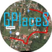
Maps GPS Places 1.8
Registren la empresa donde trabajan:GPlaceS surgió como un proyecto que busca aprovechar al máximolalocalización GPS y Google Map v2. Si eres un empresario osoloalguien que desea registrar una cuenta para una empresa ygestionartodos los servicios que ofrece dicha empresa, ya quetendrás elcontrol de tu cuenta y de los productos o servicios quepublicasserán administrados por el dueño de la cuenta.Pero si eres un usuario que desea calificar o votar porlasempresas que se encuentran registradas, podrás registrar unacuentade usuario la cual te permitirá calificar a lasempresasregistradas desde 1 a 5 estrellas y muy pronta, podrásopinar sobrelas empresas que calificas.GPlaceS se encuentra en fase beta, es por ello que concadapersona que registre su empresa en nuestra base dedatos,lograremos una aplicación estable y con muchos lugaresdondeescoger. por lo que pido a las personas que votan con unaestrella,piensen primero que esta aplicación tiene sus bases dedatosintactas y que entre mas empresarios conozcan esta app,masopciones de búsqueda exitosas tendrán. GPlaces se encuentraendesarrollo y por el momento las cuentas son gratis.Características*Registrar cuenta gratis*Localización GPS de tu empresa en cualquier parte delmundo.(Google Map)*Registro de varias categoría para tu empresa (Hotel,Restaurante,Soda)*Registro de productos o servicios*Estado de empresa open/closed*búsqueda por categoría, distancia, cantidad de resultadoycoordenada.*Calificación a lugares visitados*Información de la empresaMuy pronto se podrán comprar productos y servicios desde lamismaaplicación.Record the companywherethey work:GPlaceS emerged as a project that seeks to maximize theGPSlocation and Google Map v2. If you are a businessman orjustsomeone who wants to register an account for a company andmanageall the services offered by the company, as you will havecontrolof your account and the products or services you post willbeadministered by the account holder.But if you're a user who wishes to qualify or vote forthecompanies that are registered, you can register a useraccountwhich will allow you to qualify from the registered from 1to 5stars and very prompt companies can review the companiesthatqualify.GPlaceS is in beta, which is why each person registeringyourcompany in our database, we will achieve a stable and plentyofplaces to choose application. so I ask people to vote with astar,think first that this application has data bases intact andthatthe more entrepreneurs know this app, more options havesuccessfulsearch. GPlaces is under development and currentlyaccounts arefree.Features* Register Free Account* GPS of your company at any location in the world.(GoogleMap)* Record multiple categories for your business (Hotel,Restaurant,Soda)* Registration of products or services* Company State open / closed* Search by category, distance, number of resultsandcoordinate.* Rated to places visited* Company InfoSoon be able to buy products and services from thesameapplication.


GPS Map 27.0.7
GPS Map is a free, advertising supported app that allows you todoawesome things with a map powered by Google on Android devices.Fora price, you can get GPS Map Pro which is identical withouttheadvertising banner.Activities are organized into the following categories:* Search - Find new Placemarks by address, or coordinates.* My Location - Center or mark your place quickly, toggleReal/Mocklocation, Search nearby, and Share your location.* Layers - Allows you to toggle the visibility of MyLocation,Placemarks, Satellite, Traffic, Track, and Routelayers.* Placemarks - View list, Center, Change location, use asMocklocation, Navigate to, Route to, Search nearby, Street View,andShare* Routes - View list, Change color, Details, Hide, ShowandShare* Tracks - View list, Start/Stop Recording, Change color,Graph,Tour on Google Earth, View at Human, Land, and Plane speed,andShare* Images - View list, set Default for Marker, Import as aMarker,Import location from Image* Markers - View list, Edit/Delete/Hide/Show groups ofPlacemarks,Markers created for each Import* Compass Mode - All visible layers rotate instead of MyLocationarrow rotating towards north* Copyright - All the legal copyright and disclosure stuff* Data Management - Import/Export/Manage data* Help - A quick introduction, the FAQ, and links to otherhelpfulcontent about GPS Map* Preferences - Adjust update time, long press time, thevisibilityof various items and featuresUse almost any image from your Camera, Gallery, or file browsingappto create a Marker for a Placemark on the map. Imagescontaininglocation information can be imported as Placemarks withtheir imageas the Marker on the map.GPS Map has the following features:* Easy to search for a location by address, placemark name,orlatitude, longitude.* Import/Export your Placemarks - GPSMap GPS, Garmin CSV,GeocodeGEO, Google Earth/Google Maps KML,GPS Exchange GPX filesandTomTomASCII* Imports the location and image from a photograph to createaPlacemark on the map with the Image as the Marker* Able to view Placemarks, Routes and Tracks with GoogleEarth* Able to be taken to Google Street View for a Placemark(ifavailable)* Able to use Placemarks to start a navigation app likeGoogleNavigation* Export to Google Drive Fusion Tables with an activeGmailaccount* Creates Tours for Google Earth based upon your recorded TrackWorks best with:* Google Earth, Google Maps, Google Street View installed.GPS location service enabled.Visit https://sites.google.com/site/wrightkeith/gpsmap/formore information.
Live Mobile Location Tracker 1.7
Live Mobile Location Tracker will allowyoutofind location and the driving directions to that locationfromthecurrent location.Live Mobile Location Tracker will helps you to know whereyouhavetraveled during the day and will be shown on the MAP. Ithelpsyou tocollect all locations that you have travelled duringthe dayandshown you on the map and list view.Live Mobile Location Tracker will let you findyourcurrentlocation on the map and will give you the address sothatyou canshare or find places around your current location.Live Mobile Location Tracker will also helps you to keeptrackofall your visited locations and its address on the MaporListview.Live Mobile Location Tracker will help you to findroutebetweenany two given places on the map. Just select 1stlocation onthemap and select 2nd location on the map and you canseedrivingdirections between these two places.You can find your location on given time intervalsonGooglemap.It’s very simple to use and easy to find locationsusingthisLive Mobile Location Tracker .Start the service and track your self on the map. Whenyoudon’trequired tracking then switch off the service.