hourglass_full Your download should start automatically in a few seconds...

Download i-Boating:Ukraine (Black Sea)_Latest Version.apk from Apk-Dl Server
Thank you for using Apk-Dl.com to download the apk file (i-Boating:Ukraine (Black Sea)_Latest Version.apk),
If the download doesn't start automatically in a few seconds, please click here to access the download URL directly.
Note: Download and save the apk file to your Android Phone's SD card and install it manually onto the Android device.


Description
Ukraine for fishing,kayaking,boating & sailing. Coverageincludes marine vector charts,freshwater lake maps & inlandriver maps. First marine GPS app to have route assistance withVoice Prompts for marine navigation. You can create new boatingroutes or import existing GPX/KML routes. It supports NauticalCharts course up orientation. Includes Tide & Currentsprediction.
►FEATURES
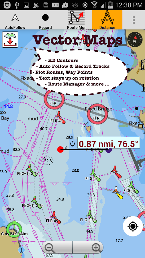
√ Beautiful & detailed Hardware/GPU accelerated vector charts(text stays upright on rotation)
√ Query details of Marine object (Buoy,Lights,Obstructionetc).
√ Customizable depth(Ft/Fathom/Meter) & distance units(km/mi/NM)
√ Customizable Shallow Depth.
√ Record tracks,Autofollow with real-time track overlay &predicted path vector.
√ Voice Prompts for marine navigation (requires GPS )
√ Supports GPX/KML for boating route editing/import.
√ Tide & Currents prediction.
√ Seamless chart quilting. Map details fromCoastal,Approaches,Harbour,Inland
Encs(rivers)& general ENC charts are automatically mapped tocorrect zoomlevel
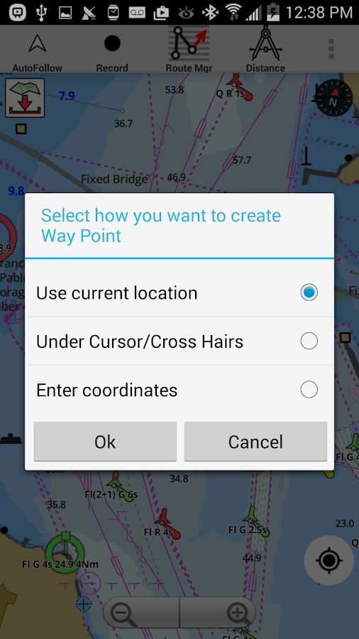
√ Enter or import Waypoints.
► MAPS
Get all the details that you find in your chart plotters!
Includes unlimited updates for 1 year.
Ukraine
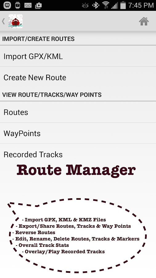
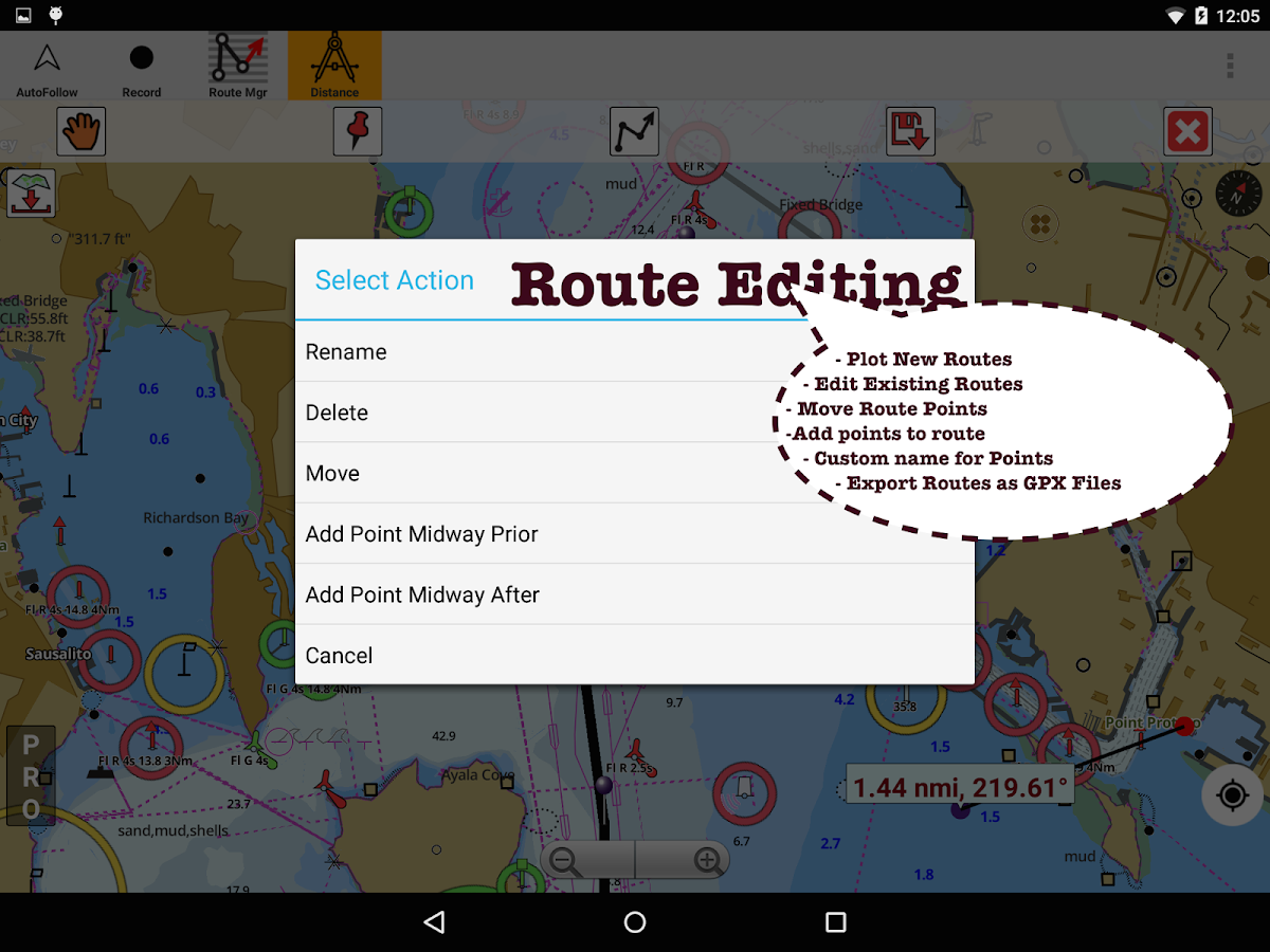
►ROUTE MANAGEMENT / TRIP PLANNING
√ Create New Route/Edit Routes
√ Reverse Routes
√ Enter,Move,Add,Delete,Rename Waypoints
√ Import GPX,KML & KMZ files
√ Plot/Edit Routes
√ Share/Export Routes,Tracks & Markers
►GPS FEATURES
√ Auto Follow
* Real Time Track Overlay
* Predicted Path Vector
* Course Up (Text stays upright)
* Speed & Heading
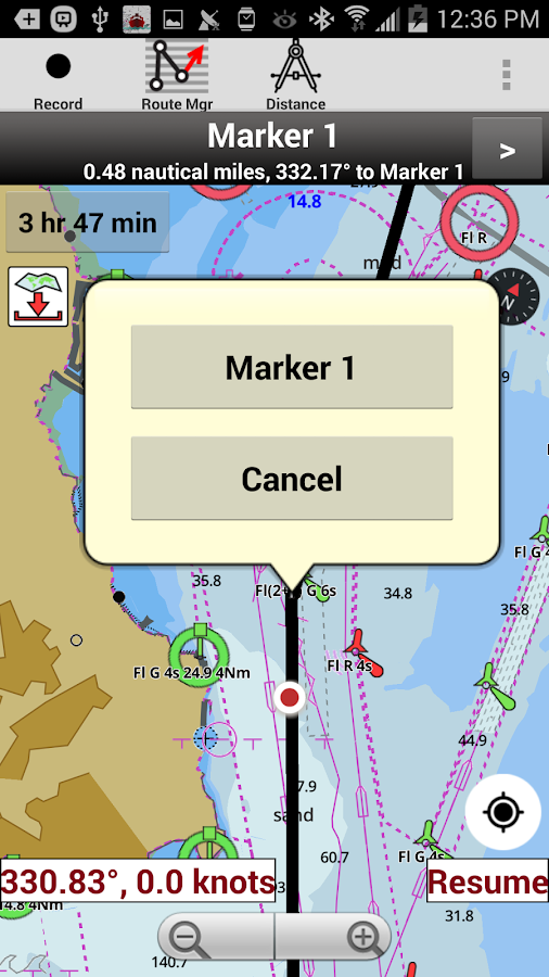
√ Route Assistance With Voice Prompts
* Prompts when approaching a boating route marker
* Continous distance & ETA updates
* Alerts when sailing/boating off route
* Alerts when boating in wrong direction
√ Record Tracks
►TIDE & CURRENTS
* For US,Canada,UK,Germany&New Zealand
* High/Low Tides
* Tidal Current Prediction
* Active Current Stations
► SHARING
* Share tracks/routes/markers on Facebook & Twitter
* Export as compressed GPX files.
Sample Charts
Dvoiakirna Bay
Sevastopolska Bay
Mariupol to Bezimenna Beak
Sea of Azov
Yevpatoriia
Yalta Port
Kizomys-Kherson Port
Kerchenska Strait
Kerch
Kyz-Aulskyi lighthouse
Feodosiia
Zmiinyi Island. Budaky lighthouse
Mykolaiv,Kherson
Berdians'k
Yelanchytska Beak - Kryva Beak
Mehanom Cape - Dvoiakirna Bay
Krym
Zhebriians'ka Bay. Ust'-Dunais'k
Mariupol
Donuzlav Lake
Feodosiiska Gulf
Oktiabrs'k
Yalta
Sevastopolskyi
Ochakiv - Mykolaiv
Odesa - Yuzhnyi
B. Karadzhyns'ka Bay
Heniches'k Port
Podviina Bay
Ochakivs' kyi Sea
Syvash Gulf
Yevpatoriia Port
Zhebriianska Bay
Zmiinyi
Sudats'ka Bay
Striletska & Kruhla Bays
Dzharylhatska Gulf
Zmiinyi Island
. Kipchak Bay
Henichesk
Novoselivka
Zhebriians'ka Bay
Ochakiv Portpoint
Yevpatoriia
Fiolent Cape to Aiia Cape
Kerchenska Strait
Bilhorod-Dnistrovs'kyi Port
Illichivs'k Port with approaches
Karantynna Bay
Approaches to Berdiansk
Balaklavska Bay
Sevastopolskyi Roadstead
Feodosiia Port with approaches
Sea of Azov. Novoazovsk
North-Western Part of Black Sea
Tahanrozka Gulf
Andriievo-Zoryne Portpoint
Kherson Port
Approaches to Bystre (Novostambul's'ke) Mouth
Yarylhatska Bay & Chornomorsk Port
Akhilleon Cape to Yeni-Kale Cape
Sea of Azov. Berdiansk
Approaches to Mouthes of Danube Delta
Yalta Port
Approaches to Feodosiiska Gulf
Black Sea. Karkinitska Gulf. Kalamitska Gulf. Yevpatoriia
Koktebel' & Dvoiakirna Bays with approaches
Black Sea. Danube Mouth
Mykolaivskyi Potash Terminal 'Nika-Tera' & 'CompanyEvrovneshtorg' Ltd
Masandra Shipping Port
Sea of Azov. Mariupol
Black Sea. Yalta to Sudak
Dnistrovskyi Firth to Odesa
Approaches to Odesa Port
Sevastopolska Bay & Pivdenna Bay
Yuzhnyi Port
Karkinitska Gulf
Mykolaiv
Feodosiia
Yuzhnyi - Dniprovskyi Firth
Sevastopolska Bay
Black Sea. Sevastopol
Dnipro-Buz'kyi", "Mykolaivs'kyi Sea Commercial Port"
Donuzlav Lake
Krymskyi Peninsula
Odesa