hourglass_full Your download should start automatically in a few seconds...

Download Tauber Altmühl Radweg_Latest Version.apk from Apk-Dl Server
Thank you for using Apk-Dl.com to download the apk file (Tauber Altmühl Radweg_Latest Version.apk),
If the download doesn't start automatically in a few seconds, please click here to access the download URL directly.
Note: Download and save the apk file to your Android Phone's SD card and install it manually onto the Android device.
Description
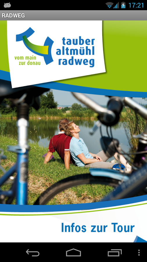
Ihr perfekter Tourenbegleiter mit GPS-Kartenanwendungen!
Beschreibung
Ihr perfekter Tourbegleiter mit GPS-Kartenanwendungen unddetaillierten Informationen zu radfreundlichen Gastbetrieben. Tippszum Radurlaub (Veranstaltungen, Sehenswürdigkeiten, etc.) undvielen wichtigen Adressen (Tourist-Informationen, Fahrradverleih-und Reparaturstationen, etc.).
Der „tauber altmühl radweg“ ist die Verbindungsroute vom Main zurDonau. Erleben Sie vier fränkische Urlaubslandschaften, vierWasserläufe und einen wunderbaren Weg für Flussgenießer. Die Tourmit Iandschaftlichen, kulturellen und kulinarischen Höhepunktenverspricht Radelgenuss pur.
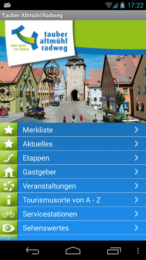
Die Tour im Überblick / detaillierte Infos:
Gastgeber, Veranstaltungen, Tourismusorte, Tipps, Sehenswertes undAktuelles
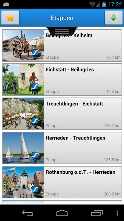
Im Lieblichen Taubertal:
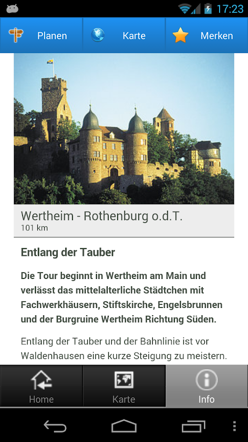
Entlang der Tauber
Im Romantischen Franken:
Zu historischen Städten
In Fränkischen Seenland:
Fränkisch. Seen. Land.
Im Naturpark Altmühltal:
Zwischen Fels und Fluss
Aktuell verfügbares Kartenmaterial:
* Bayern / Franken
Topographische Karten:
* Bundesland Bayern (bis zu TK 1:10.000)
Luftbilder über LVG Bayern
* Bundesland Bayern
Zusätzliches Kartenmaterial:
* Luftbilder über Microsoft Bing Maps (in 100cm/pixel)
* Straßenkarten über OpenStreetMaps (CloudMade)
Herausgeber / Impressum:
Tourismusverband Franken e.V.
Postfach 440453
D-90209 Nürnberg
Tel.: +49 / (0) 911 / 94151-0
[email protected]
Teile dieser Website wurden mit Mitteln der EU kofinanziert.
Diese Anwendung baut auf den interaktiven Karten-FrameworkeContent.Maps der hubermedia GmbH auf. Details dazu unter http://iphone.hubermedia.de. Kontaktieren Sieuns, falls Sie Fragen oder Anregungen haben: [email protected].
Website von Tourismusverband Franken e.V.(www.tauber-altmuehl-radweg.de)
Tauber Altmühl Radweg
Your perfect tour guide with GPS mapping applications!
Description
Your perfect tour guide with GPS mapping applications and detailedinformation about cycle-friendly guest farms. Tips for cyclingholidays (events, sites, etc.) and many important addresses(tourist information, bicycle rental and repair stations,etc.).
The "deaf altmühl bikeway" is the connecting route from the Main tothe Danube. Experience four Frankish holiday landscapes, waterwaysfour and a wonderful way for river lovers. The tour withIandschaftlichen, cultural and culinary highlights promises cyclingpleasure.
The Tour Overview / detailed information:
Hosts, events, tourism places, tips, updates and Attractions
In Rothenburg ob der Tauber:
Along the river Tauber
In Romantic Franconia:
To historic towns
In the Franconian Lake District:
Franconian. Lakes. Country.
Altmühltal Nature Park:
Between rocks and river
Currently available maps:
* Bavaria / Franconia
Topographic maps:
* The state of Bavaria (up to 1:10,000 TK)
Aerial photos via LVG Bayern
* The state of Bavaria
Additional maps:
* Aerial photos via Microsoft Bing Maps (in 100cm/pixel)
* Road maps on Open Street Maps (CloudMade)
Publisher / Imprint:
Tourist Board of Franconia e.V.
PO Box 440453
D-90209 Nürnberg
Tel: +49 / (0) 911 / 94151-0
[email protected]
Parts of this site co-financed by EU.
This application builds on the interactive maps frameworkeContent.Maps the hubermedia GmbH. Details, see http://iphone.hubermedia.de. Contact us if youhave any questions or suggestions: [email protected].
Website of Tourism Franconia (www.tauber-Altmühlradweg.de)
Tauber Altmühlradweg