hourglass_full Your download should start automatically in a few seconds...

Download خرائط وملاحة_Latest Version.apk from Apk-Dl Server
Thank you for using Apk-Dl.com to download the apk file (خرائط وملاحة_Latest Version.apk),
If the download doesn't start automatically in a few seconds, please click here to access the download URL directly.
Note: Download and save the apk file to your Android Phone's SD card and install it manually onto the Android device.

Description
وتشمل خرائط المعلومات من ويكيبيديا، يوتيوب أشرطة الفيديو،والصور،بانوراميو، مشاهدة شارع وتوقعات حالة الطقس.
تحتاج إلى خرائط المدينة والأقمار الصناعية، وحركة المروروالعبور،والطريق دراجة أو حتى المشي، وكنت دائما العثور على موقعك معخرائطملاحة!
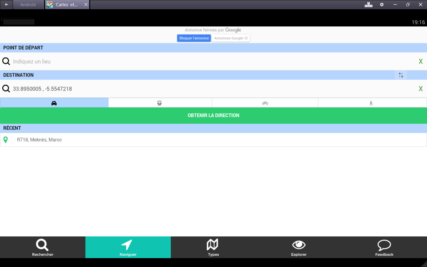
رحلة مخطط - خرائط العالم مع نظام تحديد المواقع وتحديدالموقعالجغرافي
السفر في جميع أنحاء العالم، والتحرك باستخدام أي وسيلة النقل:
• خرائط طرق للسيارات والدراجات والمشاة
• تحديد المواقع والملاحة مع حالة حركة المرور المحلية يساعدكعلىإيجاد الطريق الأسرع
• GPS صوت بمعلومات دقيقة
• تحديد الموقع الجغرافي عن طريق نظام تحديد المواقع (خطوطالطولوالعرض) أو عنوان IP إذا كان متوفرا
مدير الطريق
• جداول زمنية للحافلة، والفنادق القريبة الخ
• خرائط مدينة، حركة المرور على الطرق والنقل العام
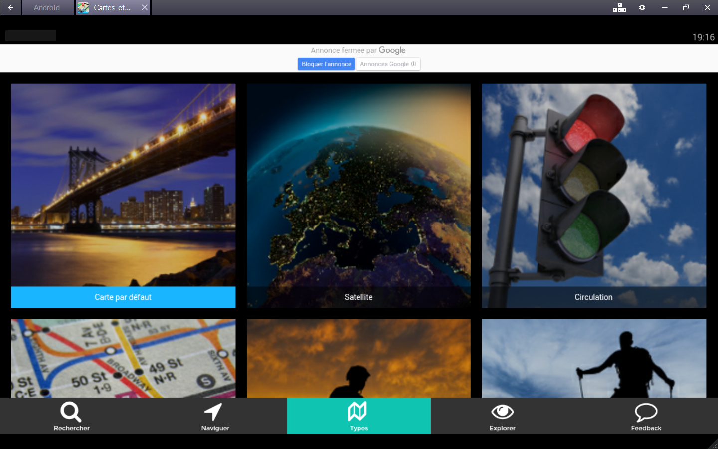
CARDS
الأقمار الصناعية والخرائط، والخرائط الدراجة والتجول ثلاثيالأبعاد.ظروف حركة المرور وبطاقات السفر مشترك:
• ستريت فيو - مشاهدة المتاحف في الهواء الطلق، والمطاعم، الخ
• خرائط زحمة - مشاهدة ظروف حركة المرور الحالية لتجنبالاختناقاتالمرورية
• خطة للدراجات مع مسارات الدراجات وطرق محفوظة - الخطة الخاصة بكجولةالدراجة المقبلة
• خرائط المشي - اكتشف مدينتك على الأقدام مع خرائط مفصلة لل
• المشي لمسافات طويلة لتحديد المواقع - البحث عن مسارات المشيأوالتخطيط لرحلة الظهر القادمة
• مشاهدة GOOGLEMAPS الفضائية - استمتع الرأي الذي أخذ منالفضاء
• خرائط ملاحة ويستخدم للإنتقال جوجل مابس وخريطة الشارعالمفتوح(OSM)
المرور - البحث عن الاتجاهات والخرائط في أكثر من 15،000 مدن
• طرق الحافلات وتحديد الموقع الجغرافي - الطرق والخرائط لأكثرمن15،000 المناطق
• الموقع من المحطات ومرات
• مسارات الدراجات
• خطط ومحطات المترو
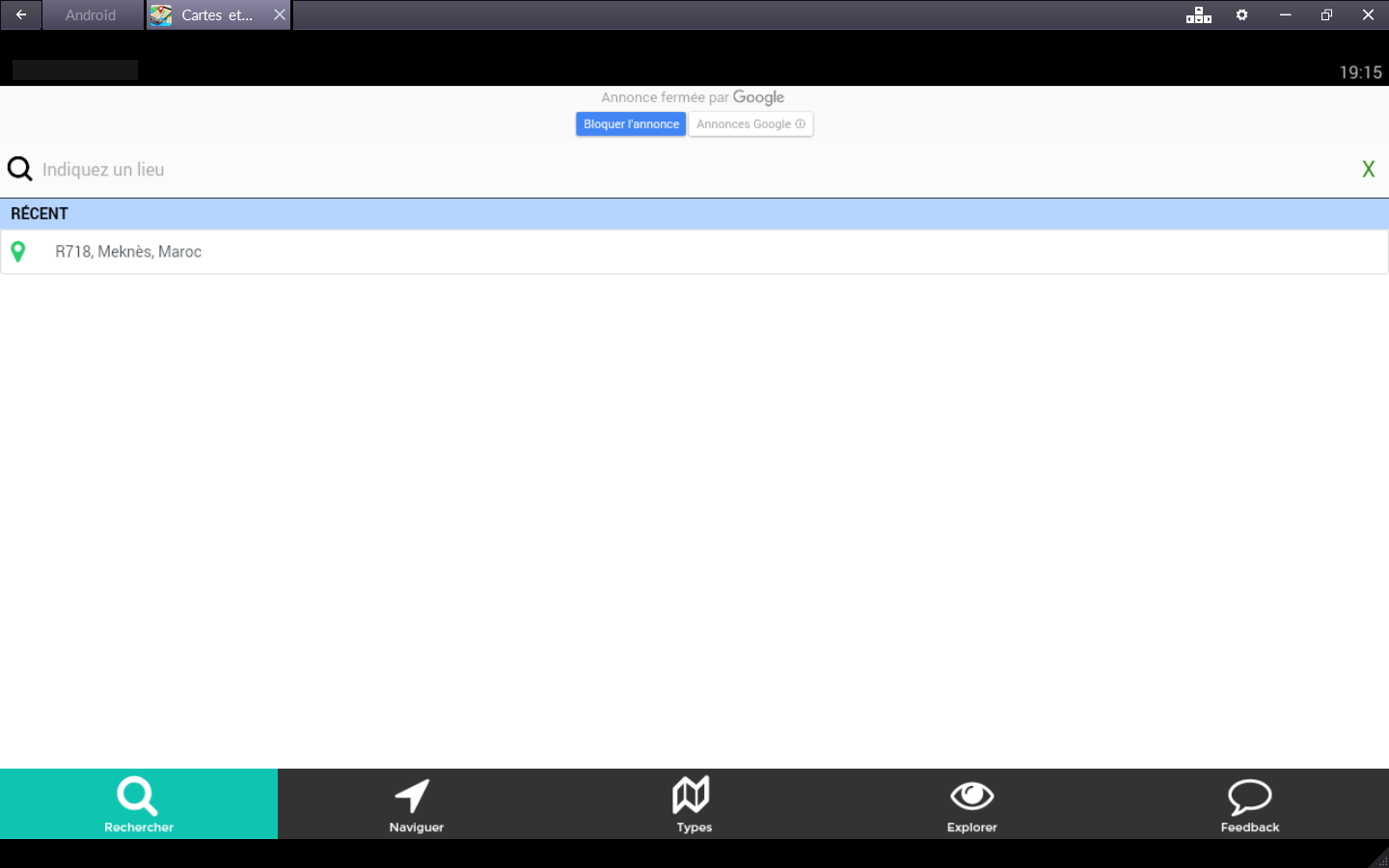
القرب بحث - البحث، العثور على:
• الغذاء
• الفنادق
• البارات
• محطات الخدمة
• آلات بيع
• عنوان (رقم واسم الشارع، المدينة)
• رموز المدينة والبريد القريبة
قرب: البحث عن الفنادق والمطاعم والمحلات التجارية والمتاحفومحطاتالقطارات والمستشفيات، الخ قريب من سكني
توقعات الطقس
• توقعات درجة الحرارة
• خطط لرحلتك وفقا للطقس
خصائص بطاقات
وتتضمن الخرائط العديد من البيانات الرائعة على النحو التالي:
★ صور على البطاقة: صور من جميع أنحاء العالم من بانوراميو ستريتفيوو
★ أشرطة الفيديو على الخارطة: ترجمة لموقع YouTube الفيديو
★ المعرفة على الخارطة: دليل ويكيبيديا - قراءة المعلوماتويكيبيدياحول المدن والمعالم الأثرية والمعالم السياحية، الخ
★ ستريت فيو على الخارطة: عرض على مستوى الشارع في جميعأنحاءالعالم
★ بعض كاميرات الويب على الخارطة: الفيديو الكاميرا في جميعأنحاءالعالم
التحرك: اكتشاف مدينتك مع عشرات الخرائط، بما في ذلك خرائطالعالموالأقمار الصناعية، وحركة المرور والعبور، وركوب الدراجات،المشيلمسافات طويلة، وحتى الطقس. كاميرات تتيح لك معرفة أحوال الطقسأوحركة المرور وكأنك في المدينة!
The maps include information from Wikipedia, YouTubevideos,photographs, Panoramio, Street View and weather forecasts.
You need city maps and satellite, traffic, transit, and roadbikeor even walking, you always find your site with navigationmaps!
Scheme - the world trip maps with GPS andgeolocationsystem
Travel around the world, and the move by using any meansoftransport:
• roads for cars, bikes and pedestrians Maps
• GPS navigation with the case of local traffic helps you findthefastest route
• GPS voice with accurate information
• geolocation by GPS (latitude and longitude) or IP address,ifavailable
Director of the road
• timetables for the bus, near the hotels etc.
• City maps, road traffic, public transport
CARDS
Satellite maps, bike maps and three-dimensional curfew.Trafficconditions and travel cards common:
• Street View - View museums in the open air,restaurants,etc.
• Traffic Maps - View current traffic conditions to avoidtrafficjams
• Plan for bikes with bike trails and roads reserved - planyournext bike tour
• Walking Maps - Discover your city on foot with detailedmapsof
• Hiking GPS - Find hiking trails or planning a tripcomingback
• View GOOGLEMAPS TV - Enjoy the view taken from space
• Maps Navigation is used to move on Google Maps andOpenStreetMap(OSM)
Traffic - Search for directions and maps in more than15,000cities
• bus routes and geolocation - road maps for more than15,000areas
• the location of stations and times
• bike trails
• plans and metro stations
Proximity Search - Search, found:
• Food
• Hotels
• Bars
• Service stations
• Vending Machines
• address (number and street name, city)
• symbols of the city and the nearby E
Close-up: Find hotels, restaurants, shops, museums, trainstations,hospitals, etc. close to the apartment
weather prediction
• forecast temperature
• Plan your trip according to the weather
Cards properties
The maps include many fascinating data as follows:
★ images on the card: Photos from around the world fromPanoramioand Street View
★ videos on the map: a translation of the video site YouTube
★ knowledge on the map: Wikipedia Guide - Wikipedia readtheinformation about the cities and monuments, touristattractions,etc.
★ Street View on the map: View at street level all overtheworld
★ some webcams on the map: the video camera all over the world
ACTION: discover the city with dozens of maps, including mapsofthe world, satellite, traffic, transit, biking, hiking, andeventhe weather. Cameras let you know weather or traffic likeyou're inthe city!